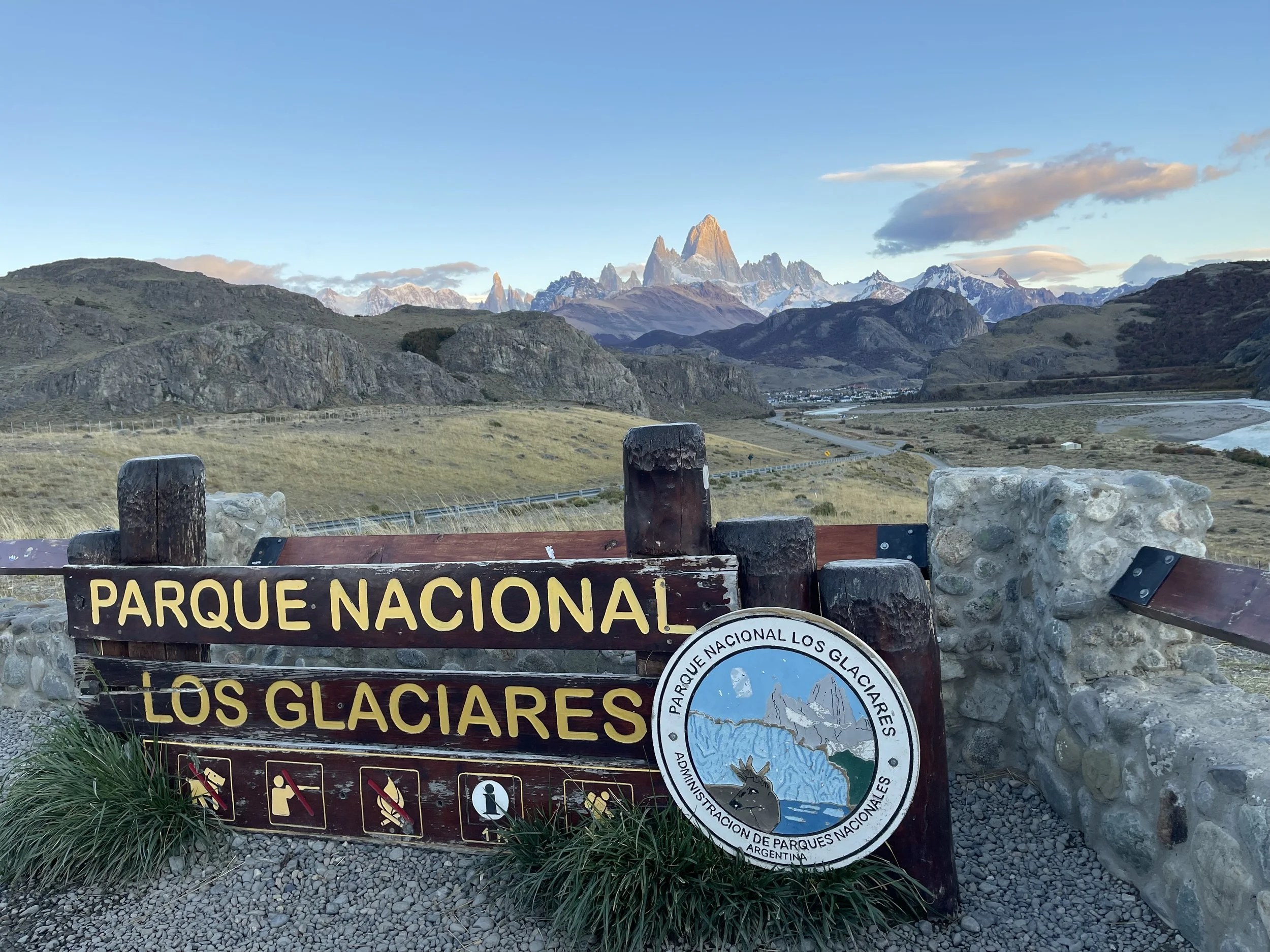
El Chalten, Patagonia, Argentina (Part 1 of 2)
Fall colors in Patagonia
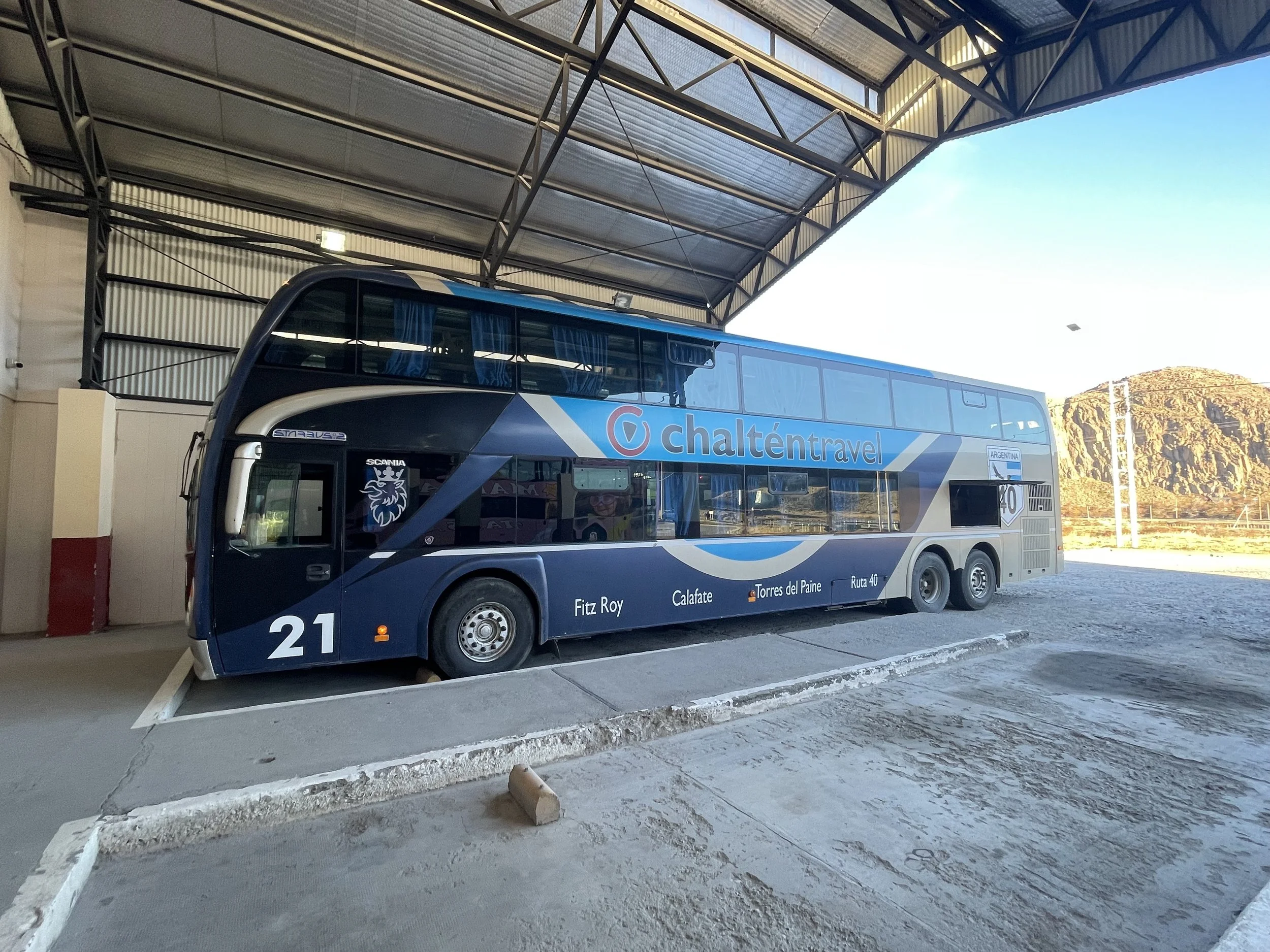
We cannot remember the last time that we took a long distance trip on a bus, but as a way of getting around from Chilean Patagonia to Argentinian Patagonia, there was nothing better.
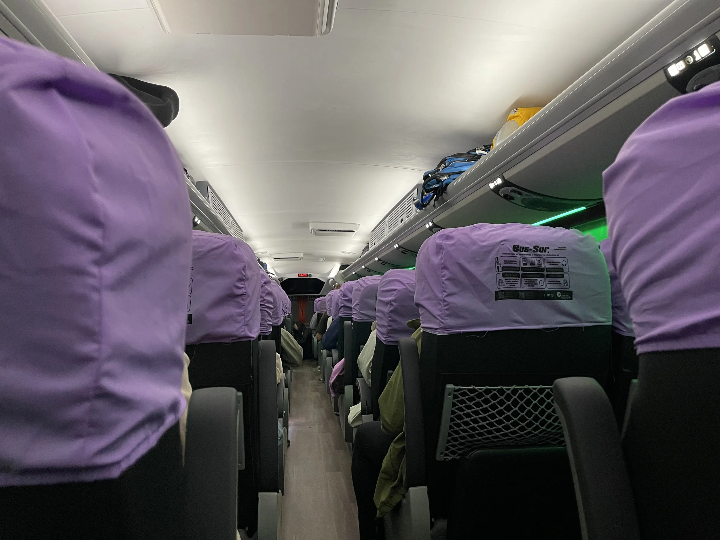
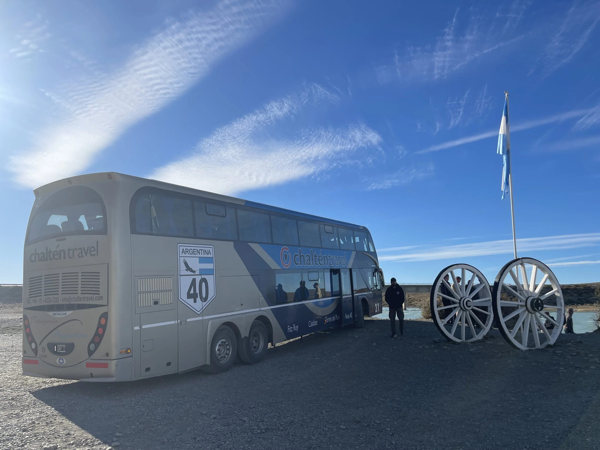
After the briefest of breakfasts in our hotel, we took a taxi to the rodoviario in Puerto Natales, in the dark still at 7 am but bustling with buses, hikers and packs. We checked in, stuffed our bags in the belly of the bus, and took our seats on the upper deck of a large and fairly comfortable bus and braced ourselves for the six-hour trip. It was quite an impressive ride, least of which because the seats semi-reclined (“semi cama”), had swinging leg rests, and even included a restroom. Each passenger was given a snack bag with water and breadsticks.
After one hour, we stopped by the international border, got off the bus, and turned in our PDI papers to Chilean immigration. (I had read stern warnings about the time and expense of replacing these little squares of thin paper if lost.) We got on the bus, crossed over to the Argentinian side, presented our passports — no stamp! — and hopped on the bus again. In the process, we realized that our bus was staffed not only with a driver, but two assistants who periodically walked the aisles, woke up passengers for the immigration stops, let us know of good views, wiped the condensation in the windows. (One was a friendly mute who smiled at everyone and held people’s hands as they descended from the bus.)
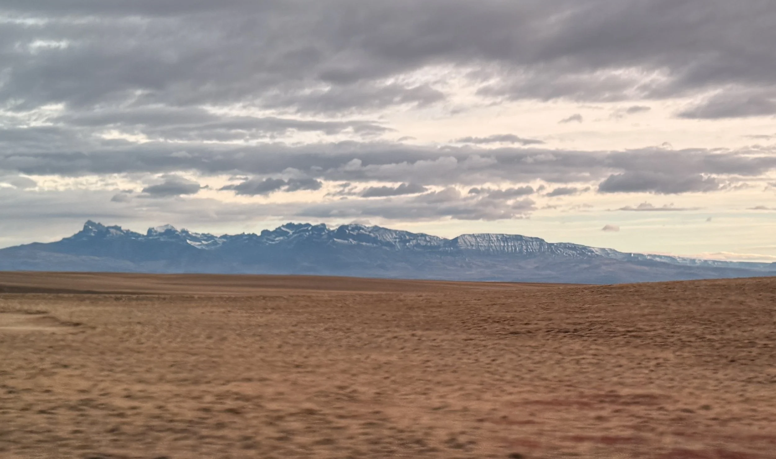
The road meandered through wide open plains, seemingly devoid of anything; we saw low hills with barely a cover of brush, a few random guanacos, lakes and running streams. And fences! Fences everywhere, although it was hard to say what exactly these structures were fencing in. Once in Argentina, we saw some higher snowy peaks farther away. Still, there was not much to photograph, especially through the grimy bus windows.
We pulled into El Calafate around 1:45 pm and walked across from the rodoviario into, of all things, a Mexican restaurant. We had surprisingly good tacos and beer for lunch, and waited for our next bus.
Despite online comments about, “Don’t sleep on the bus ride from El Calafate to El Chalten — it’s beautiful and you’ll see lots of animals!” — we didn’t see anything different or special about this portion of the ride. Also, by this time, we were exhausted, so it was easy to just pull the curtains shut against the hot sun and nod off.
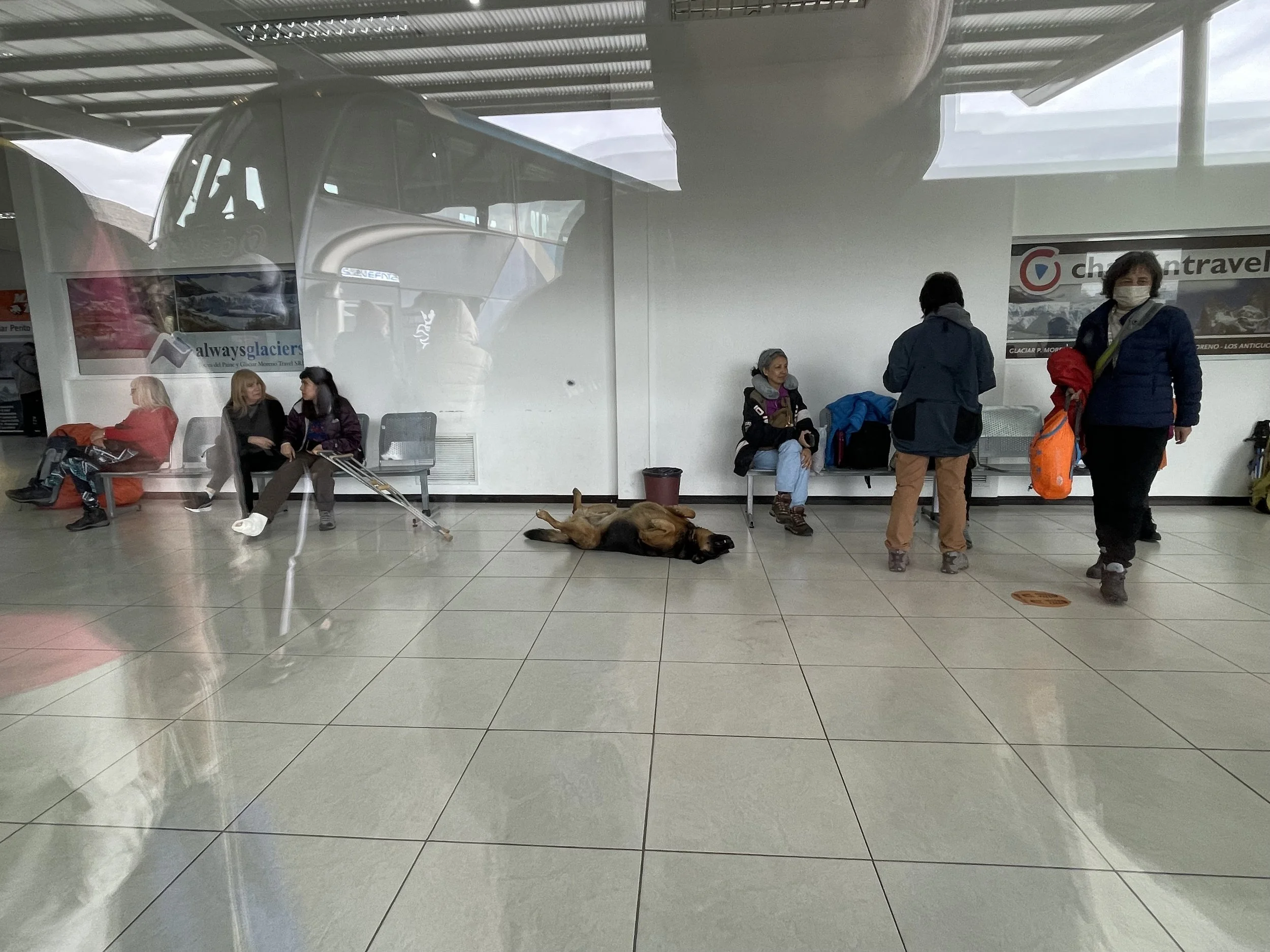
Once we arrived at our third rodoviario of the day, over N.’s grumbling, we walked the five blocks to our hotel and had dinner in the closest possible restaurant.


***
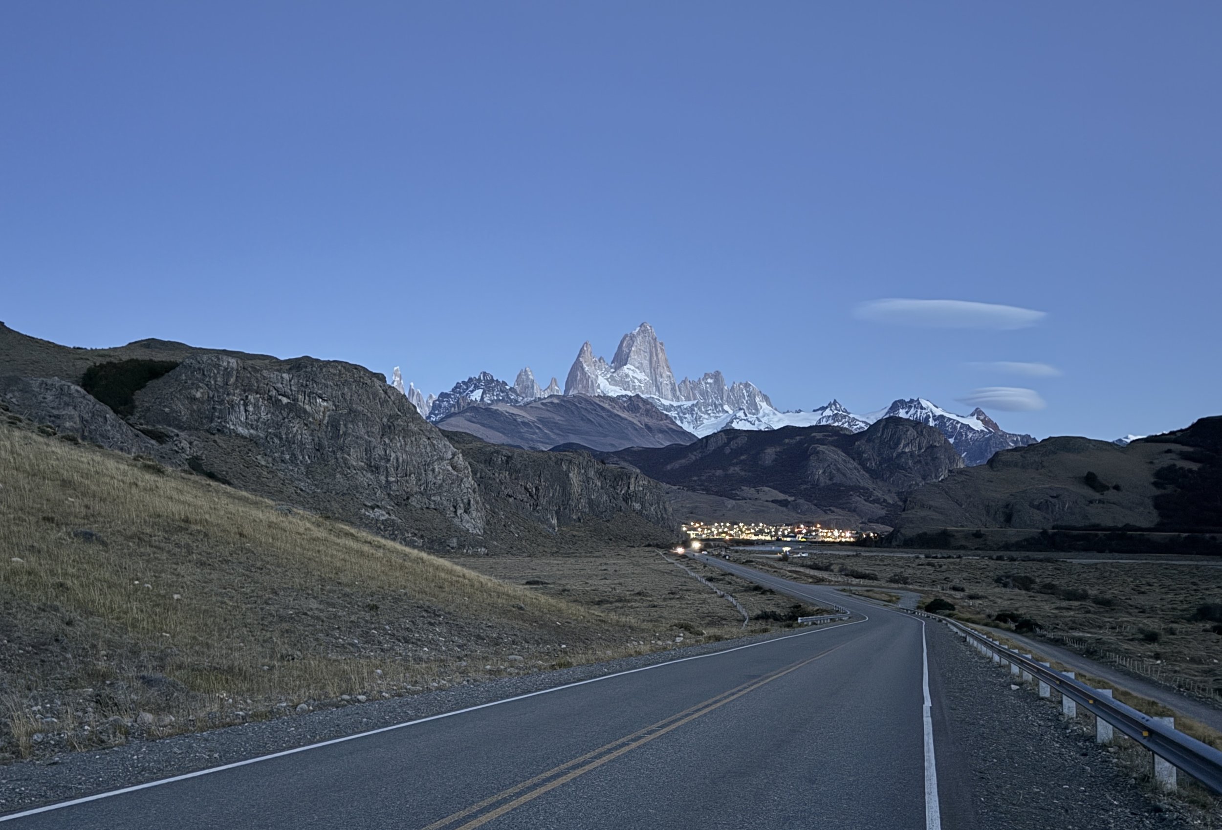
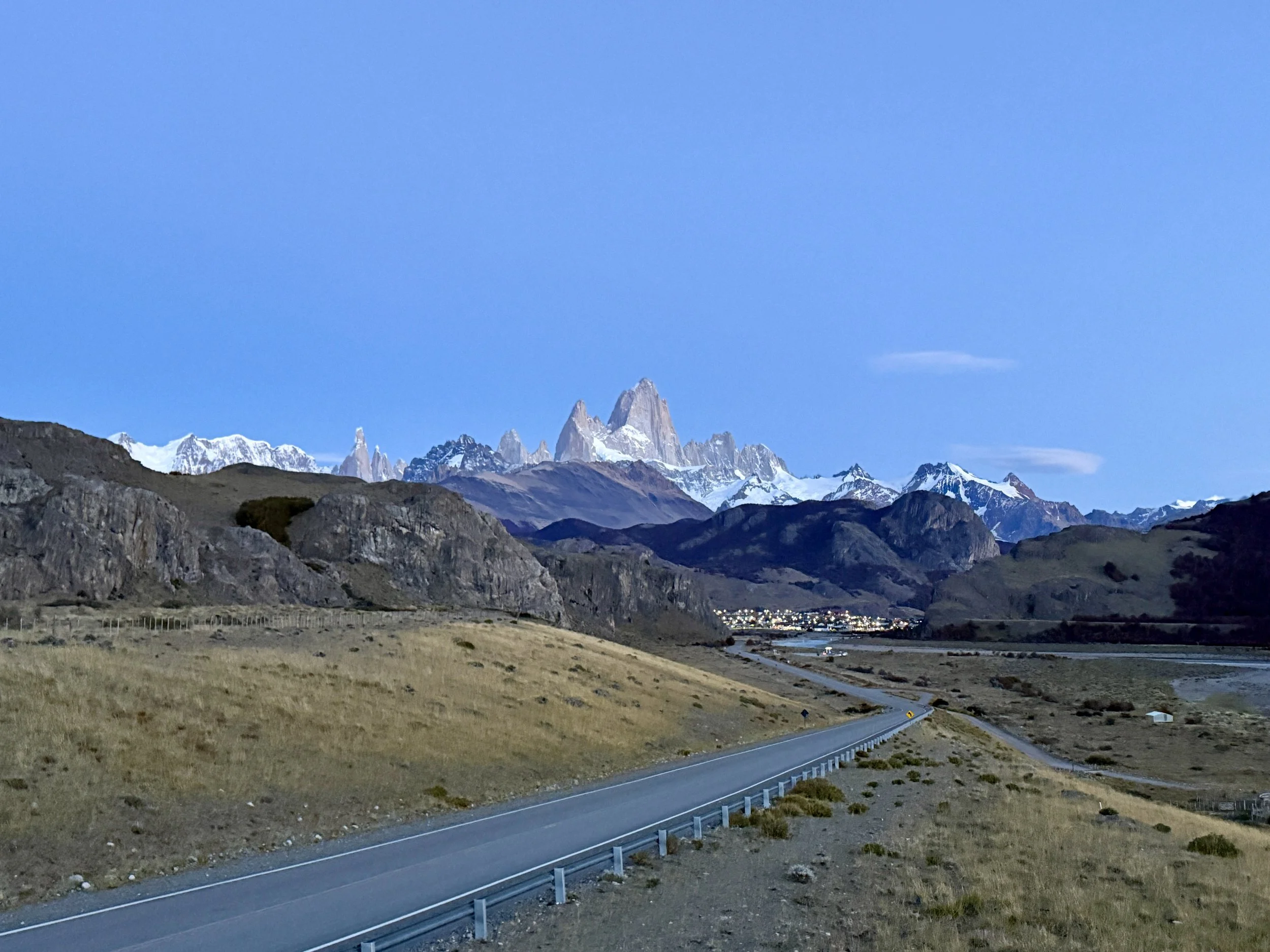
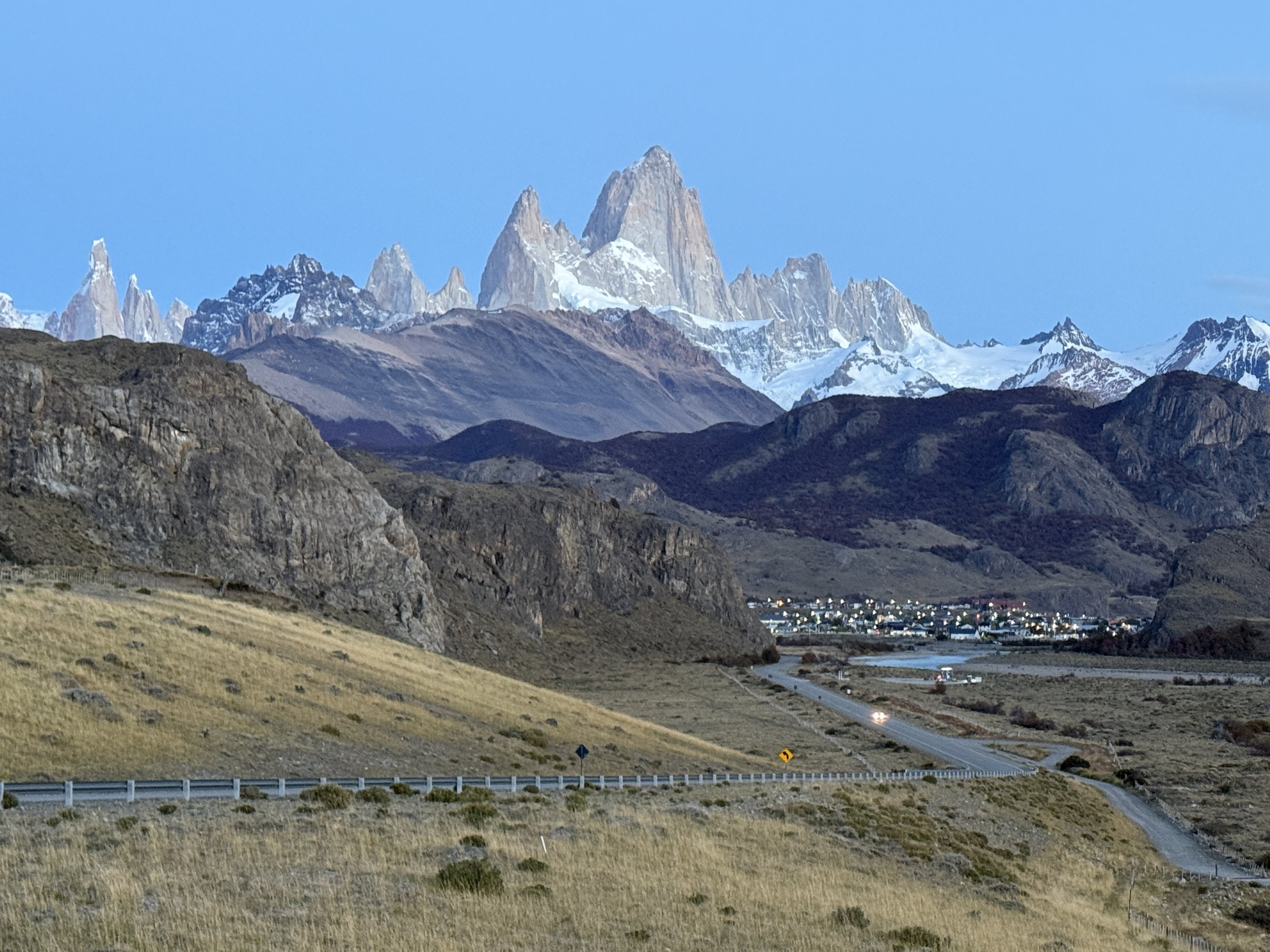
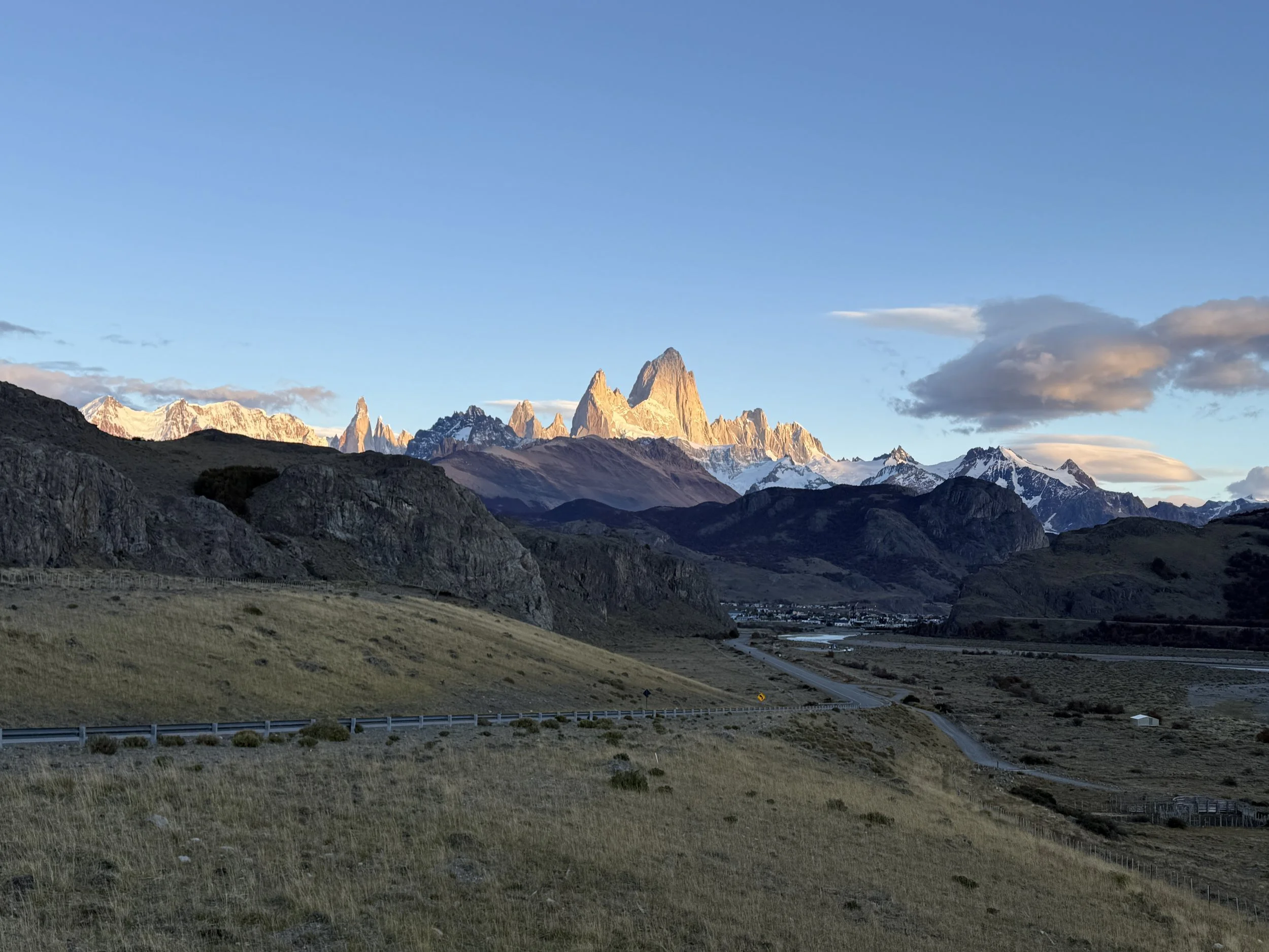
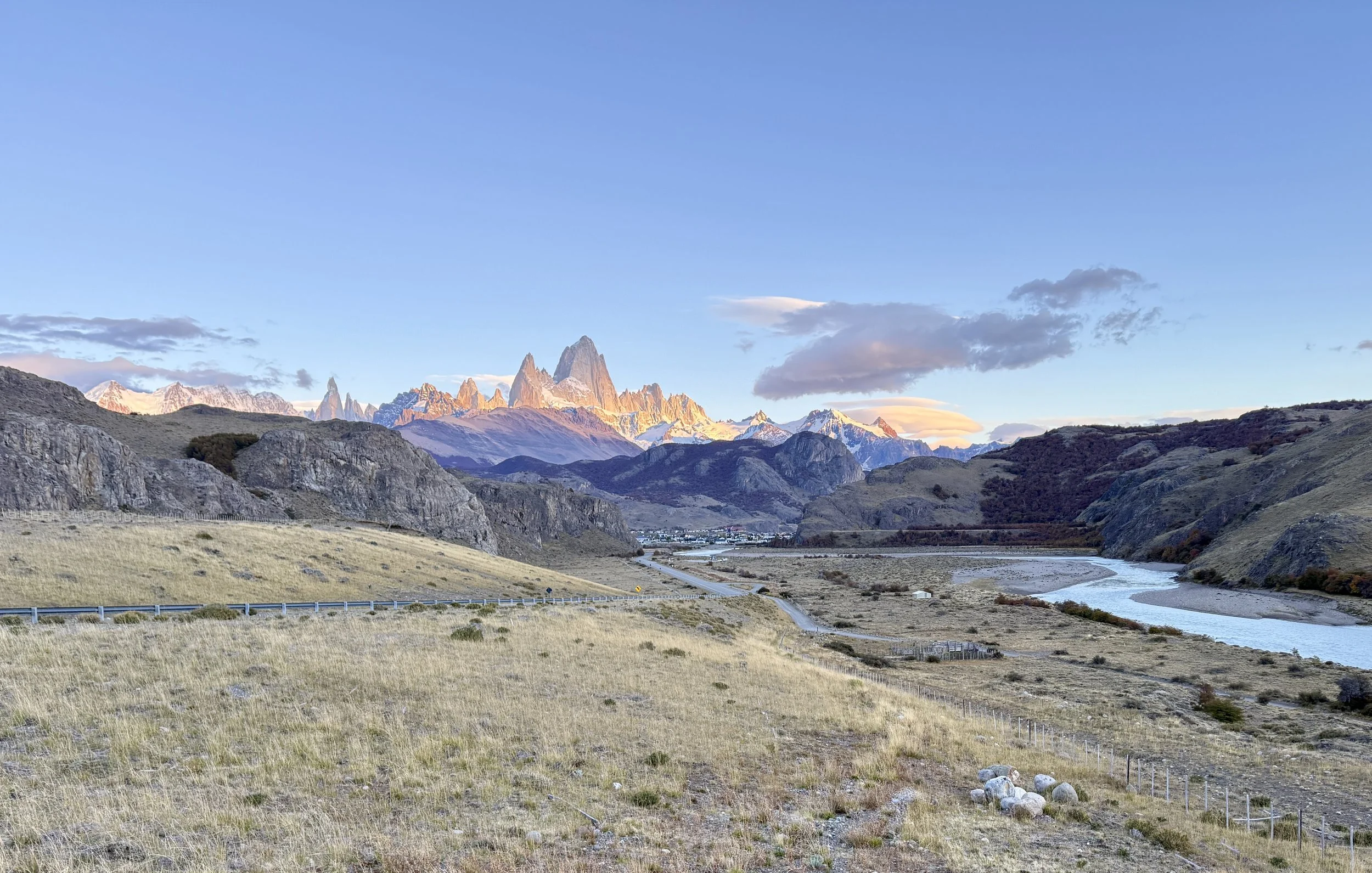
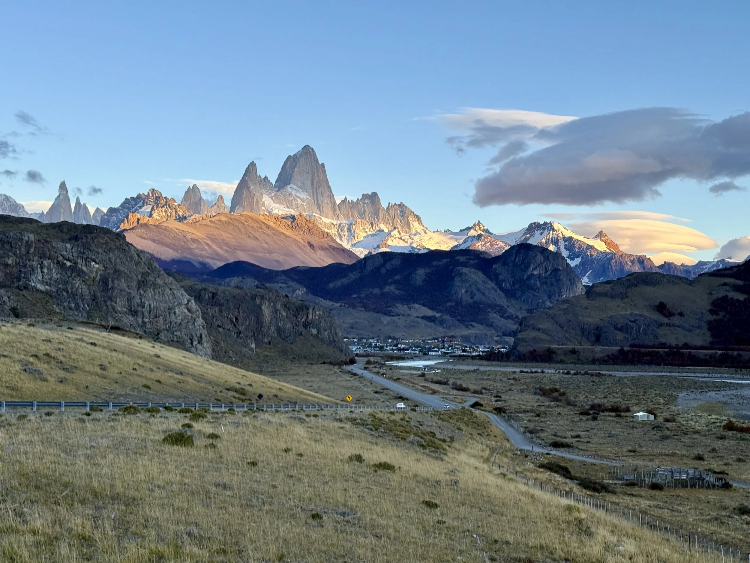
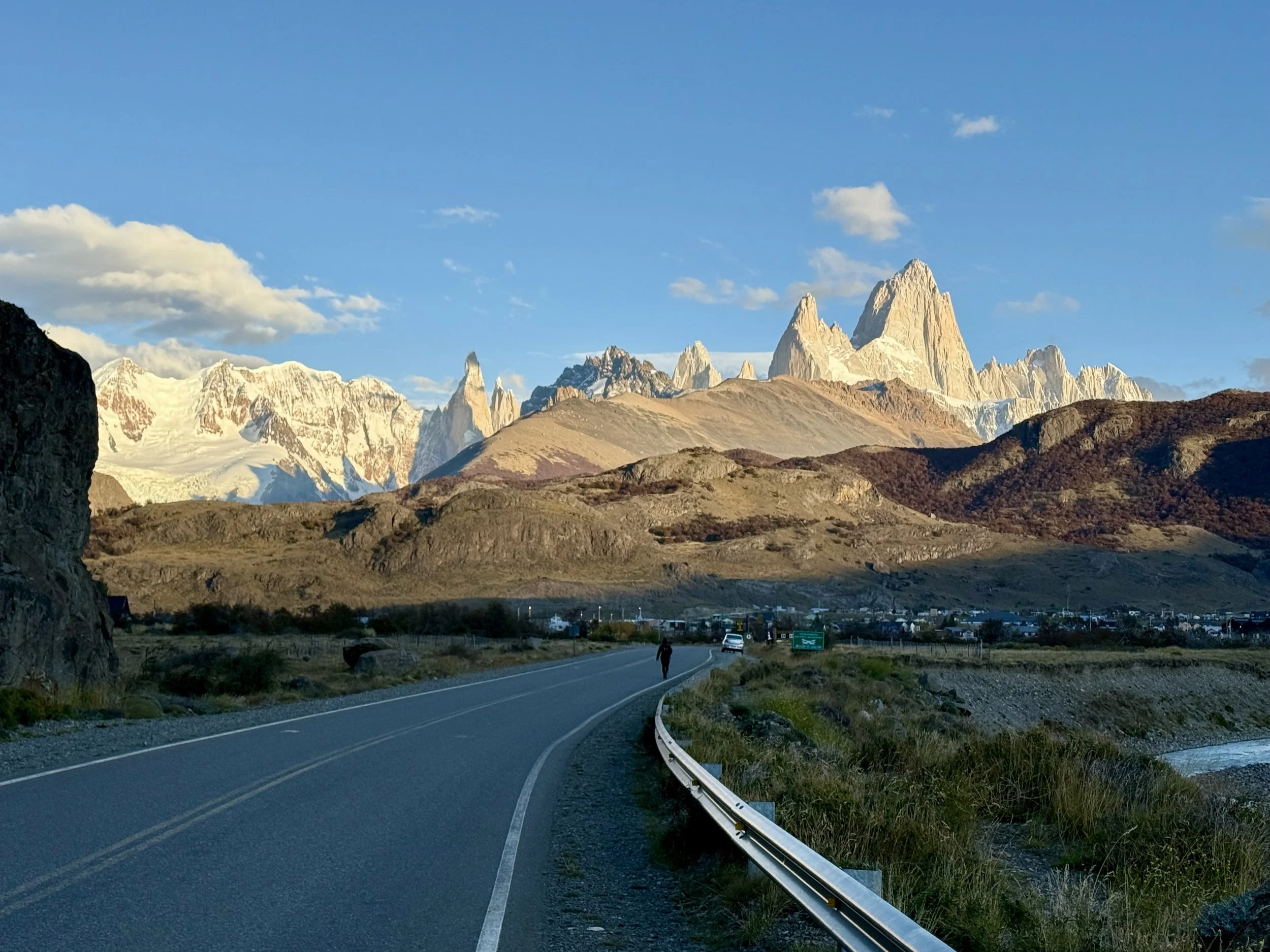
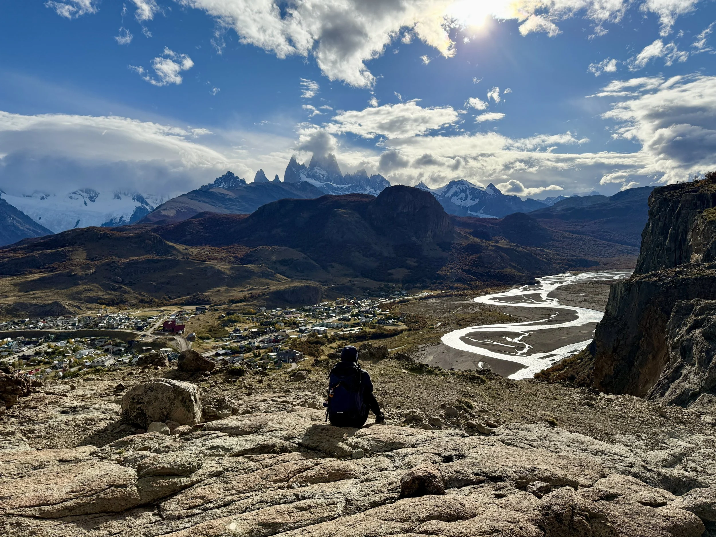
We were already walking in the cold dark, when N. pulled his classic and asked me whether I had an extra camera battery in my bag. Of course I did not. So I was left waiting in the curb — did I mention it was cold and dark? — while he ran back to the hotel, got lost, retrieved the battery and came back to find me. Only then did we walk to the Mirador El Chalten and made it in time to wait for sunrise against Fitz Roy (why do all these places in Patagonia have European-sounding names?).
It was bone-chilling cold even without the wind, but we lingered enough for N. to get the shots he wanted.
***
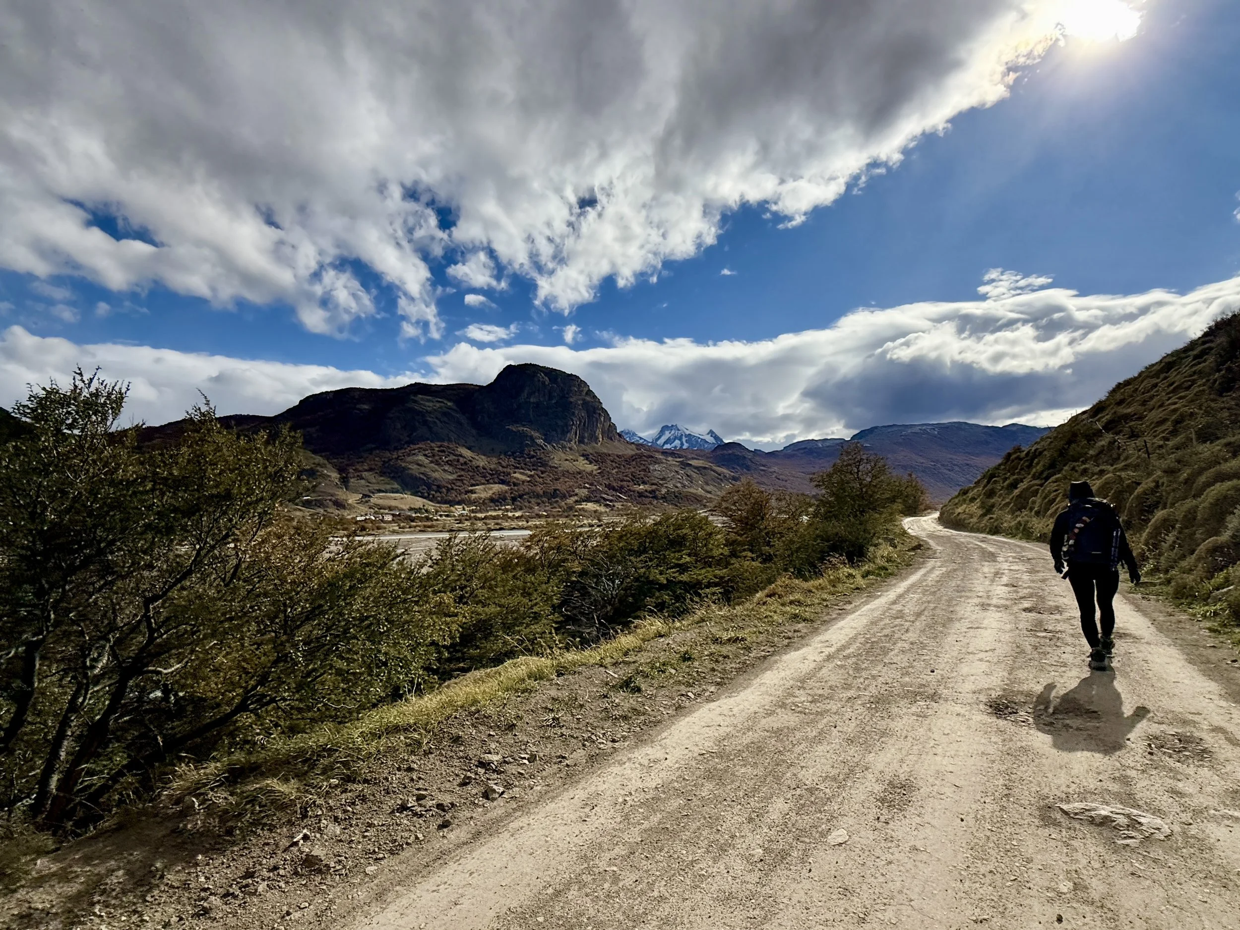
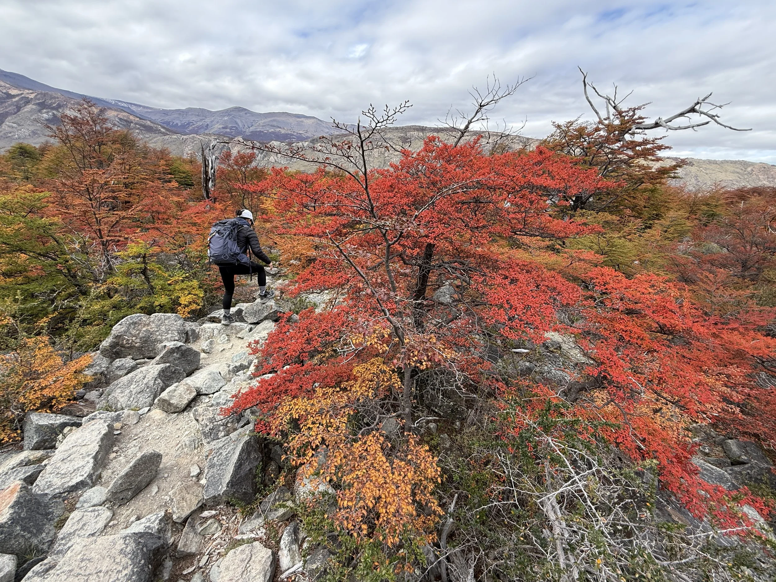
After lunch, we headed for a light hike, for a view of the town and a different angle of Fitz Roy — to Paredon y las Vueltas (4.6 stars; difficulty level: moderate, 8 kms/5.1 miles). It involved a steep incline, but the app suggested hiking clockwise as the easier alternative. N. was slow today — perhaps too soon after the W?
Once we got up there, the views of the town and of the mountains were sufficient to help us forget the effort required. We could see the Vueltas River meandering like liquid emerald while the trees below flashed orange and red. El Chalten looked tiny from here and Fitz Roy, unlike this morning, hid shyly behind low clouds. And just to make us feel like lazy slobs, we encountered a guy trail running with dog in tow.
We began going down the mountain around 5 pm, which was when a photo group was hiking up with heavy cameras and tripods. We were left to wonder how they planned to descend in the dark.
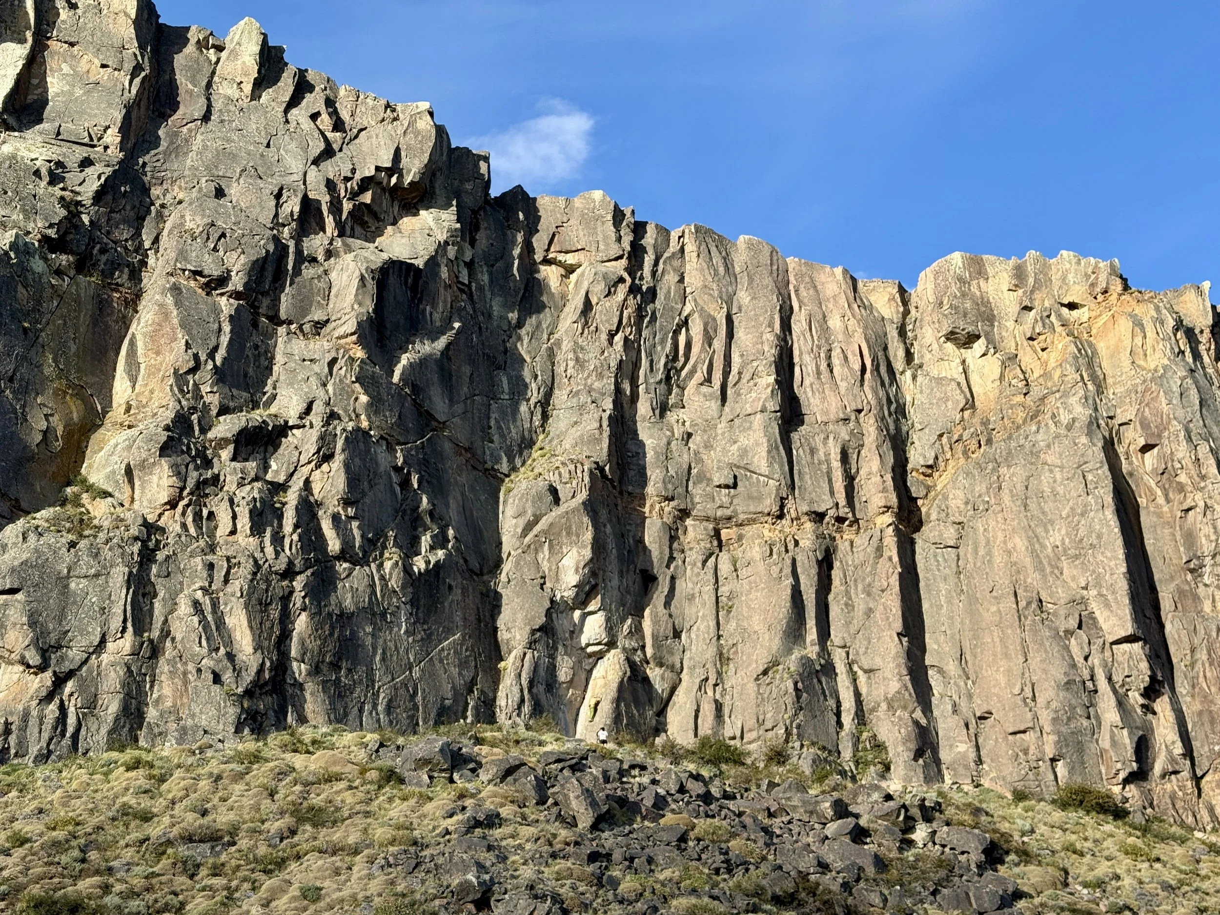
Once below, we noticed bobbing colors on the rocky mountain face and realized they were rock climbers.
***
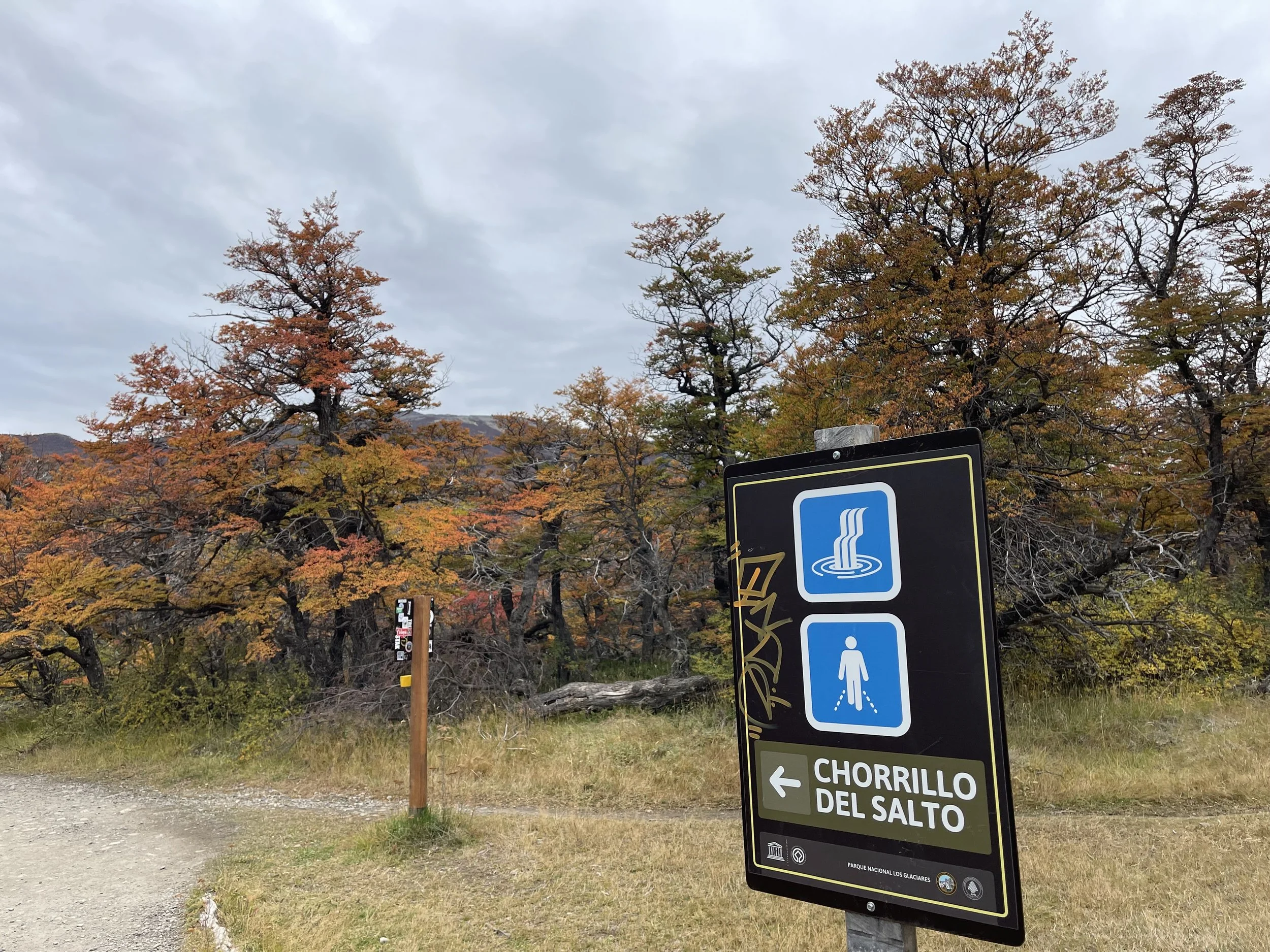
Today, our hiking plans involved the Chorillo del Salto.
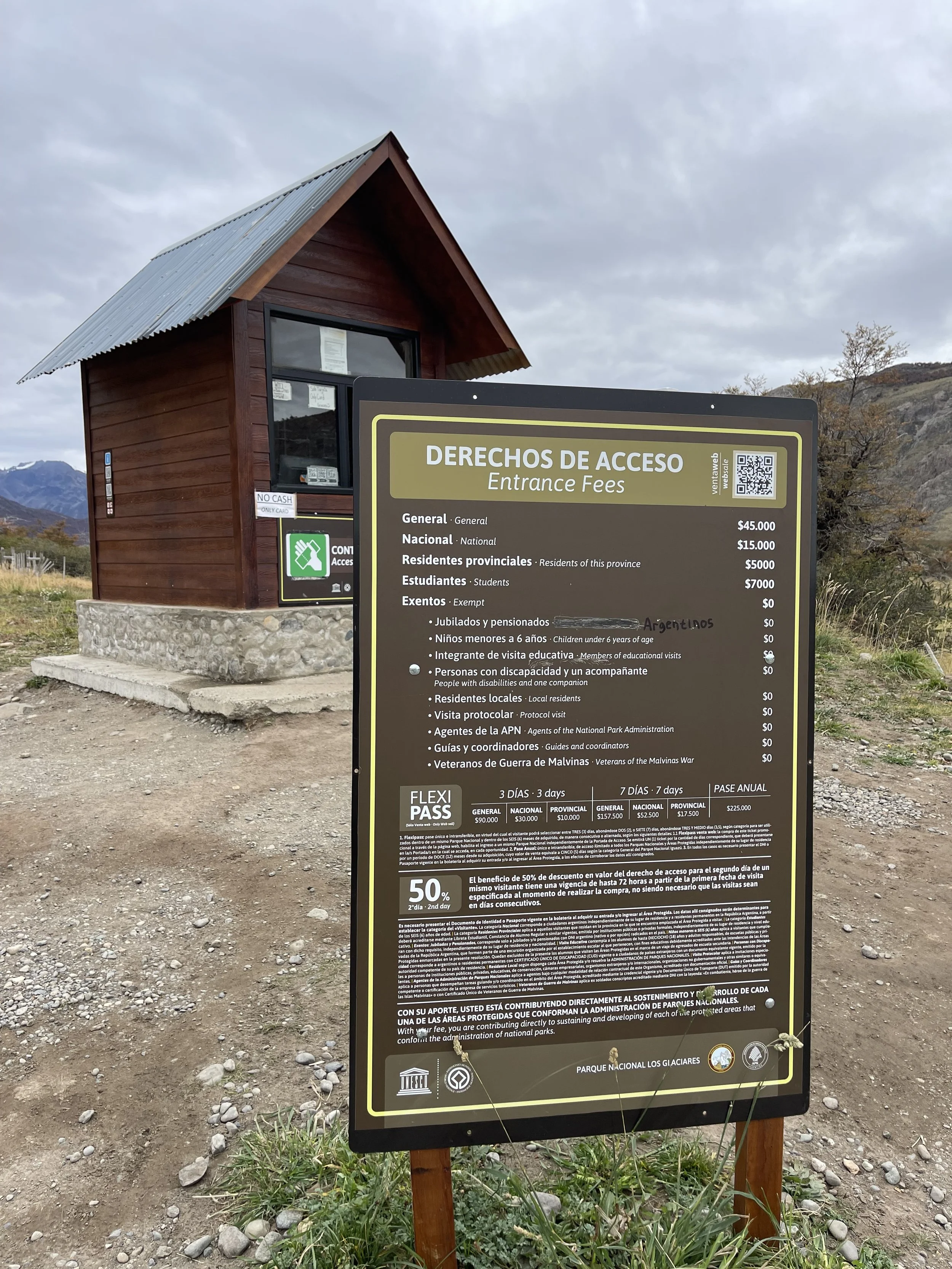
Except at first they appeared to be thwarted by a little kiosk acting as the park entrance police.
As our travels demonstrate, we love national parks and willingly and gladly pay the entrance fees which, I’m sure, do not begin to cover the costs of maintaining and caring for precious lands. So putting the question of paying entrance fees aside, what was irritating was the fact that here in Chalten, the rules regarding payment were so capriciously and randomly applied: they applied to this trail of the park, but not to that one; they applied on this day but not that; they applied when the kiosk was staffed but not when it wasn’t…
We had been told that the only two hikes where park authorities collected fees were the Fitz Roy and the Condor Lookout. But here, the young lady at the booth informed us that we were required to pay the ARG$45,000 pax for the Chorillo. Translation: we had to pay USD$40 per person for a trail that was 3km/2 miles one way. That seemed both silly and extortionist.
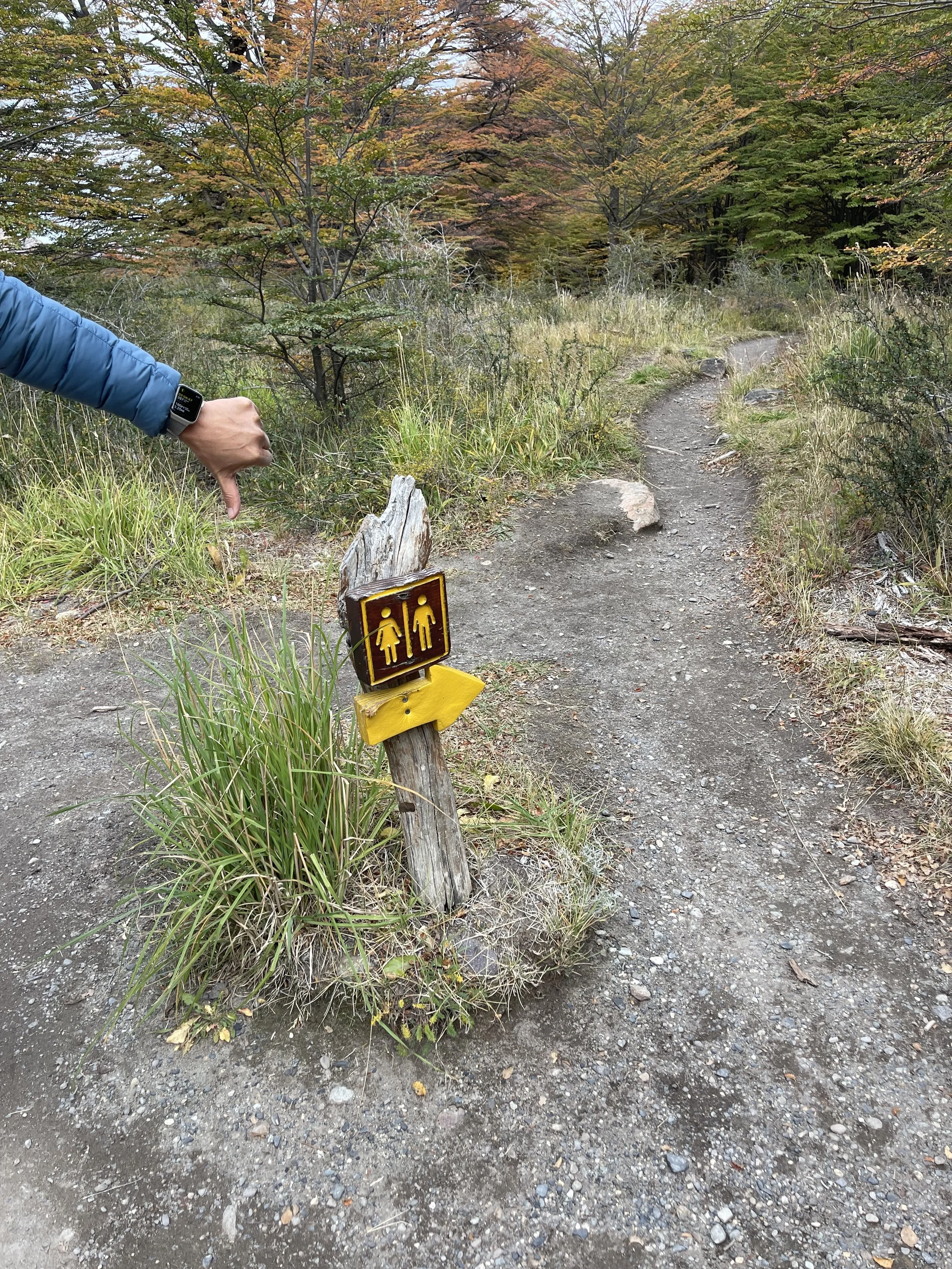
While discussing with N. what to do, I happened to catch sight of a trio coming back from the unpaved road parallel to the trail, which I knew was an alternative path to the waterfall.
“Perdon, did you come from the waterfall?”
“Si….”
“Did you have to pay an entrance fee to go there?”
“Oh, no. You just follow the road for about 3 km, and then turn left. You can just go; there’s no booth or anything…”
“Gracias!”
We followed the dusty road, followed signs to a useless little detour through some bushes, and were officially in national park land. (We did stop at a composting bathroom before the falls and really really wished we hadn’t, so entrance fees did not seem to be spent on restroom maintenance.) We followed the sounds of water and soon found ourselves by the waterfall.
N. was unimpressed, and was soon more entranced by the autumn foliage in the area, which weirdly seemed brighter here than anywhere else in the area.


***
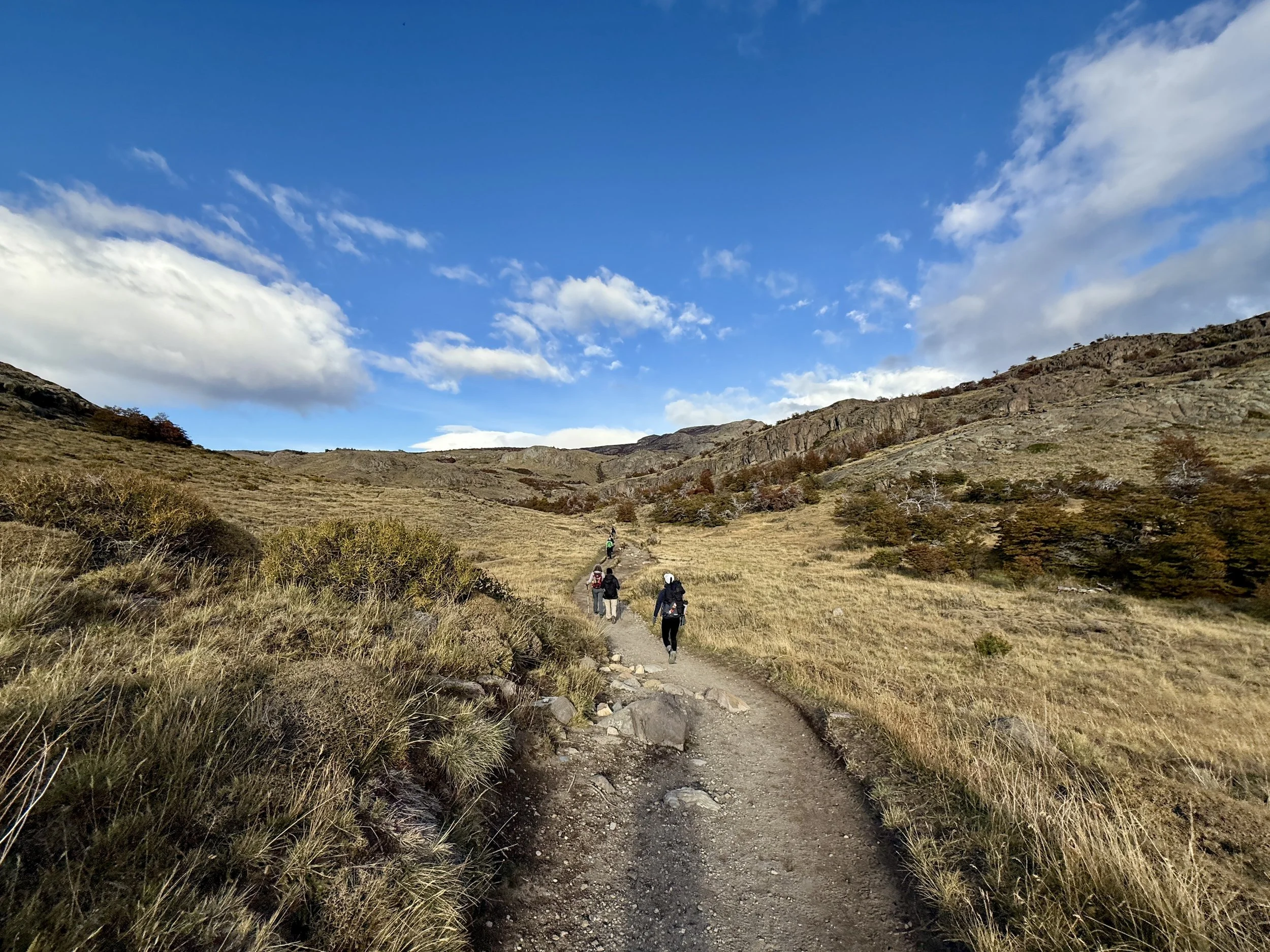
The forecast did not look that great — no rain but thick clouds — but we could not stay in the hotel room forever; we packed our bags and headed to the trailhead for Mirador Maestri. The one thing about hiking in El Chalten that’s super-convenient was the fact that most major hikes could begin and end in town — no need for a car to get to trailheads far and wide.
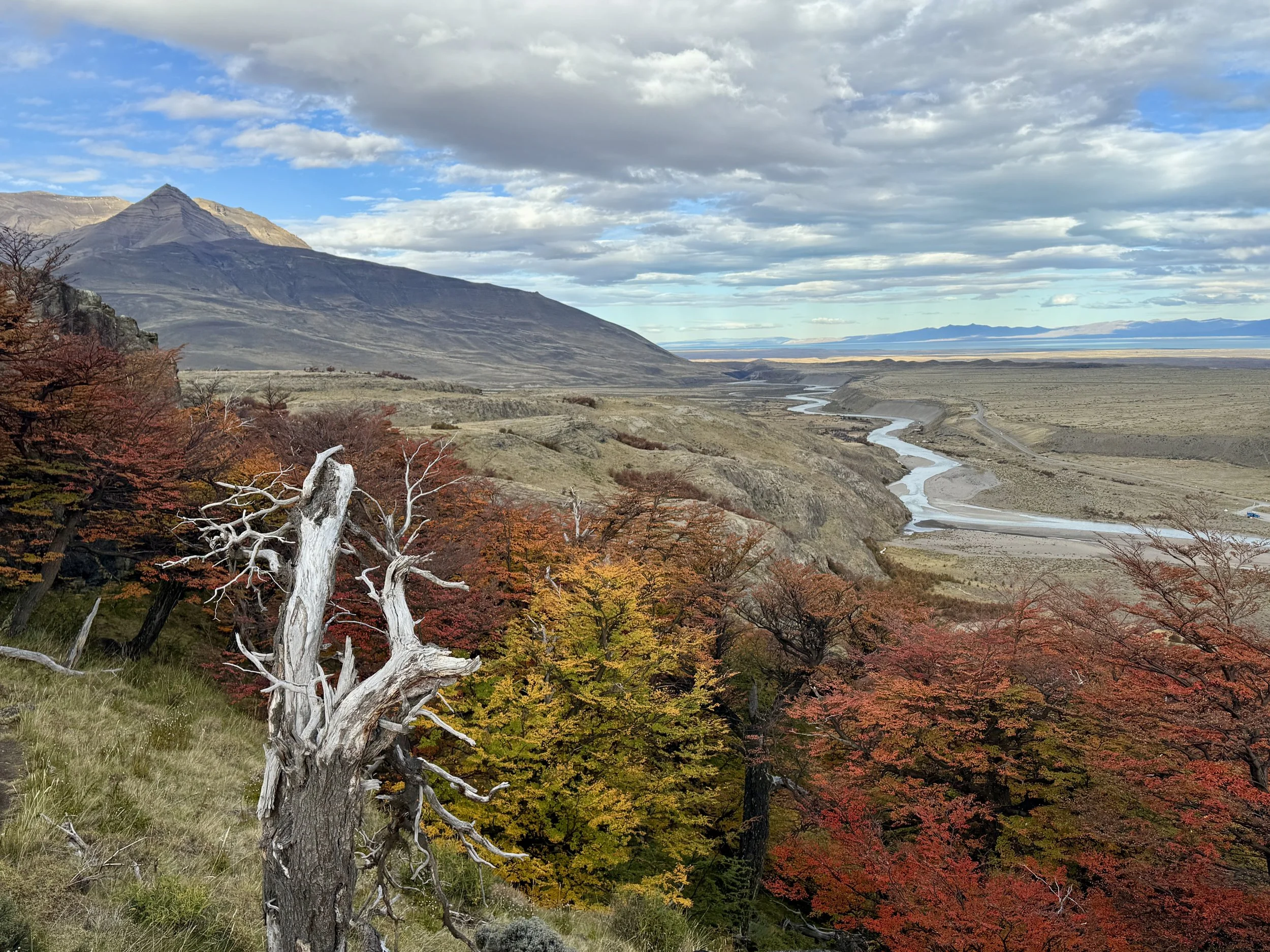
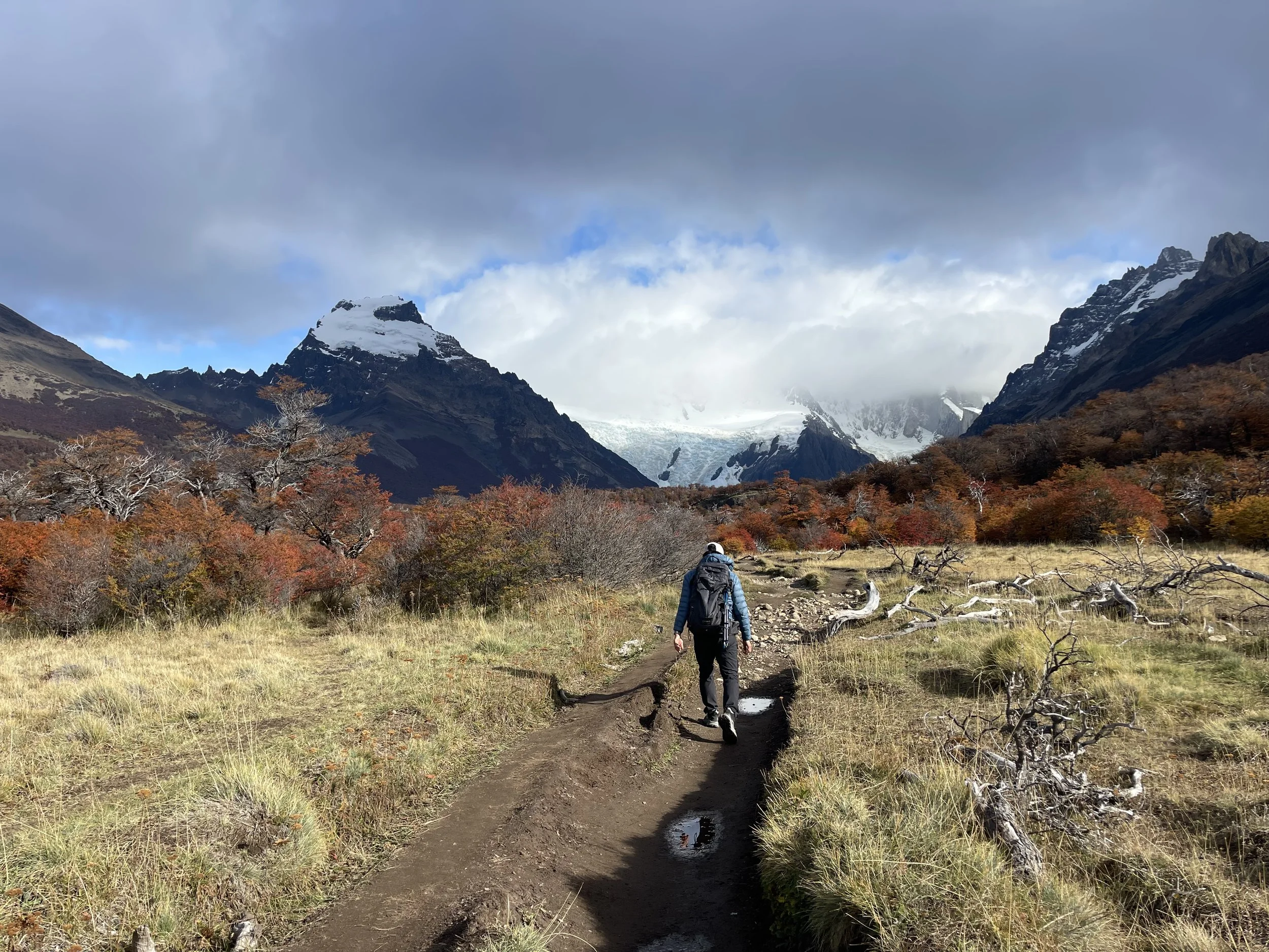
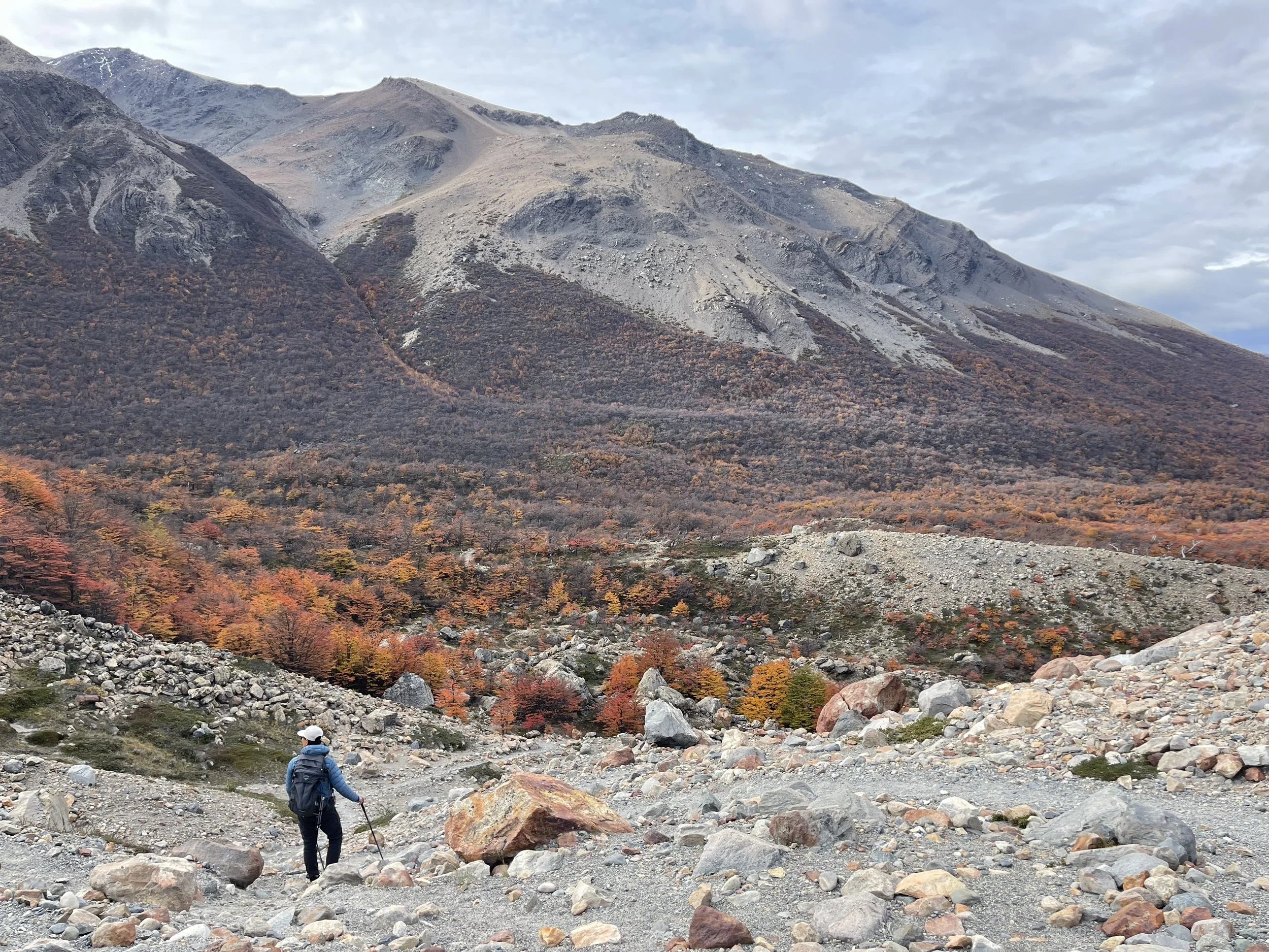
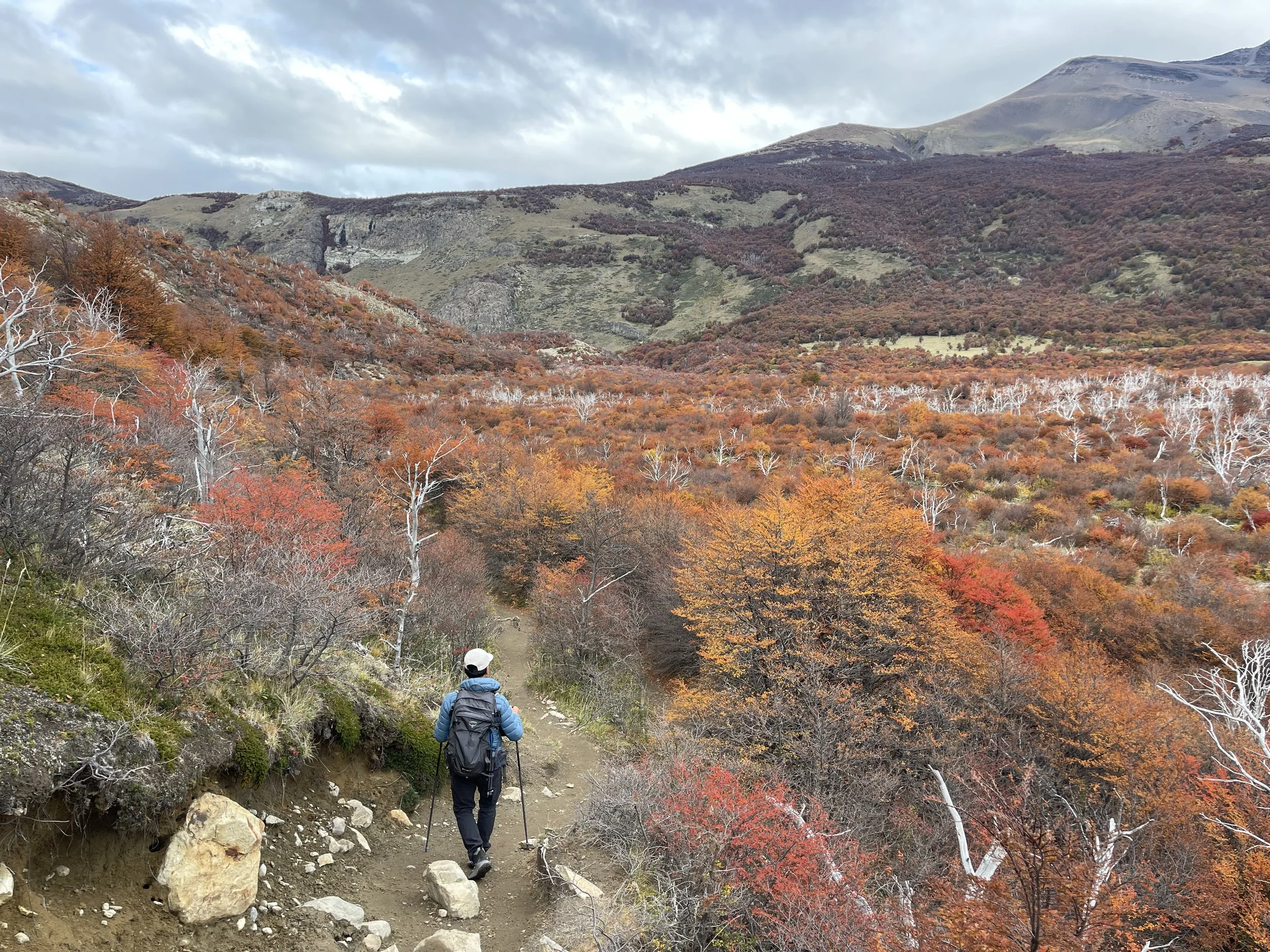
Today, we walked a few blocks and soon were on our way up and out — El Chalten disappeared in one uphill climb, into a trail that was well trod, between low brush already turning with the autumn season, in between two peaks — Cerro Solo and the tail end of the bulky heft that was the chain of Fitz Roy.
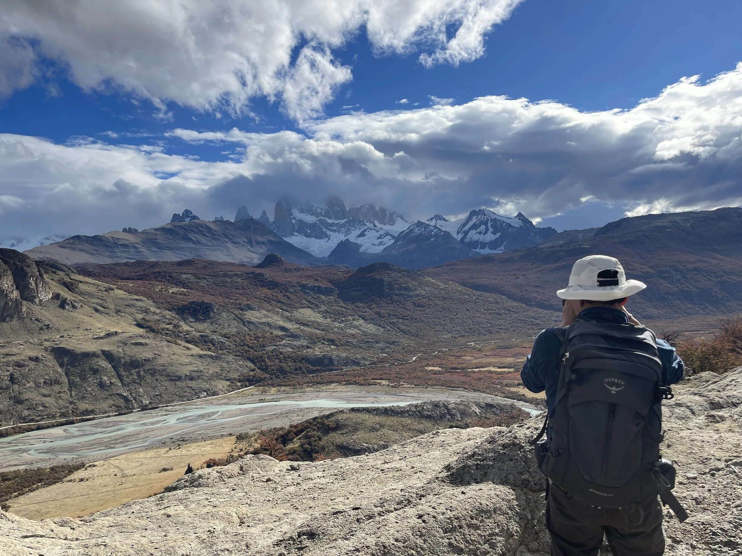
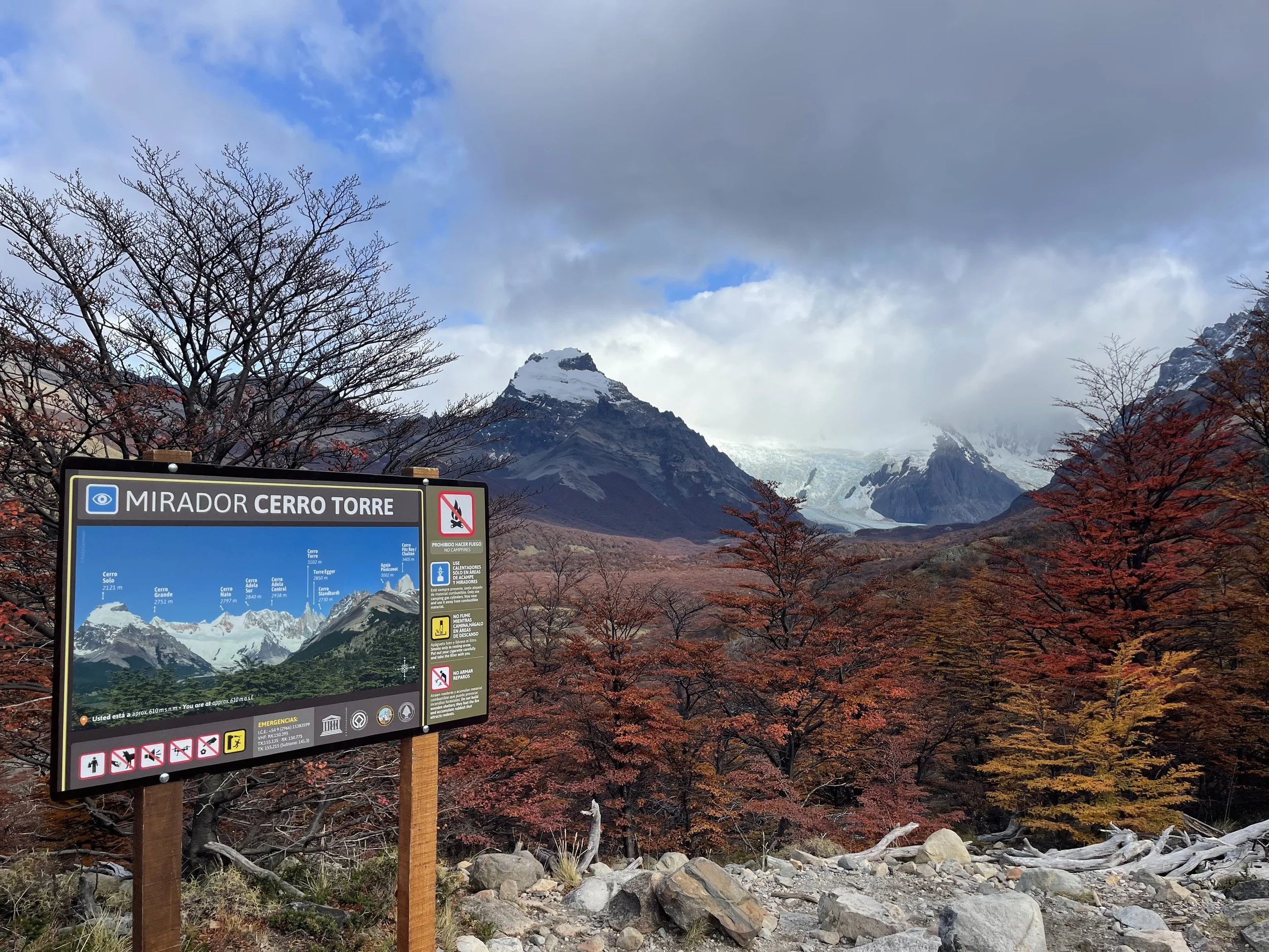
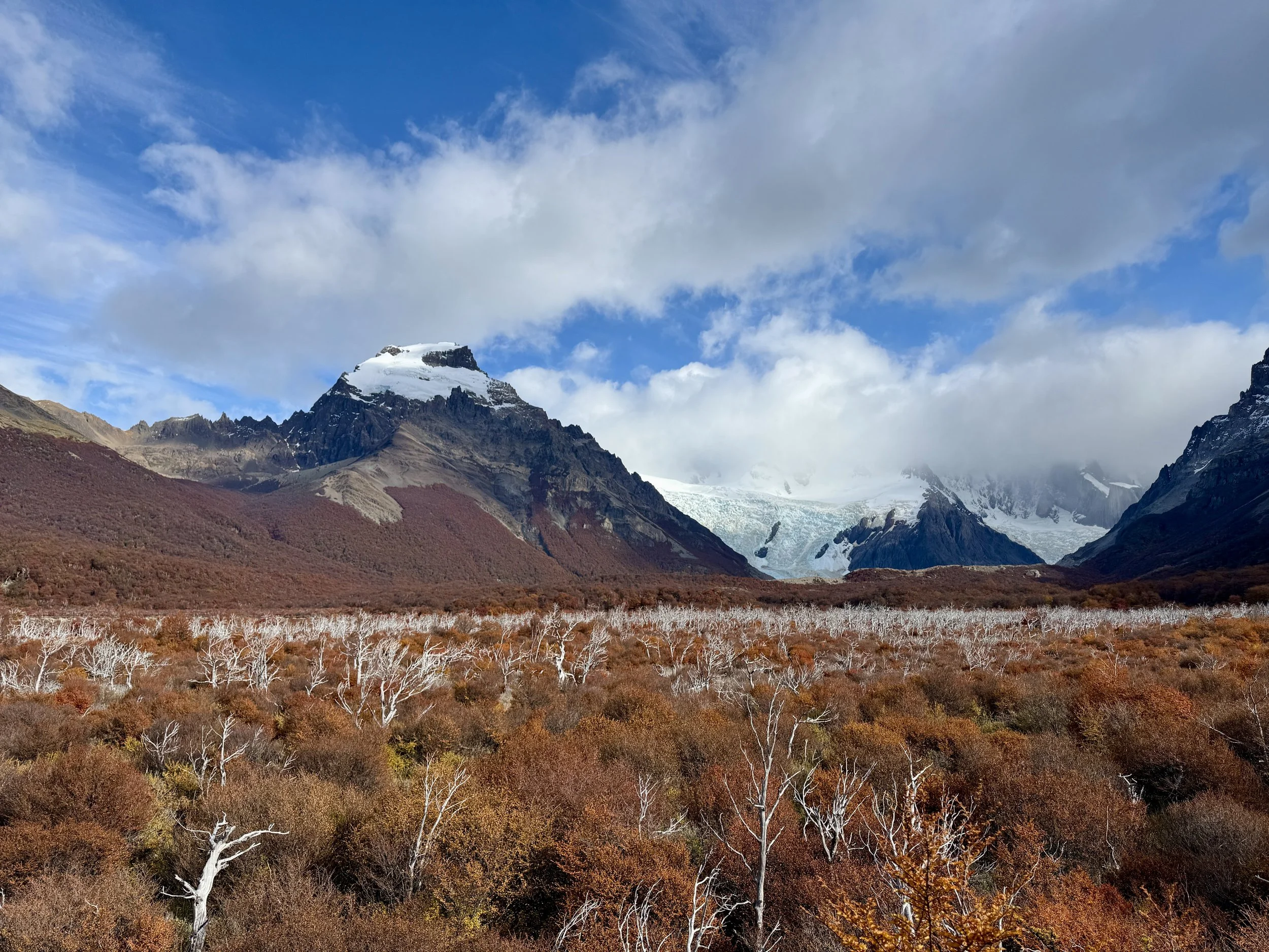
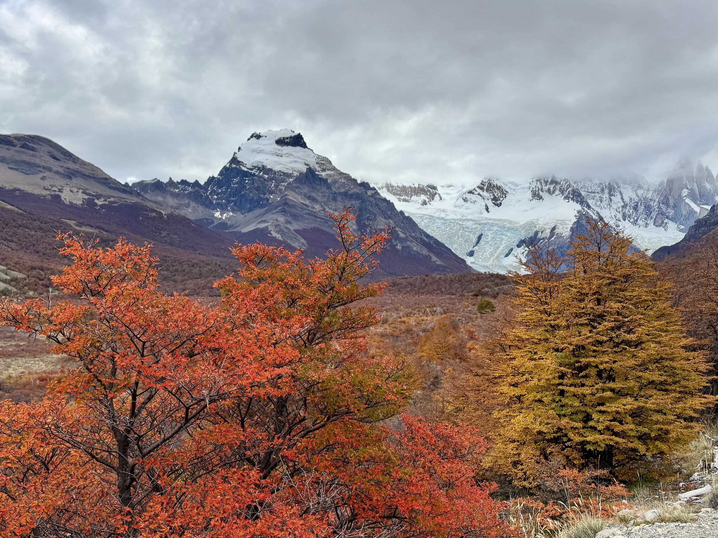
The trail opened at the Mirador del Cerro Torre, where the small rise in elevation already gave us a panoramic view of the mountains to the left and right, to the Glaciar Torre at the center, and the flat fields below.
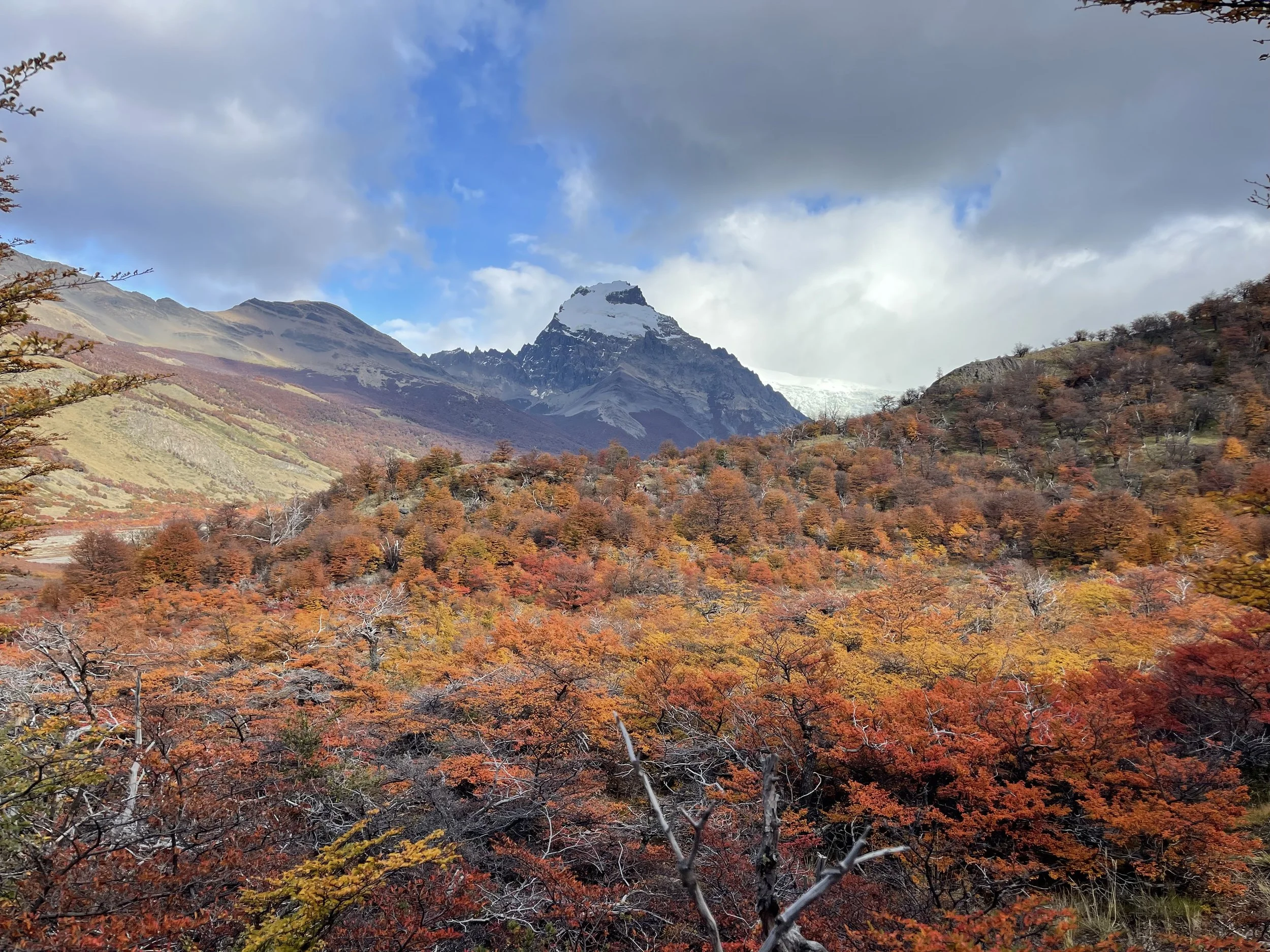
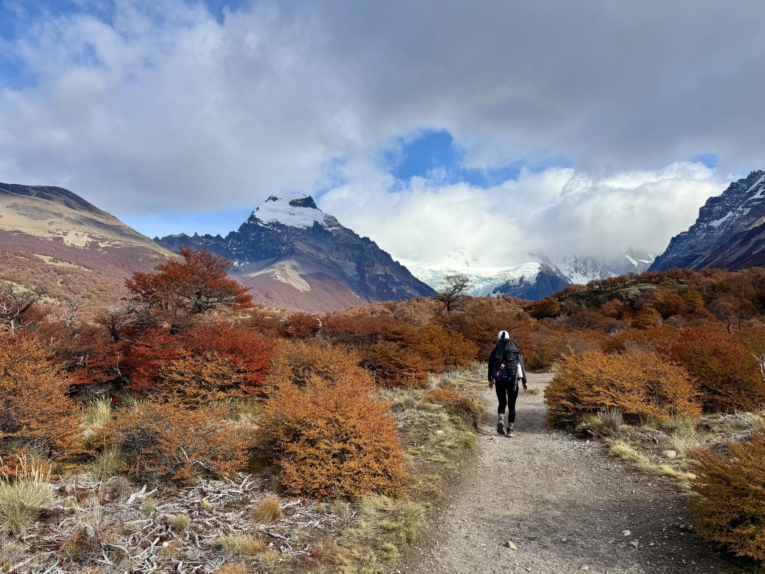
Most people at the mirador appeared to have reached their destination, so we had the rest of the trail mostly to ourselves. As we descended to the valley floor, the trail was a flat hike that seemed to yield brighter and deeper fall colors the farther we ventured inland. N. glanced up from time to time, hoping to see Fitz Roy visible, but it remained hidden behind low clouds. For once, my attitude turned lemons into lemonade: with that peak out of sight, we could focus on the scenery we were hiking through.
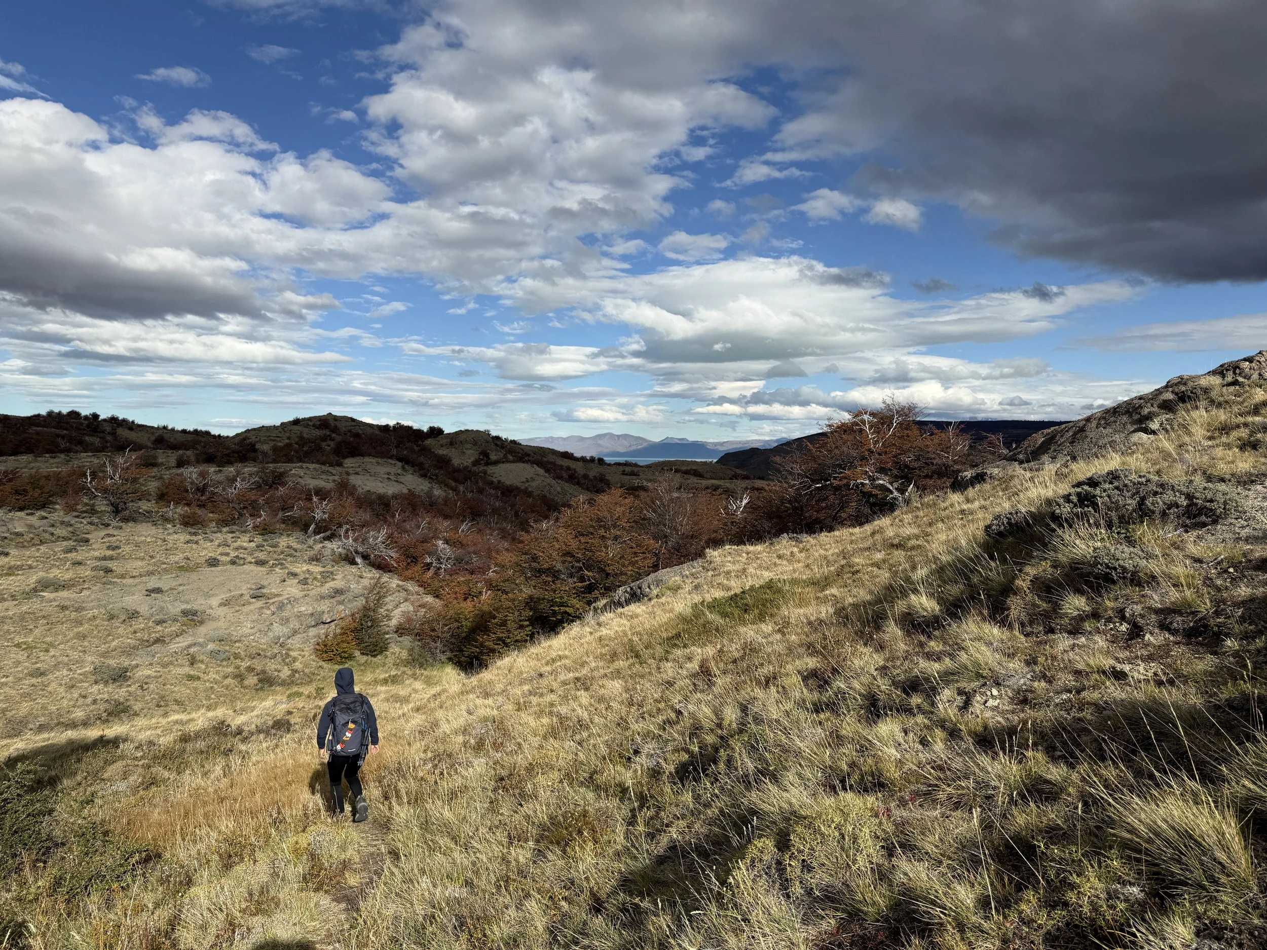
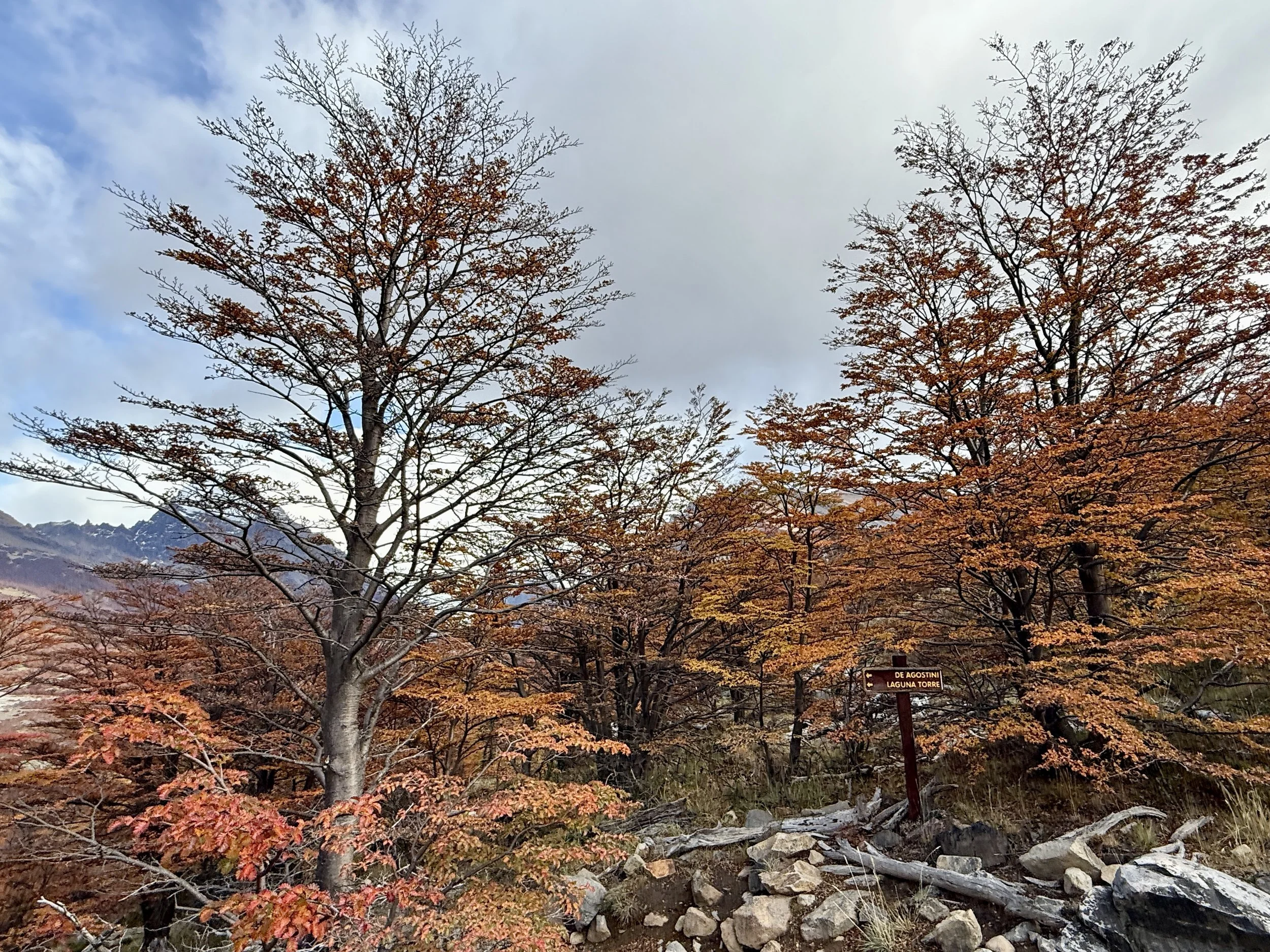
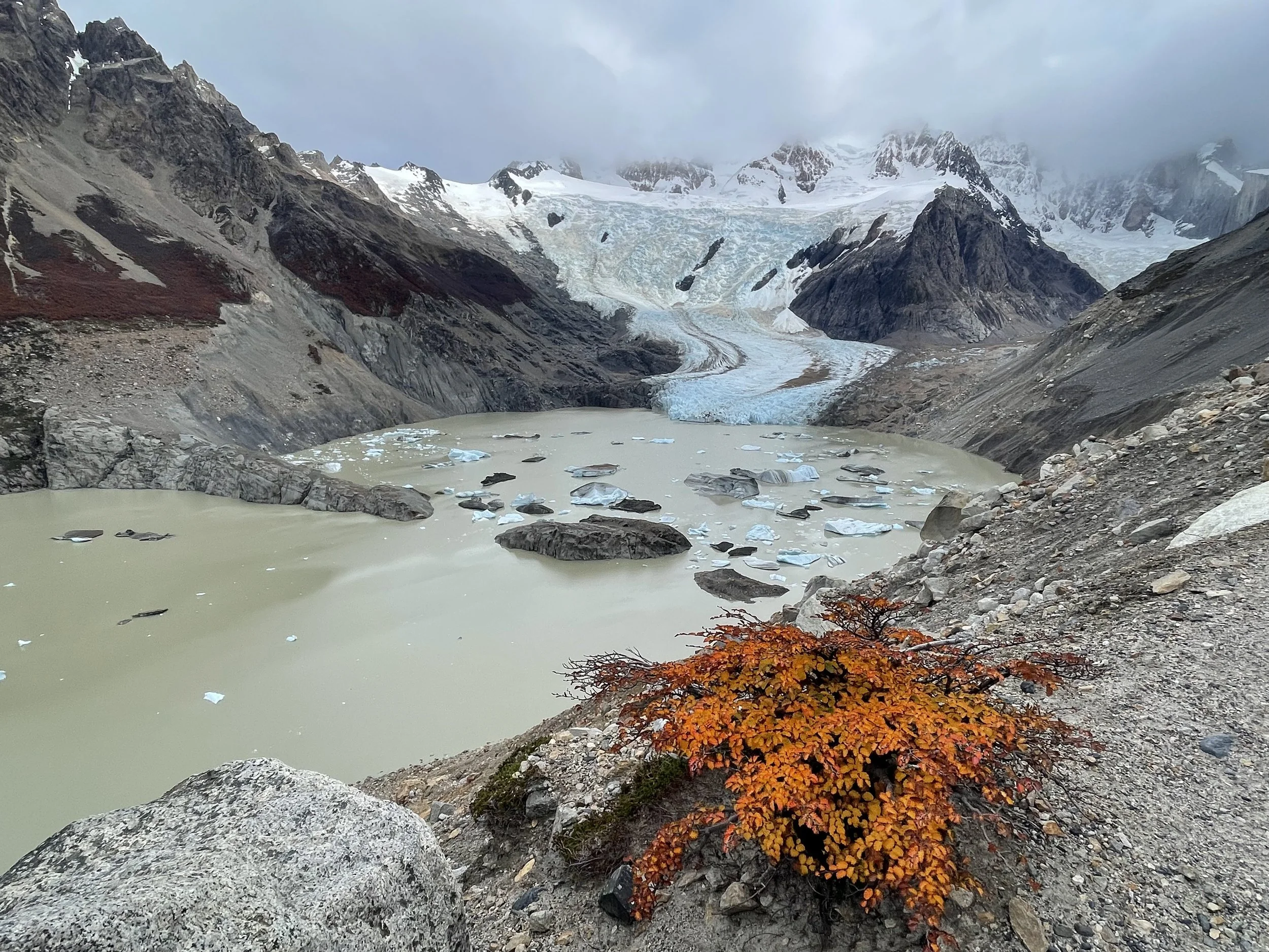
As we got closer to Laguna Torre and followed the rising trail to the hill on the right, the higher vantage point gave us a great perspective to admire the colors on the valley floor; there was even a dramatic stand of white tree trunks — perhaps the result of an old fire? — that made the oranges and reds pop even more.
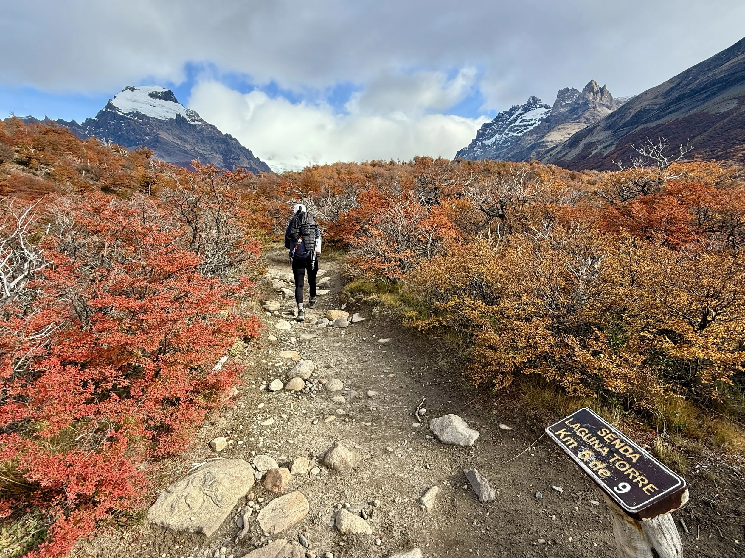


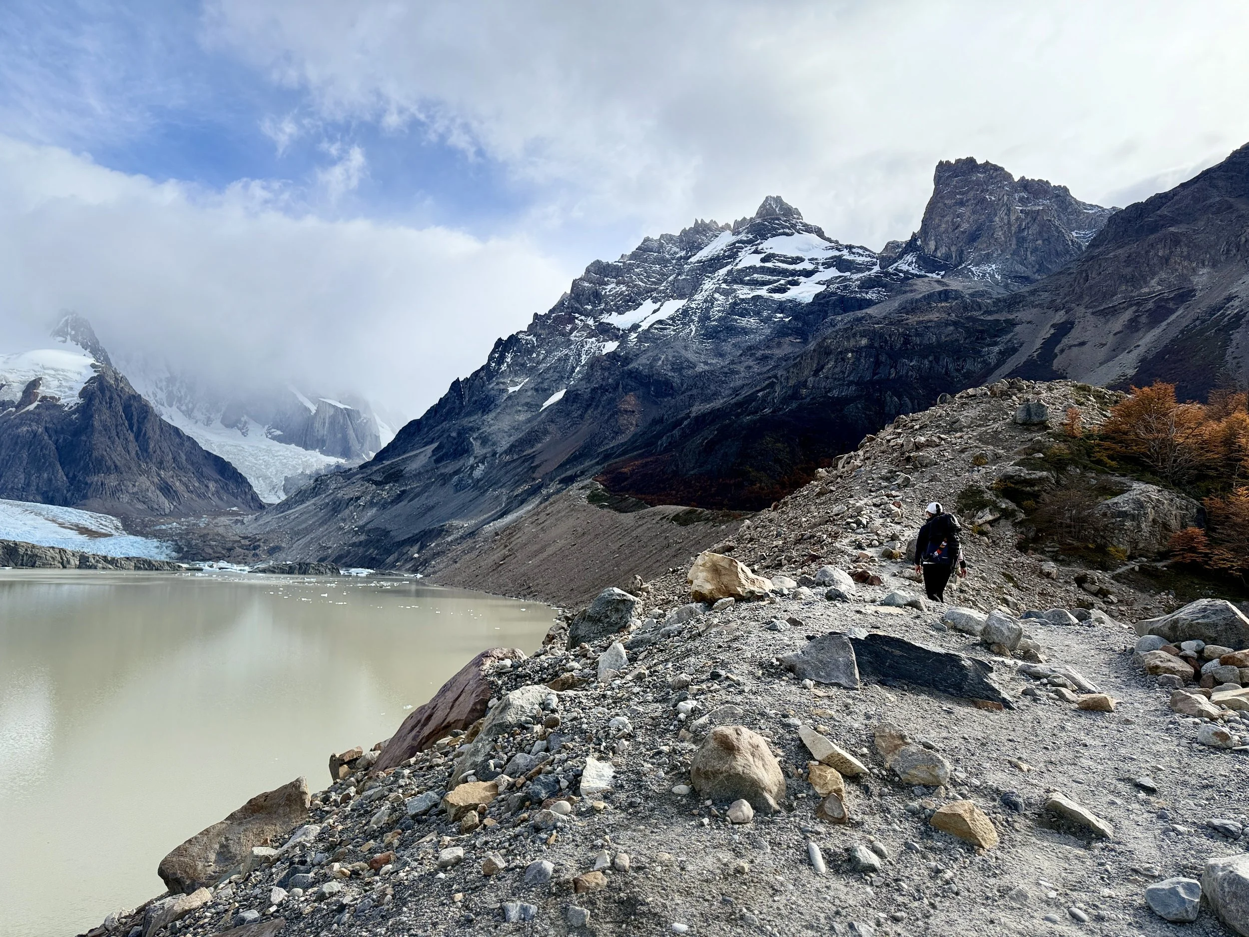
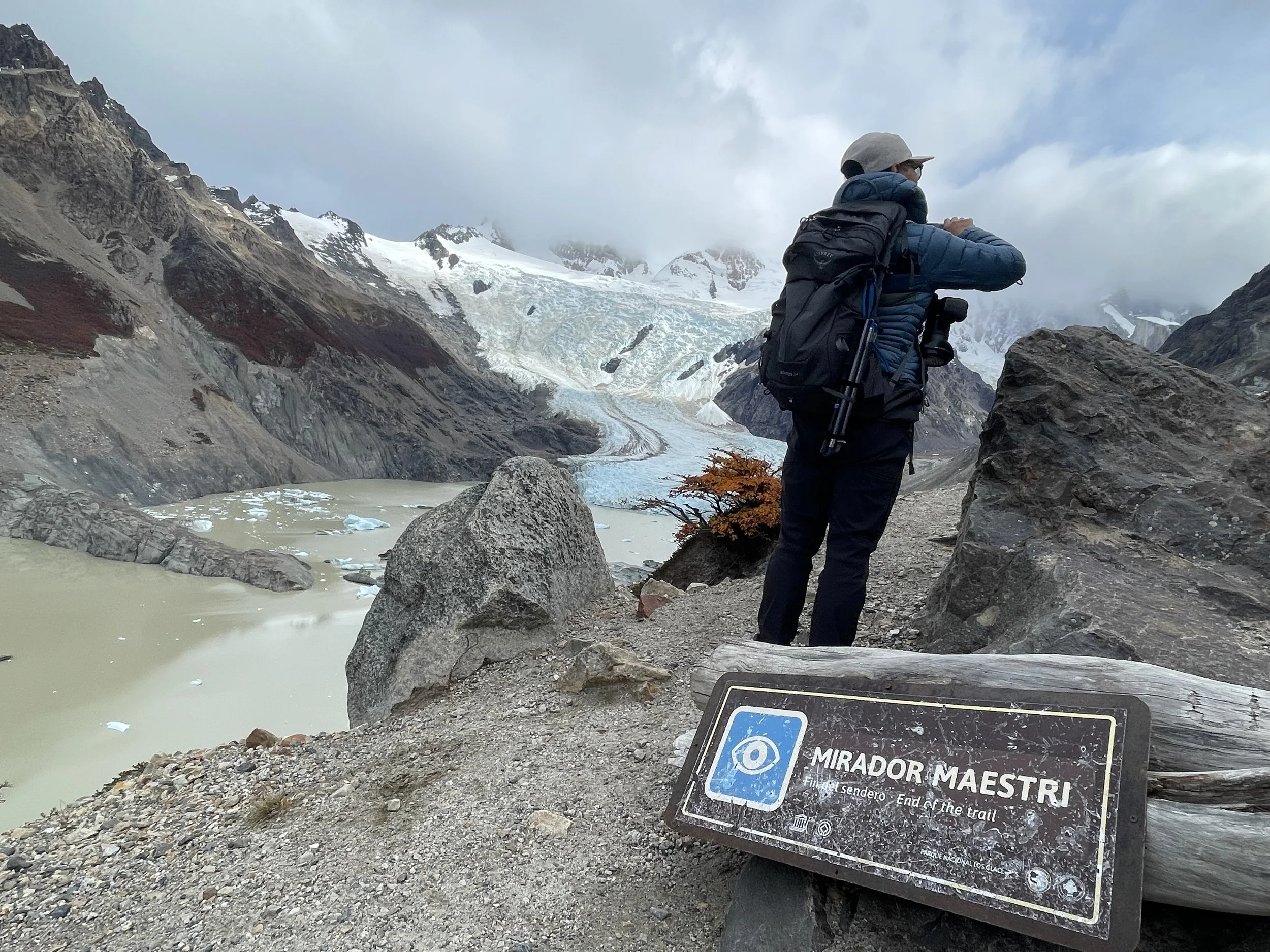
We reached the edge of Laguna Torre, where all the colorful trees and brush gave way to gray rock. From here it was a steady ascent from one edge of the lake to the other, until we reached the base of the glacier. As if on cue, N. began to lose energy and drag behind. I was determined to go to the end, to a sign that would indicate the end of the trail. I knew exactly what N. would say (“The trail is there for me; I’m not here for the trail…”), but I was hiking too far ahead of him for him to voice his objections.
The sign indicated “Mirador Maestri,” where a group was taking a break from hiking by… smoking. For some reason, I find hikers who smoke weirdly funny.
We stopped to have lunch, but again, the empanadas we got from the corner bakery tasted like the sea — and not in a good way. (We have struggled with food in this continent, carb-dense, heavily salted and overly sweetened). I managed only half of it before I started to feel my veins crying for help against the increased blood pressure.
Soon we were on our way back, with the trail familiar, just as easy and beautiful, but long!
(Mirador Maestri: 4.8 stars, difficulty level: hard, 12.7 miles, 1,988ft elevation gain. My watch’s data: day’s distance 16.1 miles)
***