Rapa Nui (Easter Island), Chile
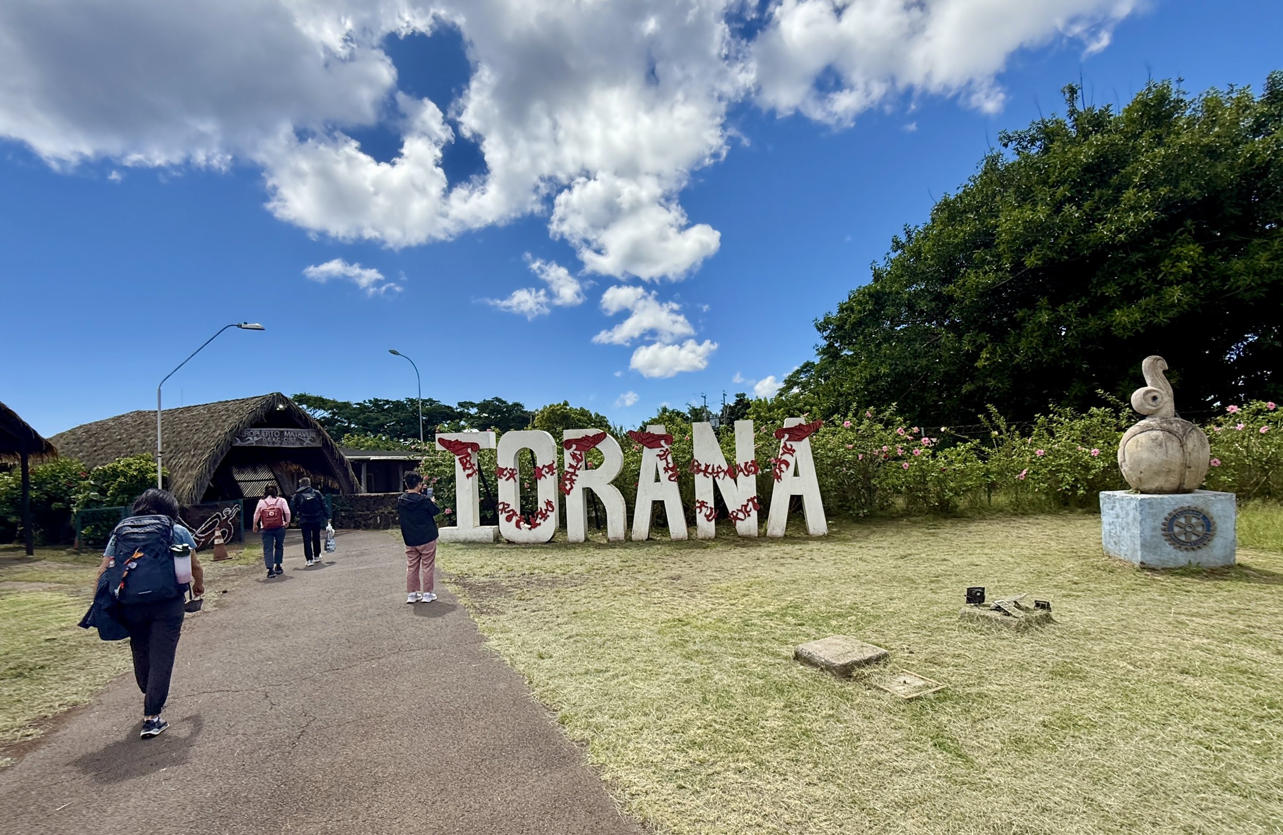
Iorana, Rapa Nui!
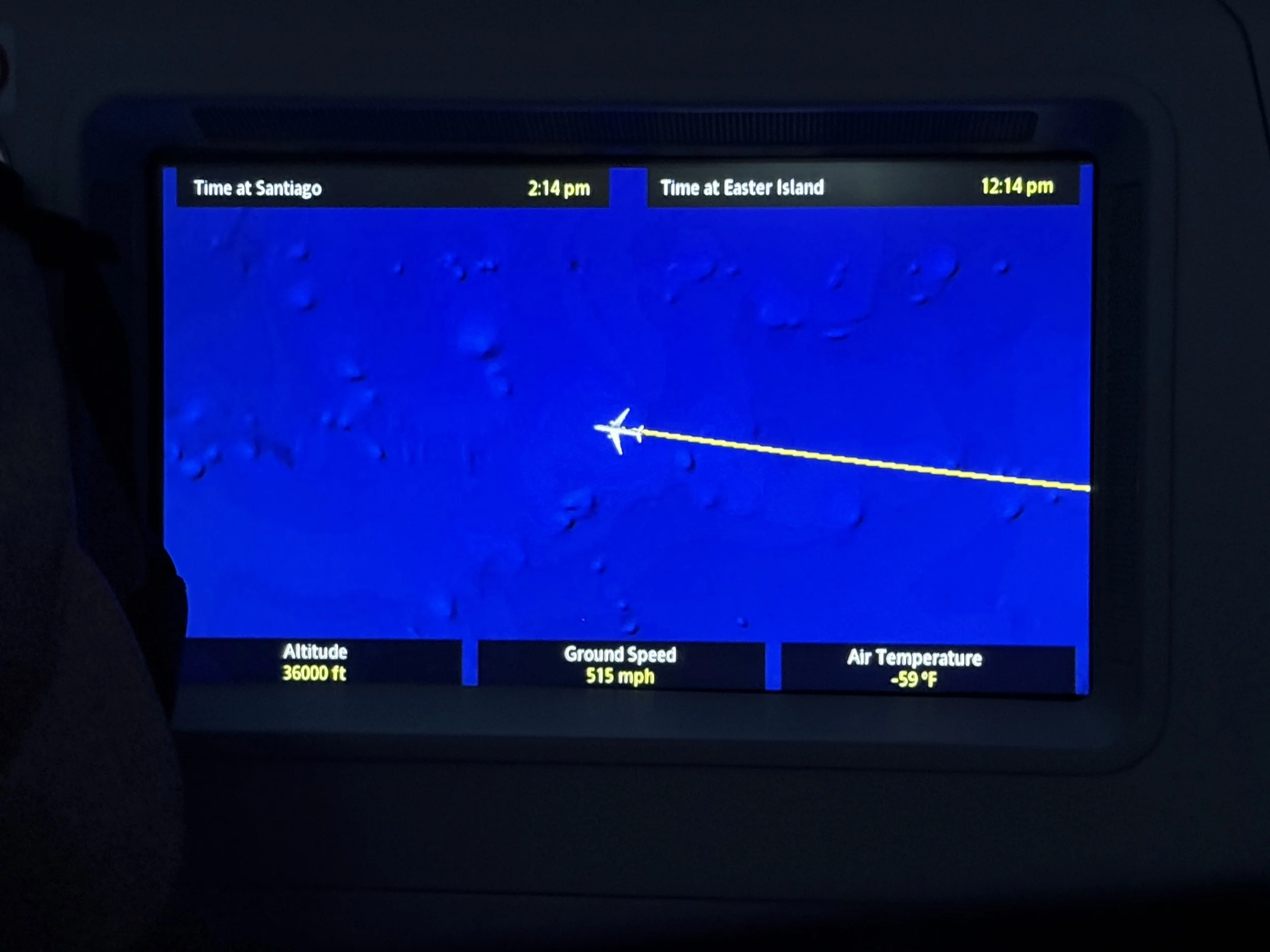
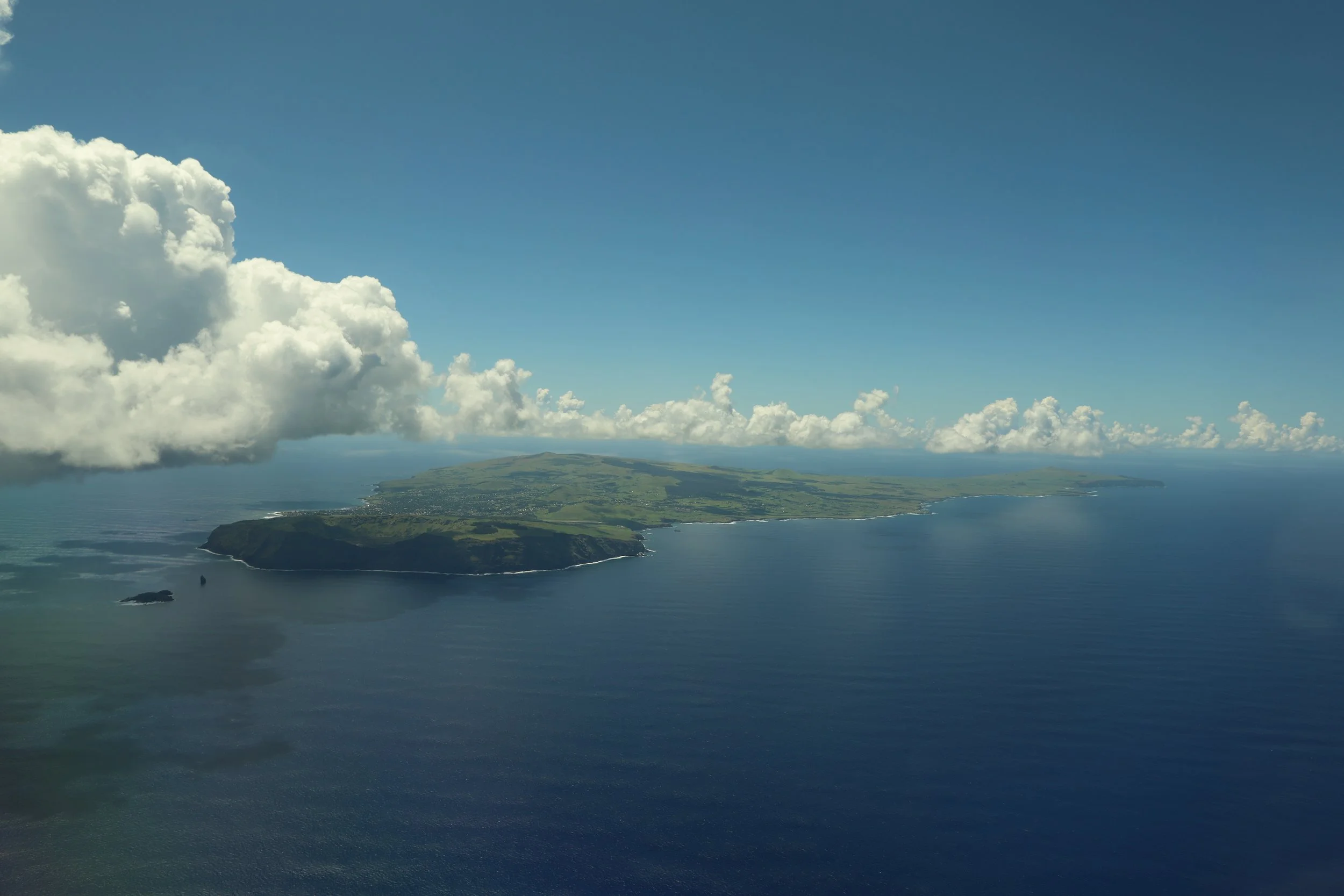
From the plane’s tracking map, it didn’t feel very comforting to see that our destination was literally a dot in the Pacific Ocean; the island was a measly 60 square miles, so, from the plane, all of it fit within one plane window frame.
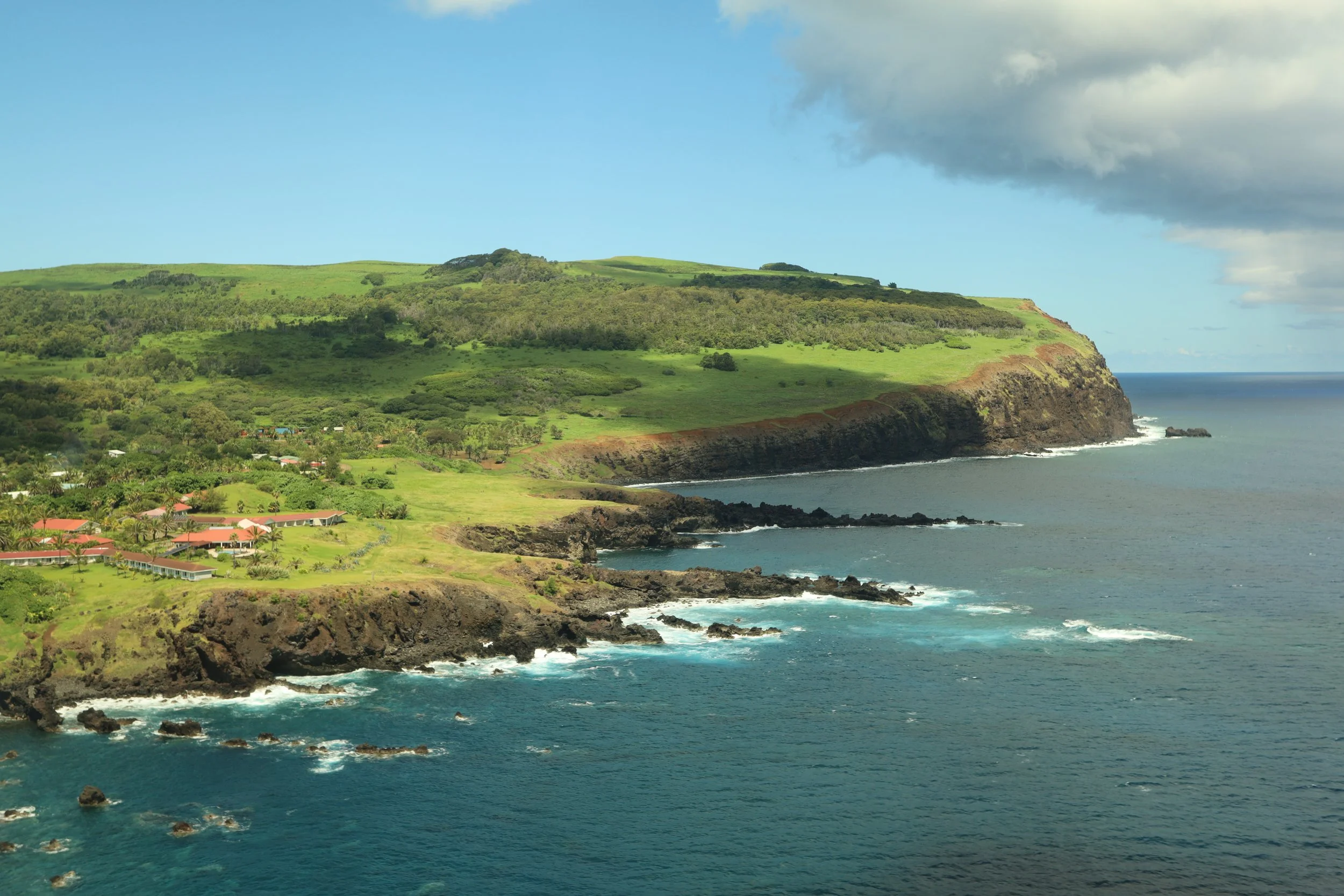
As soon as we landed on Aeropuerto Internacional Mataveri, there was no hiding the fact that we were in a tropical climate — bright, hot, humid.
Because we were on an island, dogs were working at the airport to sniff out agricultural contraband; one dog was led to sniff around the bags coming on the conveyor belt and another was wandering among the passengers headed out the door. The ladies guarding the exit asked all of us whether we had honey (note to self: find out why honey is considered dangerous contraband in islands).
We were greeted with leis by the hotel staff and taken on a little intro tour of the town of Hanga Roa — its restaurants, practical shops (pharmacy anyone?), and highlights.
For dinner, we went to an oceanfront restaurant where, it blew our minds, we had uni by the bowlful.
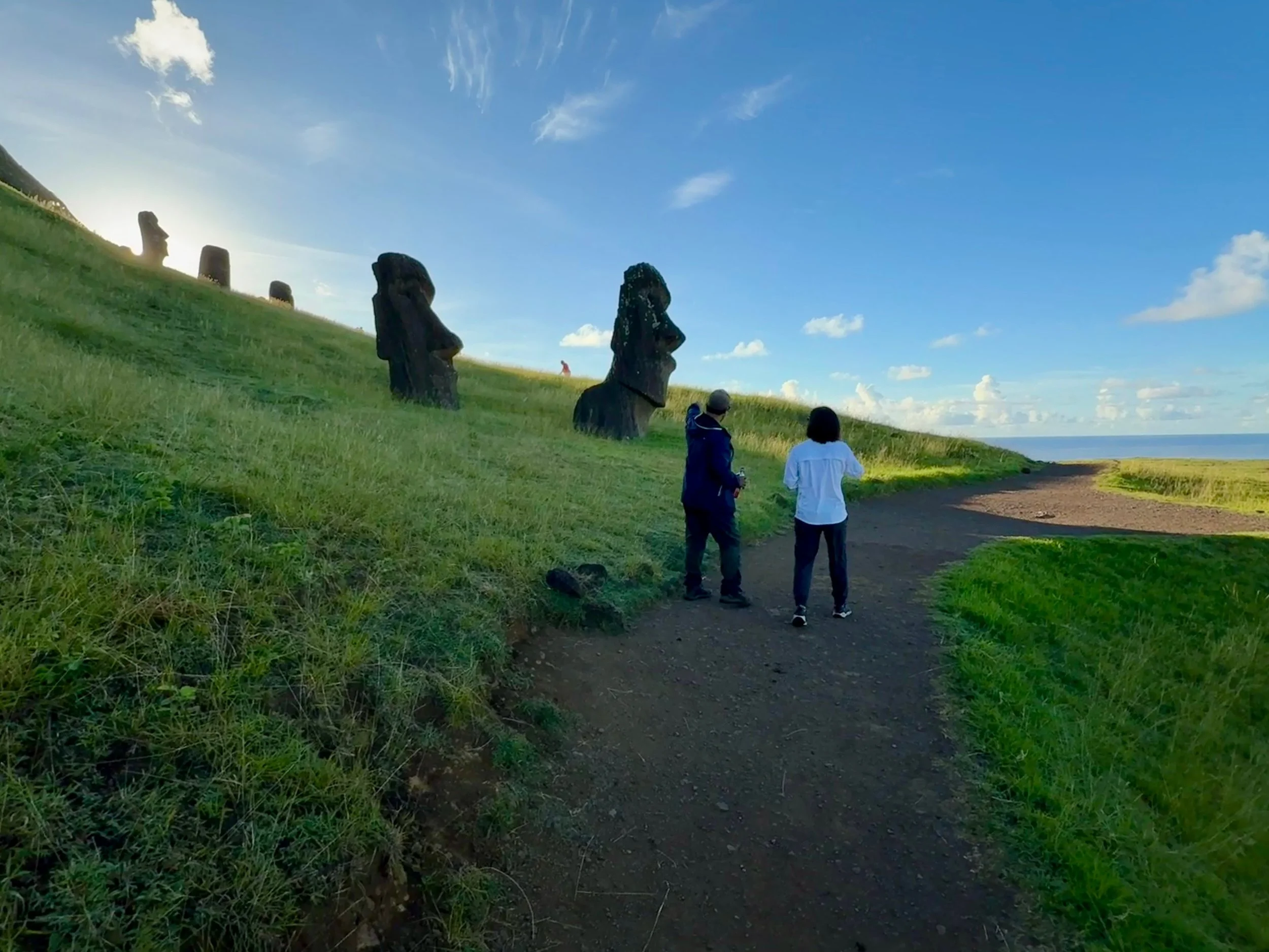
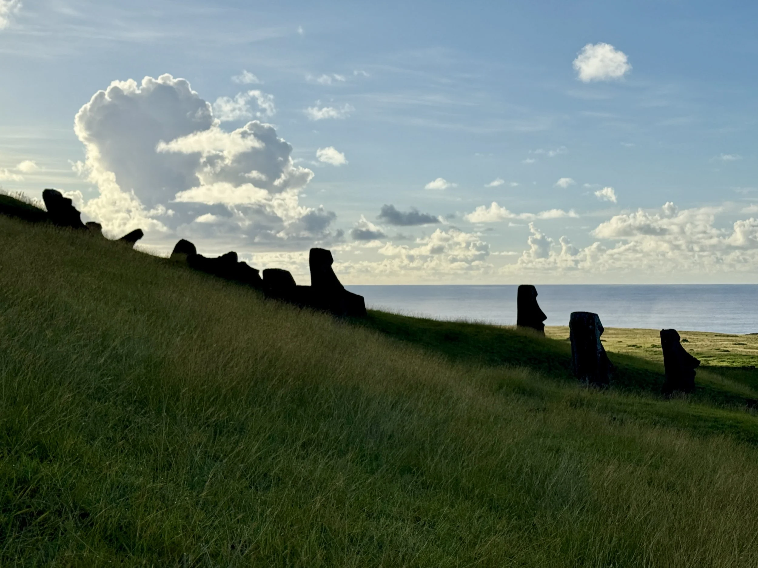
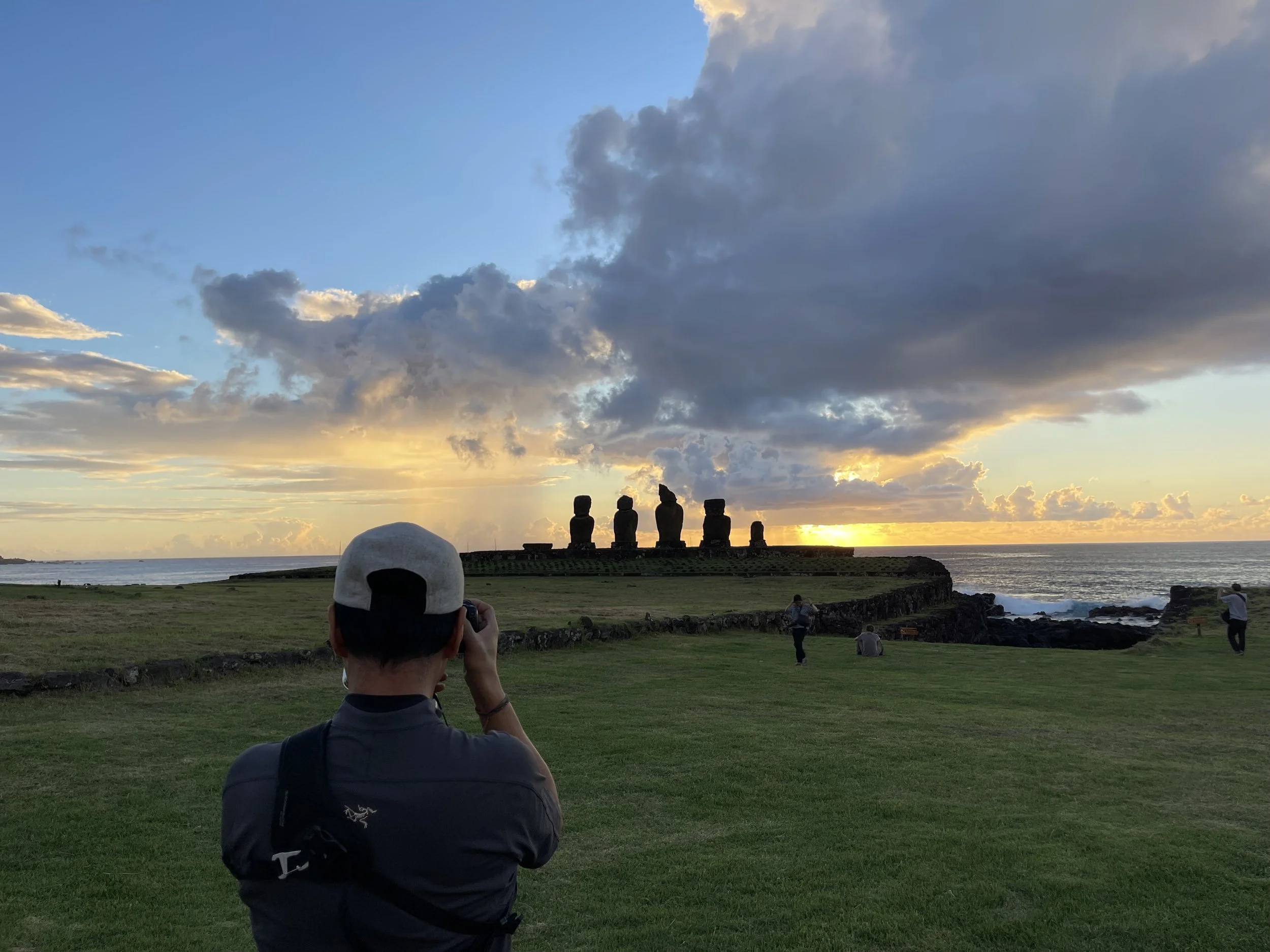
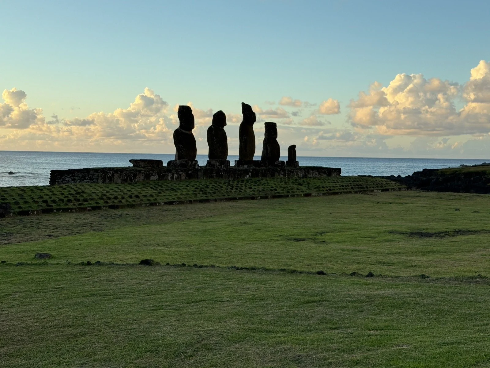
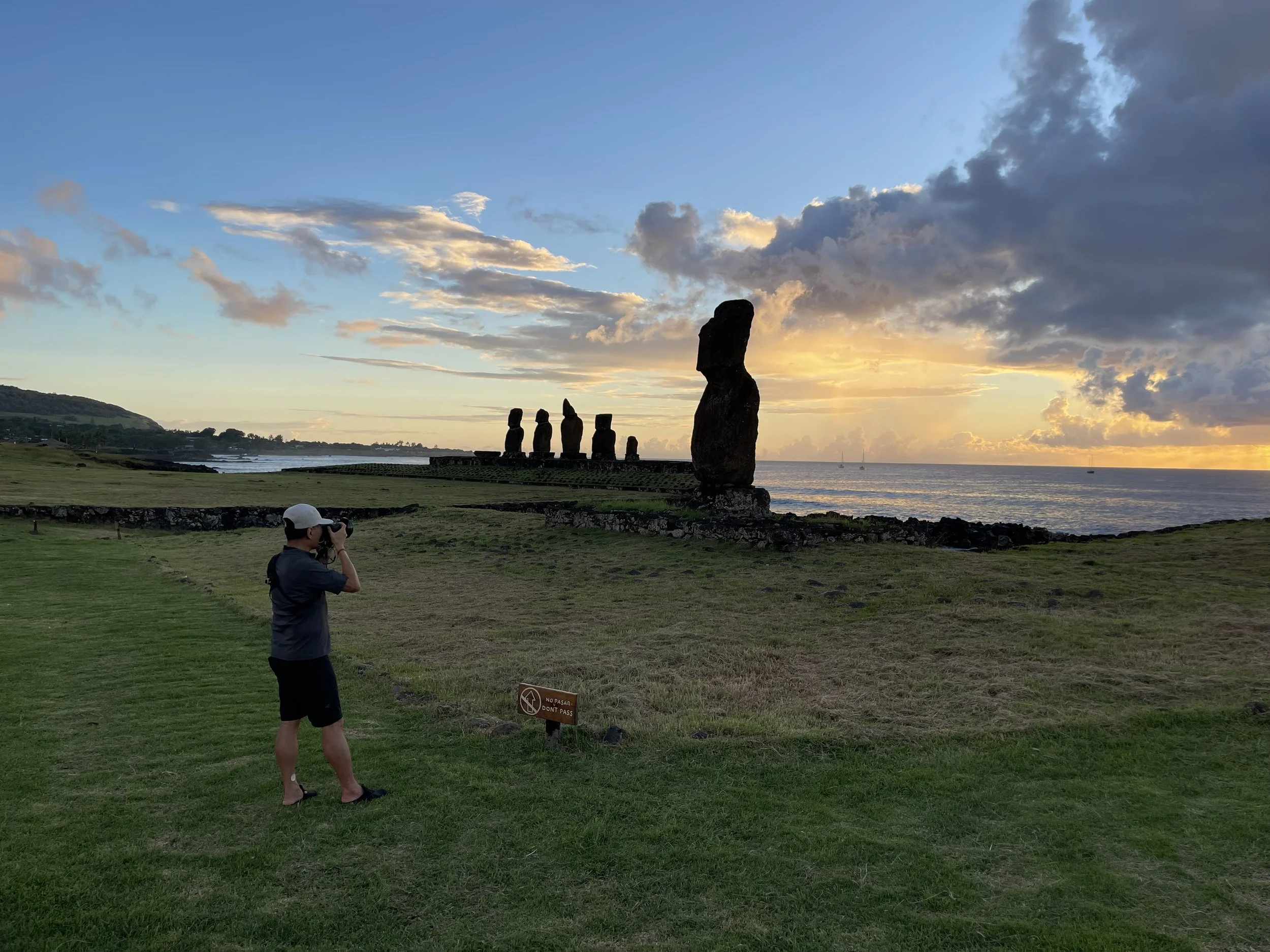
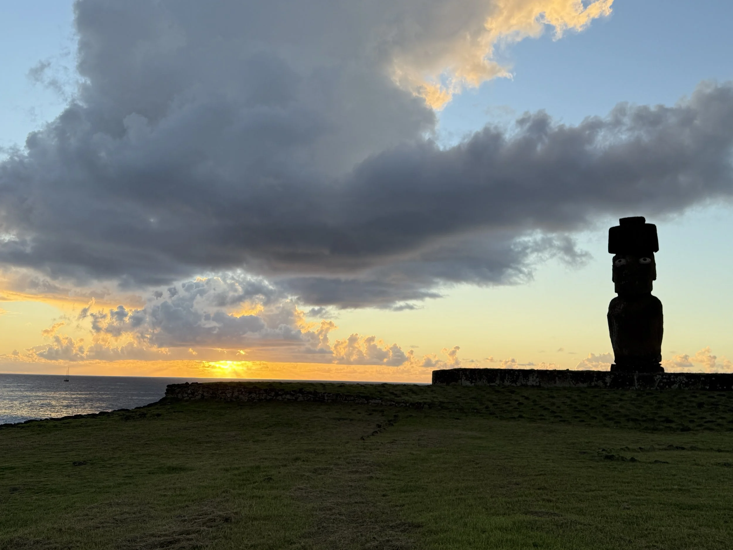
Our first moai: we walked to Ahu Tahai for sunset. It was one of the few ahu (platform) that were in town and free to visit without a guide (a constant theme on the island). The moais (statues) were standing guard by the seashore, facing land and a wide grassy field where tourists and locals alike had spread themselves to unwind the day, gather with friends, have a picnic.
***
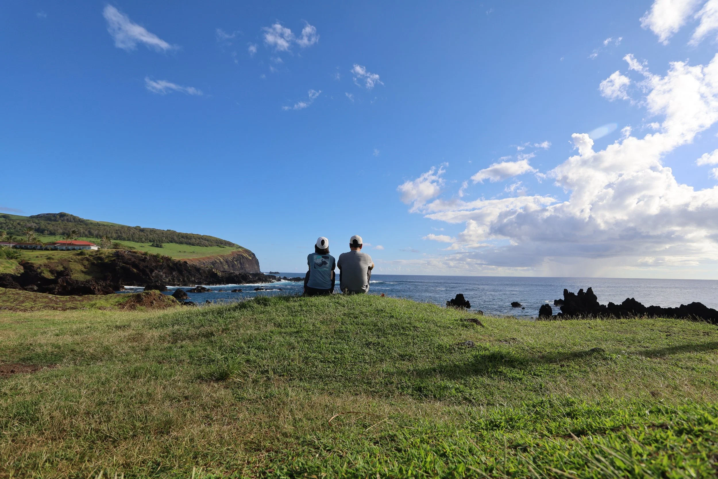
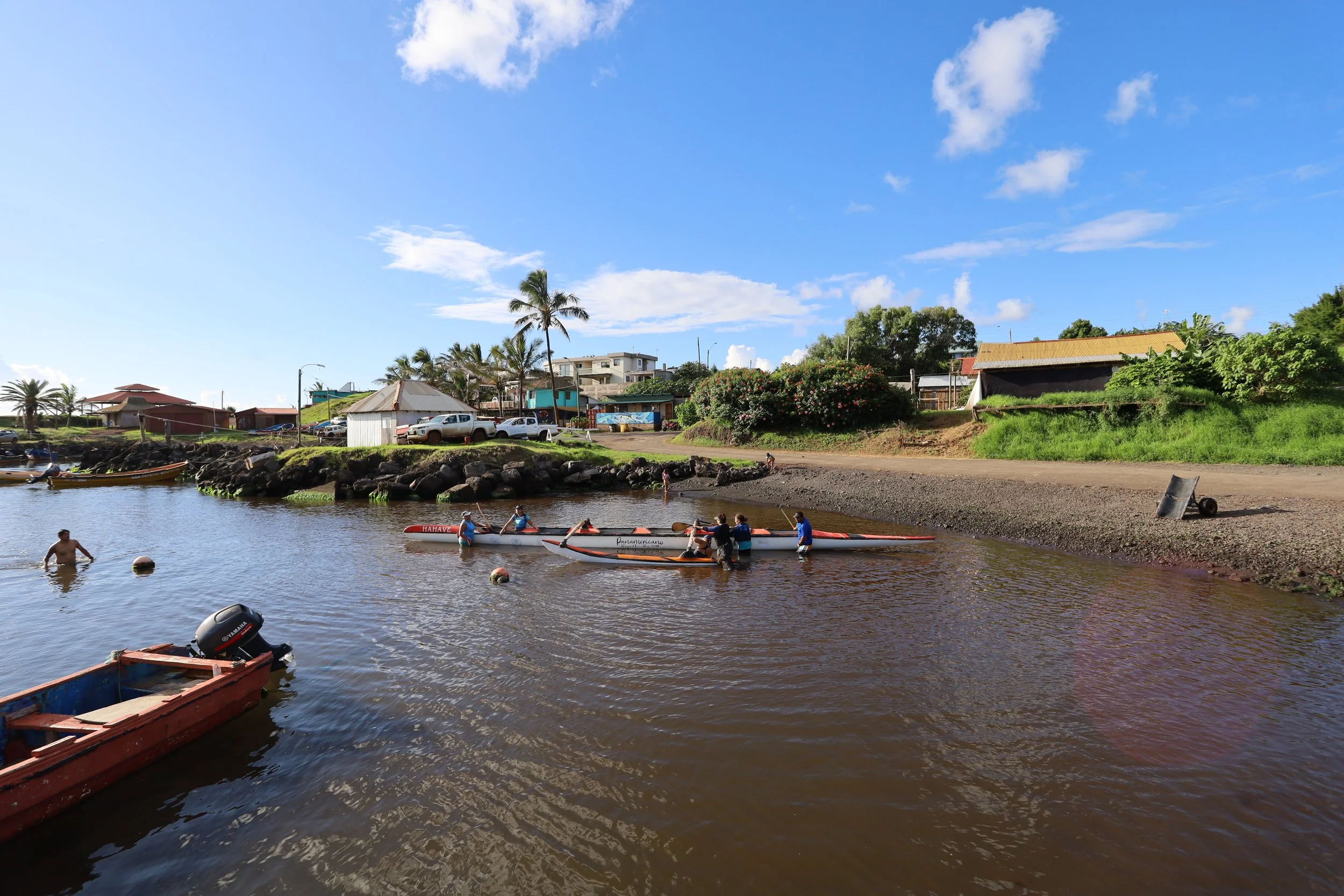
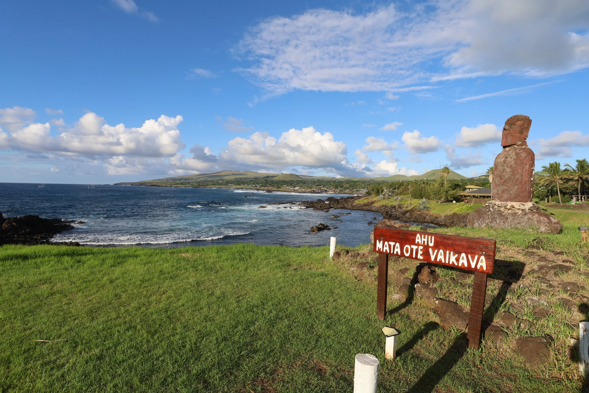
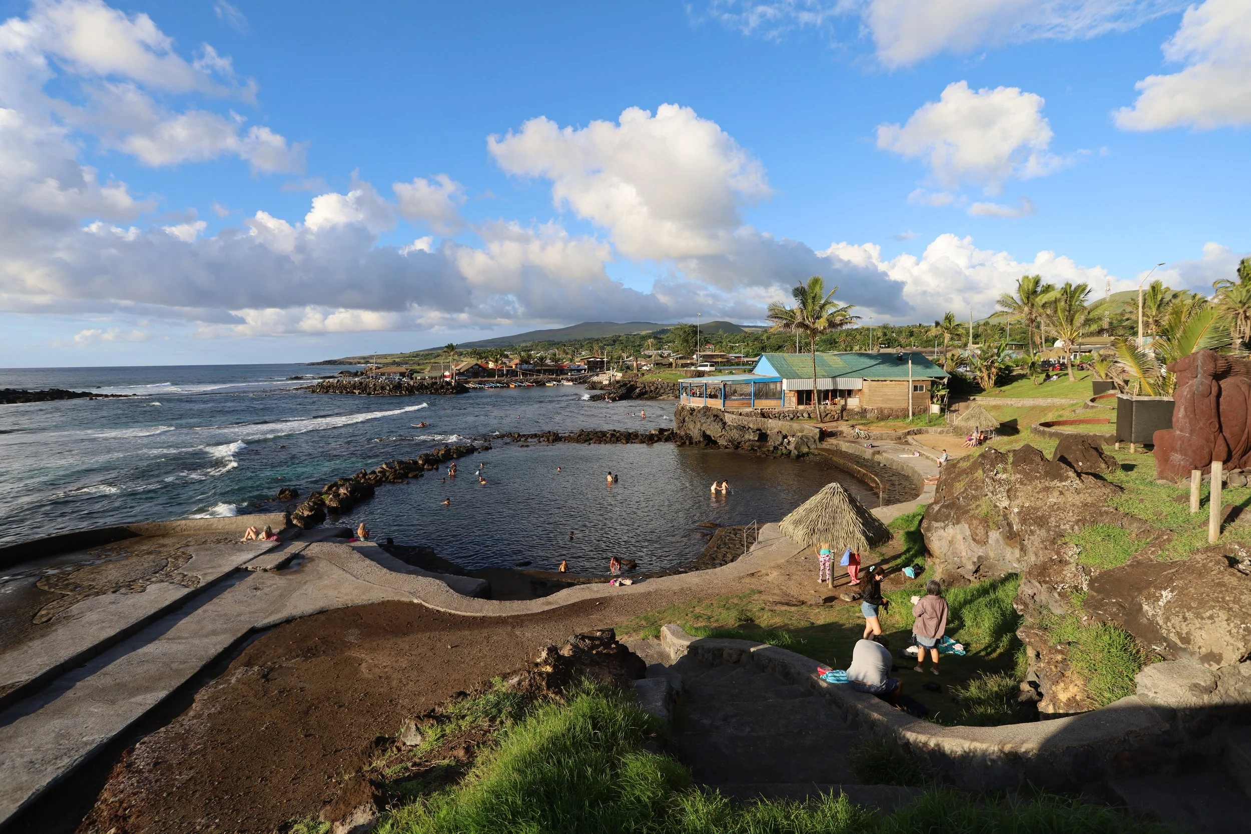
We ventured out in the late afternoon, walked to Mirador de la Costa and made our way along the shore. N. had wonderful opportunities for photos: the waves crashing into the rocky beaches; Ahu Riata by the marina, where locals were taking their canoes out to sea (and where a stray dog tried to get onto the boat himself); a bit further down, the Mirador de las Olas; Ahu Mata Ote Vaikava also standing guard.
***
Our guide P. was from Santiago but had met and married a Rapa Nui native and had been living on the island for decades. He said that as a mainlander he was not allowed to buy property, but his wife and children could. In turn, his daughter had married a Swede. And speaking of family: all native islanders are supposedly descendants from the 100 or so Rapa Nui who survived the wars and diseases brought by outsiders. I know enough of biology to say that, if I were an islander, I would also consider marrying a non-islander.
Our stops on this guided tour:
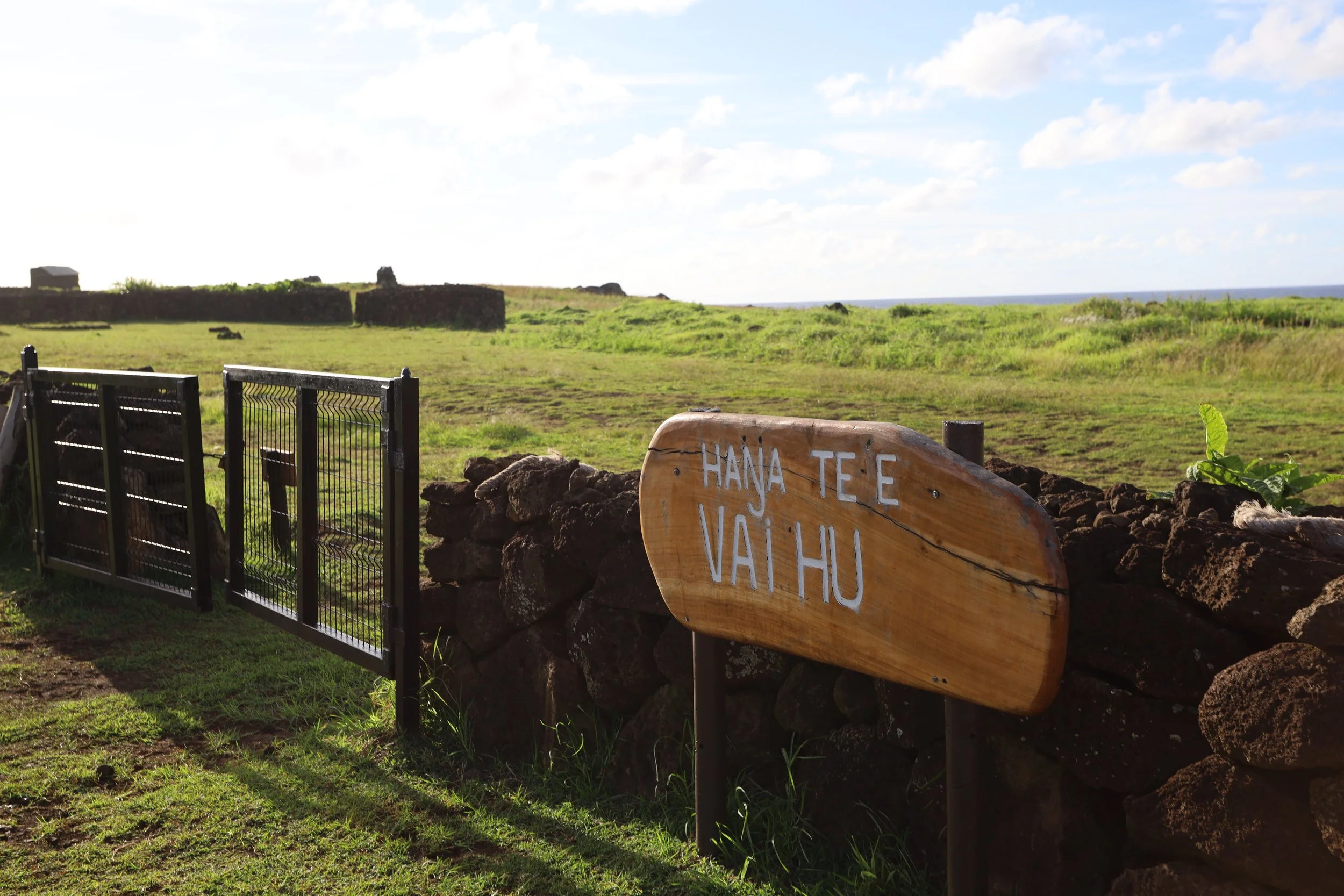
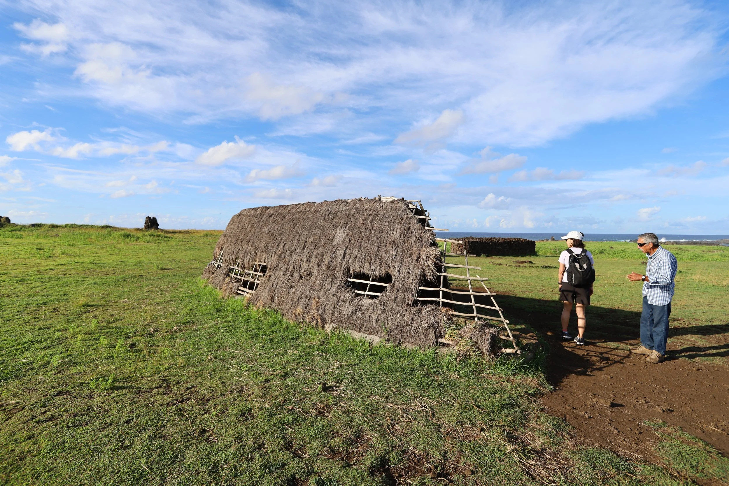
Vaihu — an outdoor museum where replicas of ancient structures give visitors an idea of the outdoor life on the island. Boat houses where islanders slept (small and short and close to the ground since they were used only for sleeping), chicken coops made of volcanic rock, enclosures for planting taro, sweet potatoes, and sugar cane, to protect them from salty sea winds.
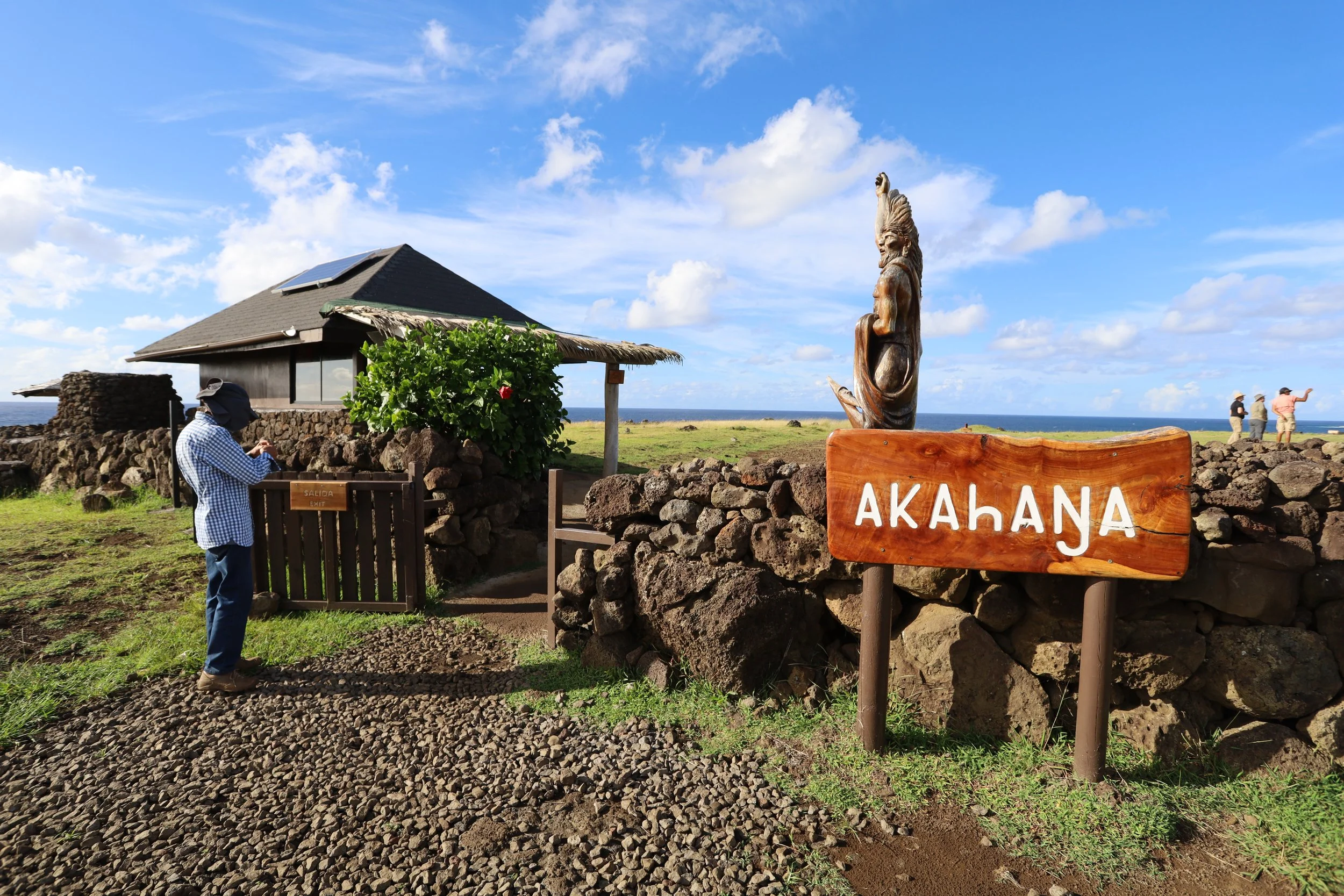
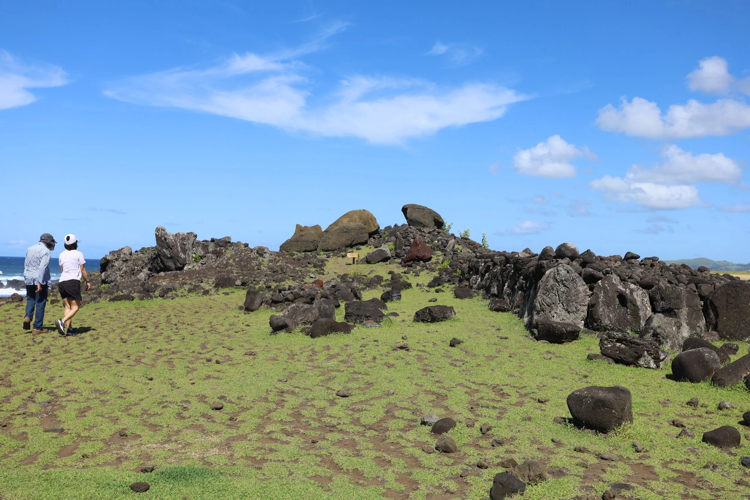
Ahu Akahanga — surviving relics of a Rapa Nui settlement where we saw the leftover footprints of a boat house and chicken coop.
Rano Raraku — one of the most important sites on the island, but it was closed for a movie shoot; I found later it was “Wild Horse Nine” with Mark Ruffalo and Sam Rockwell; damn Hollywood.
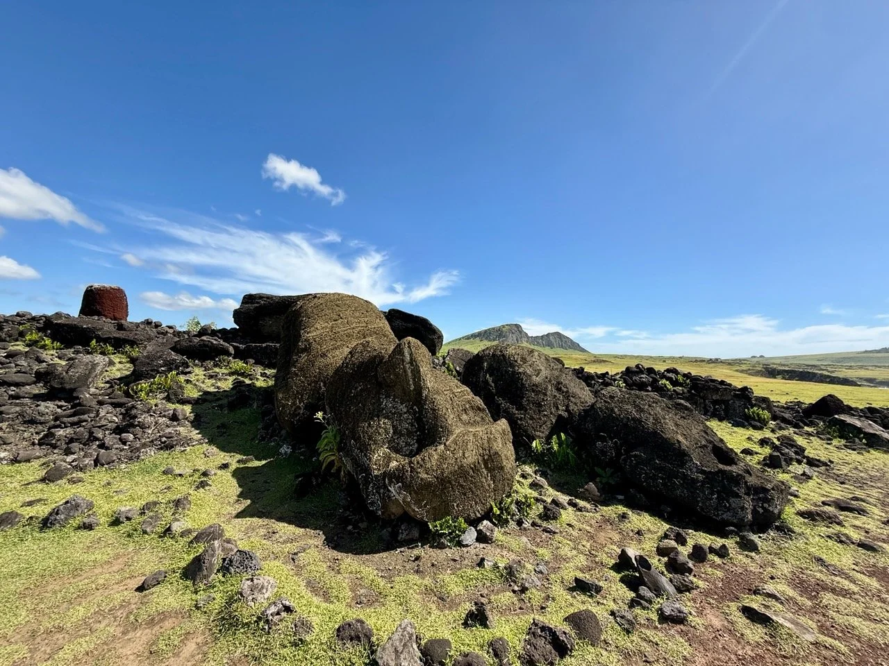
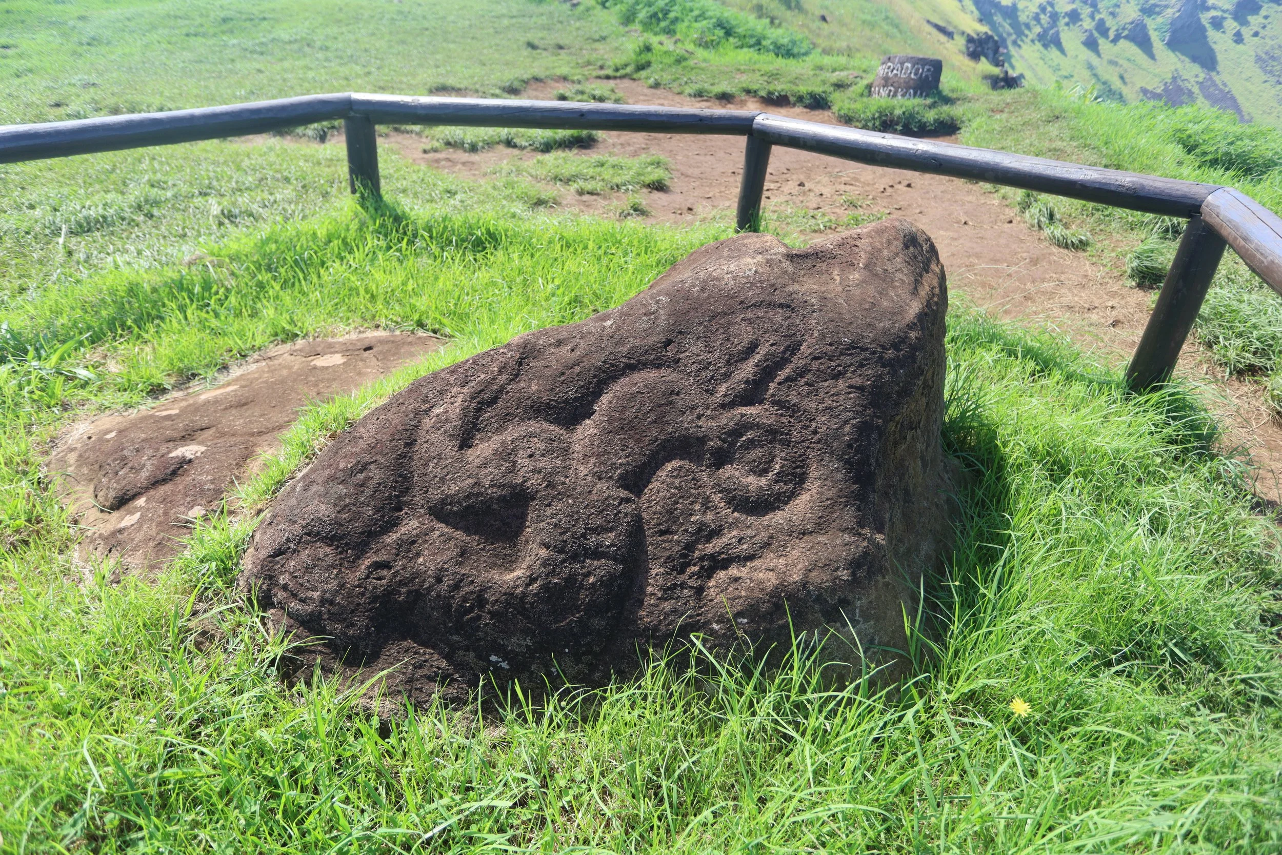
One Makihi — broken but well preserved and, for some reason, my favorite.
Ahu Te Pito Kura — supposedly a magnetic rock, but we didn’t feel much attraction (hehe)
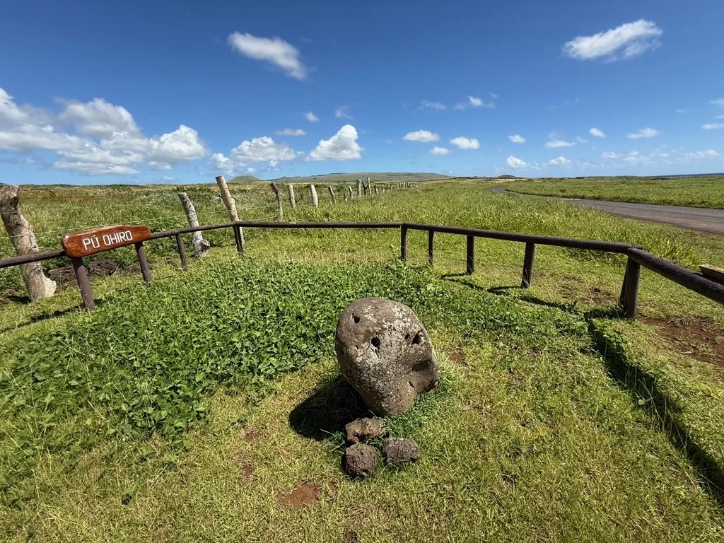
Pu’o Hiro — a rock with holes through which ancient islanders made sound/music
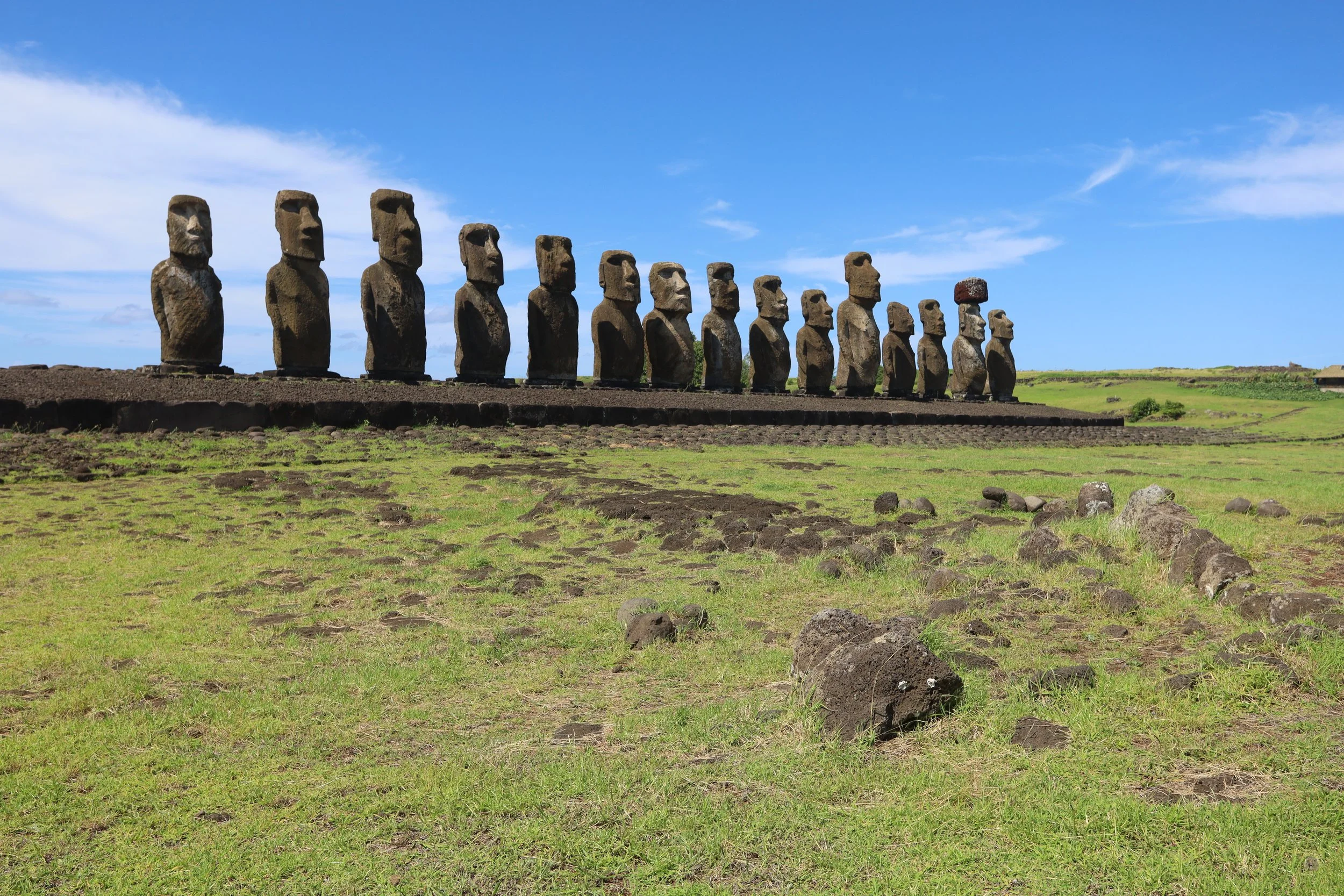
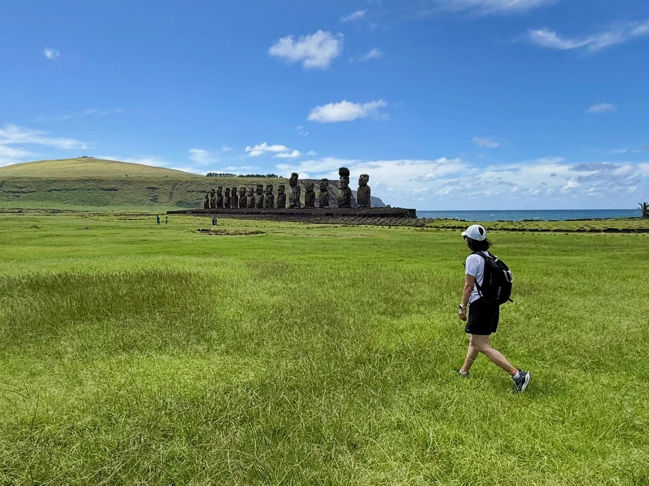
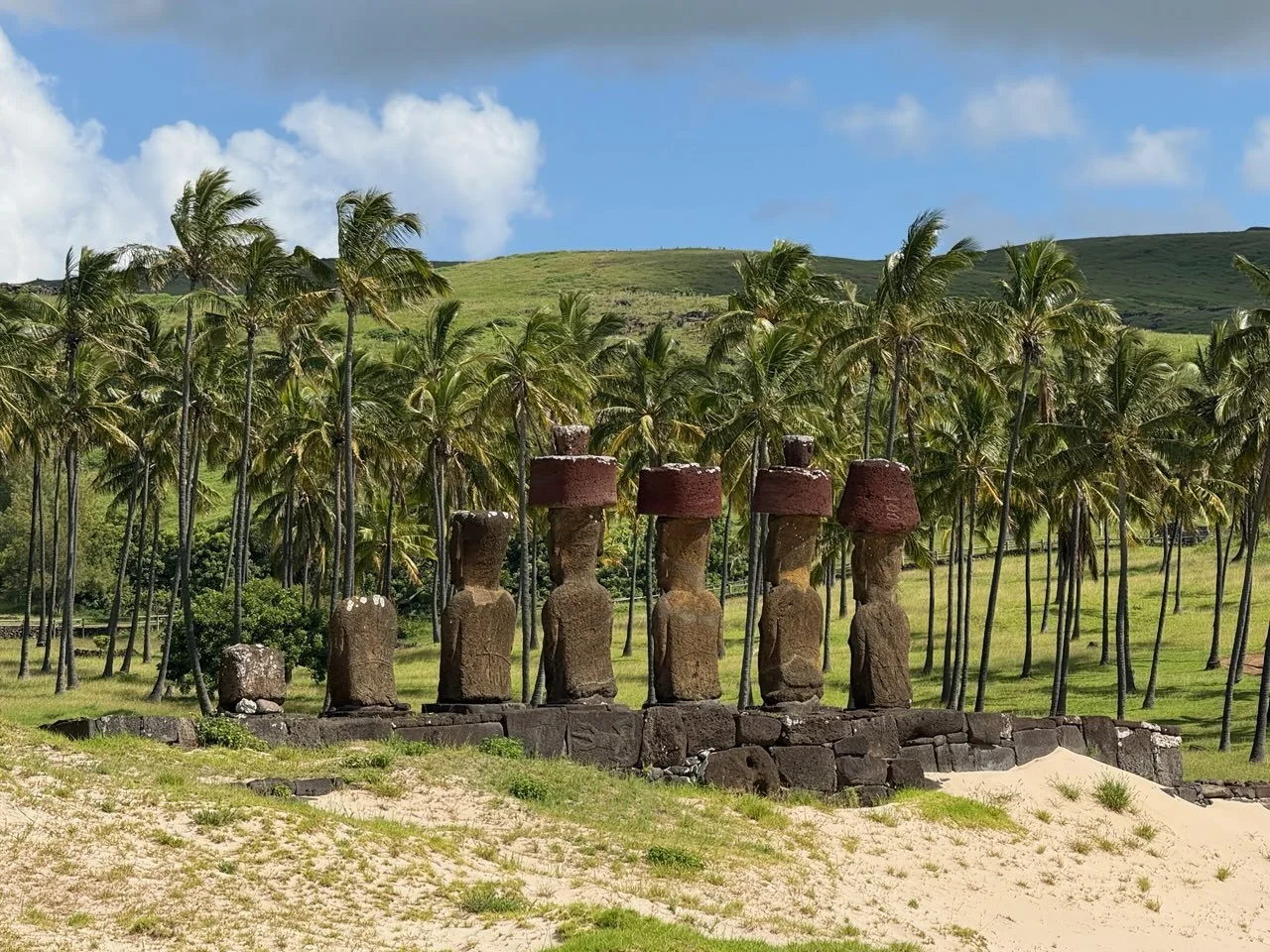
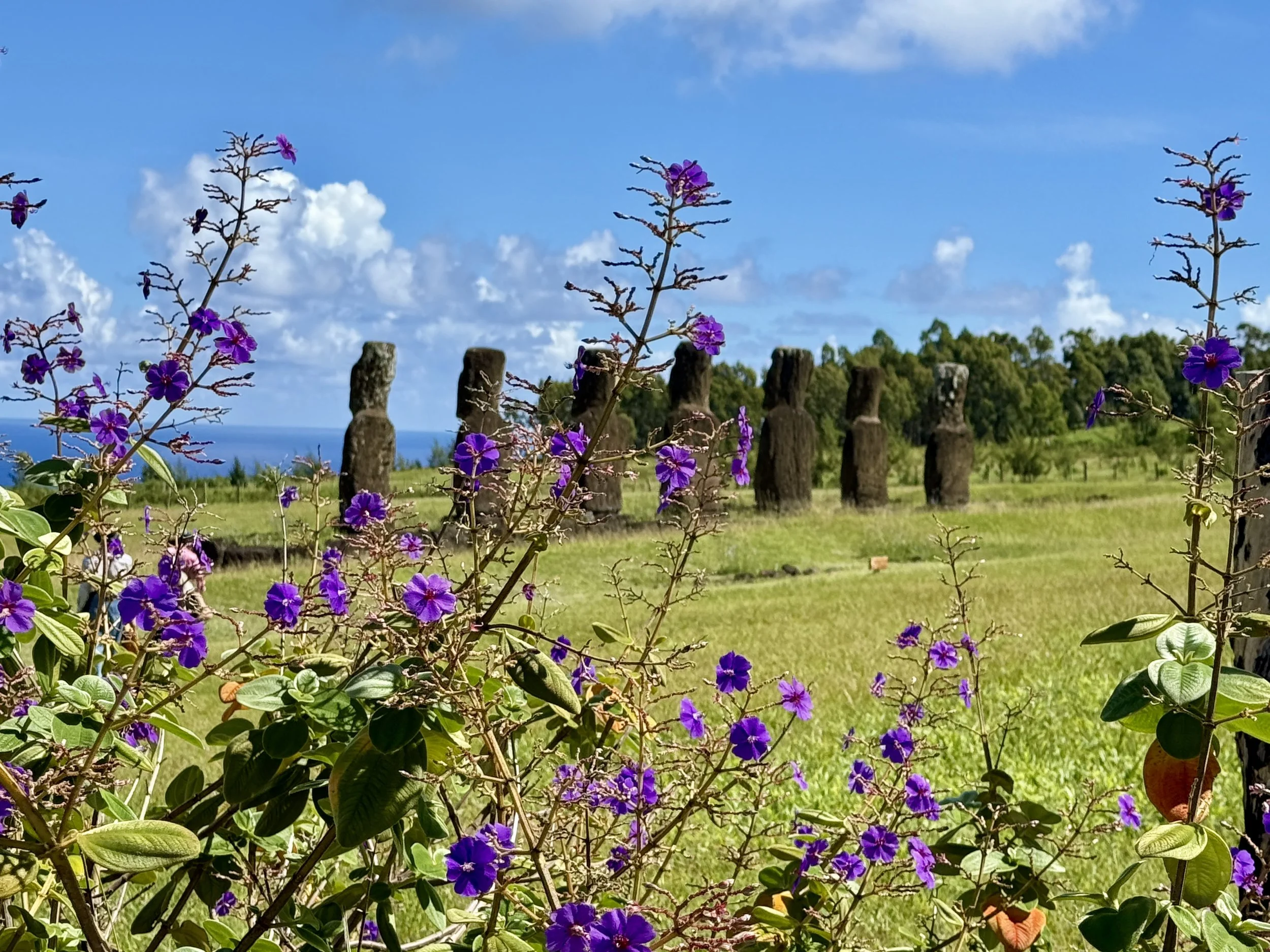
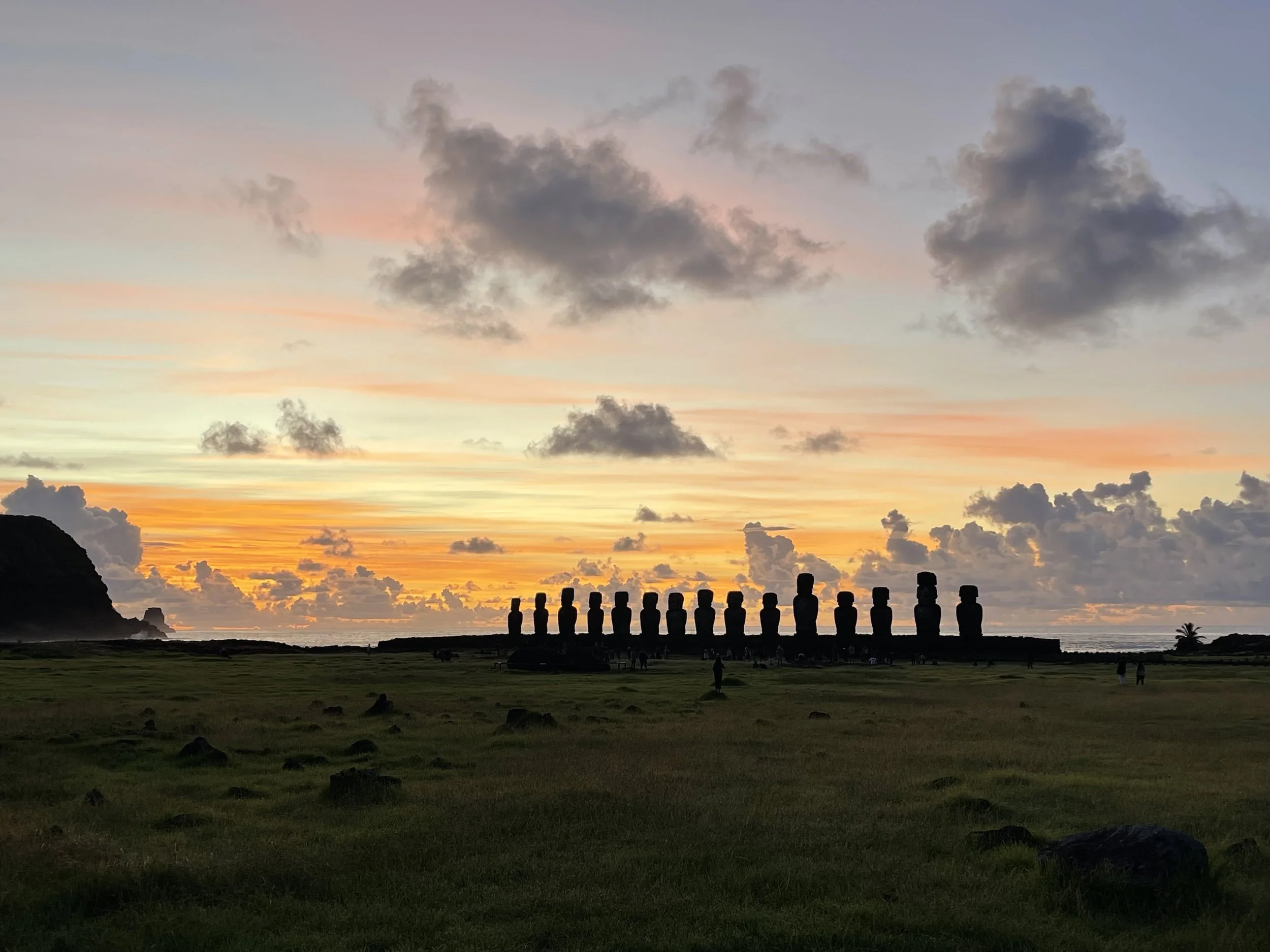
Ahu Tongariki — 15 moais by the sea, where the guide posed N. just so, to look like a 16th moai.
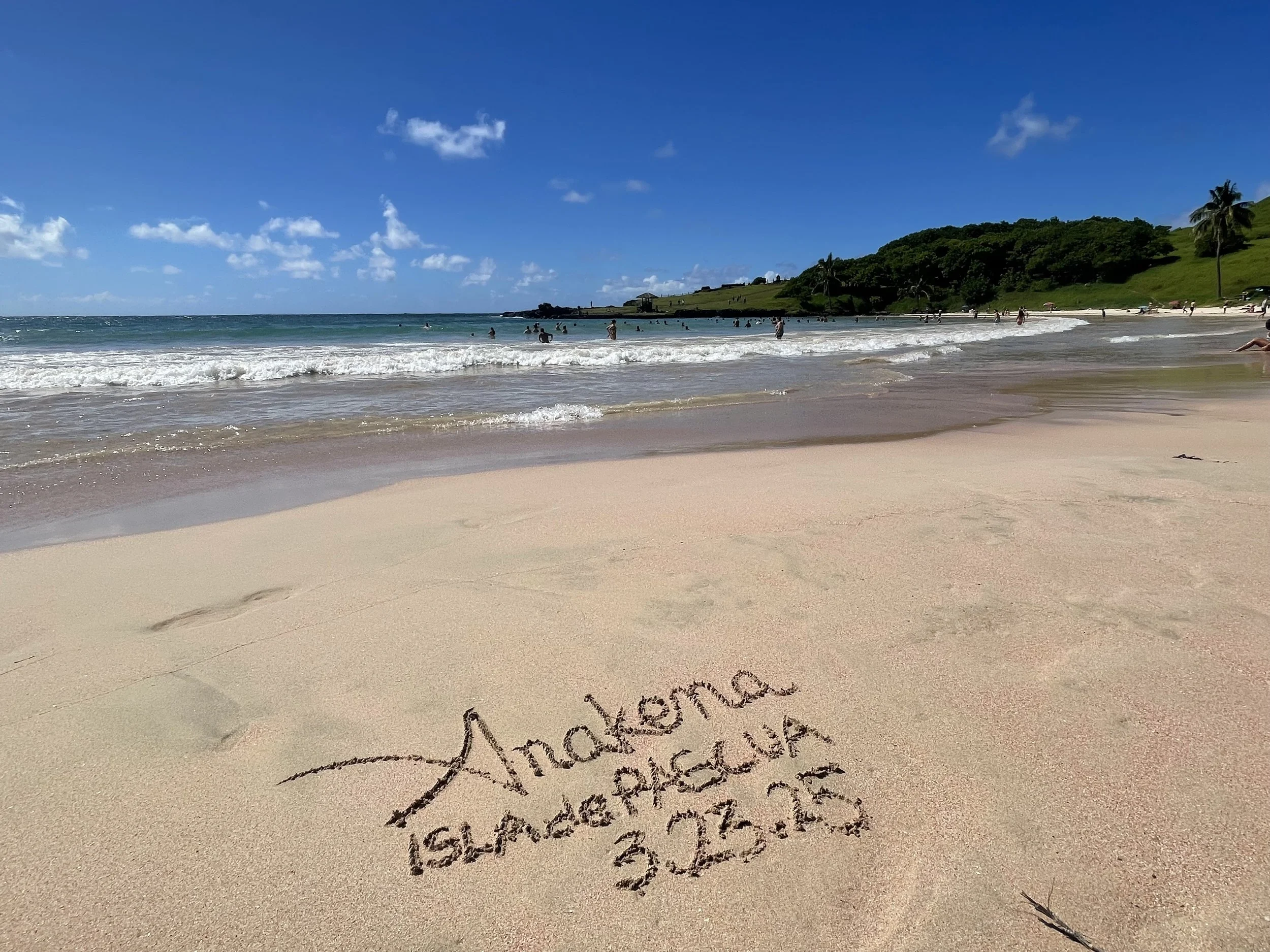
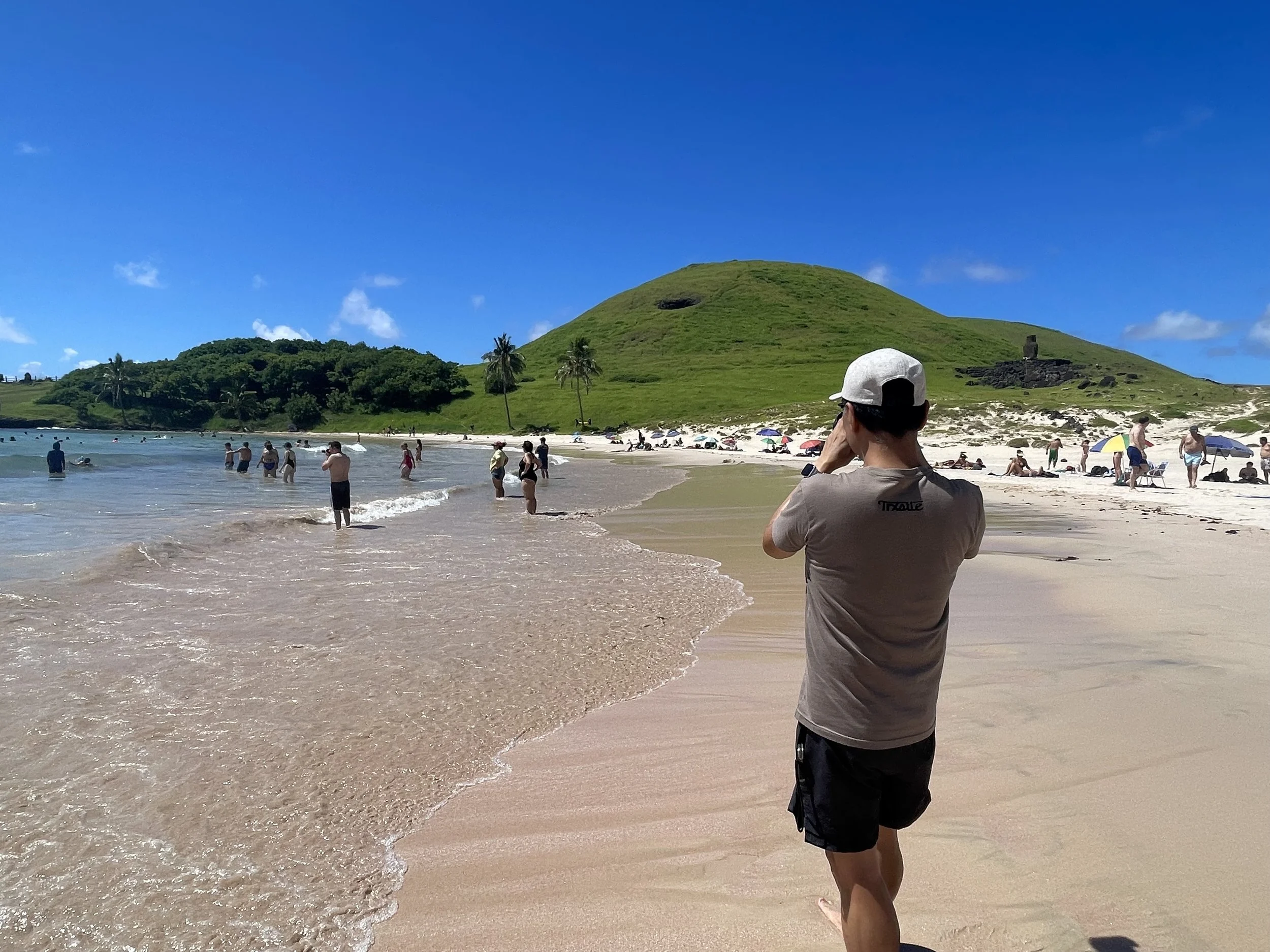
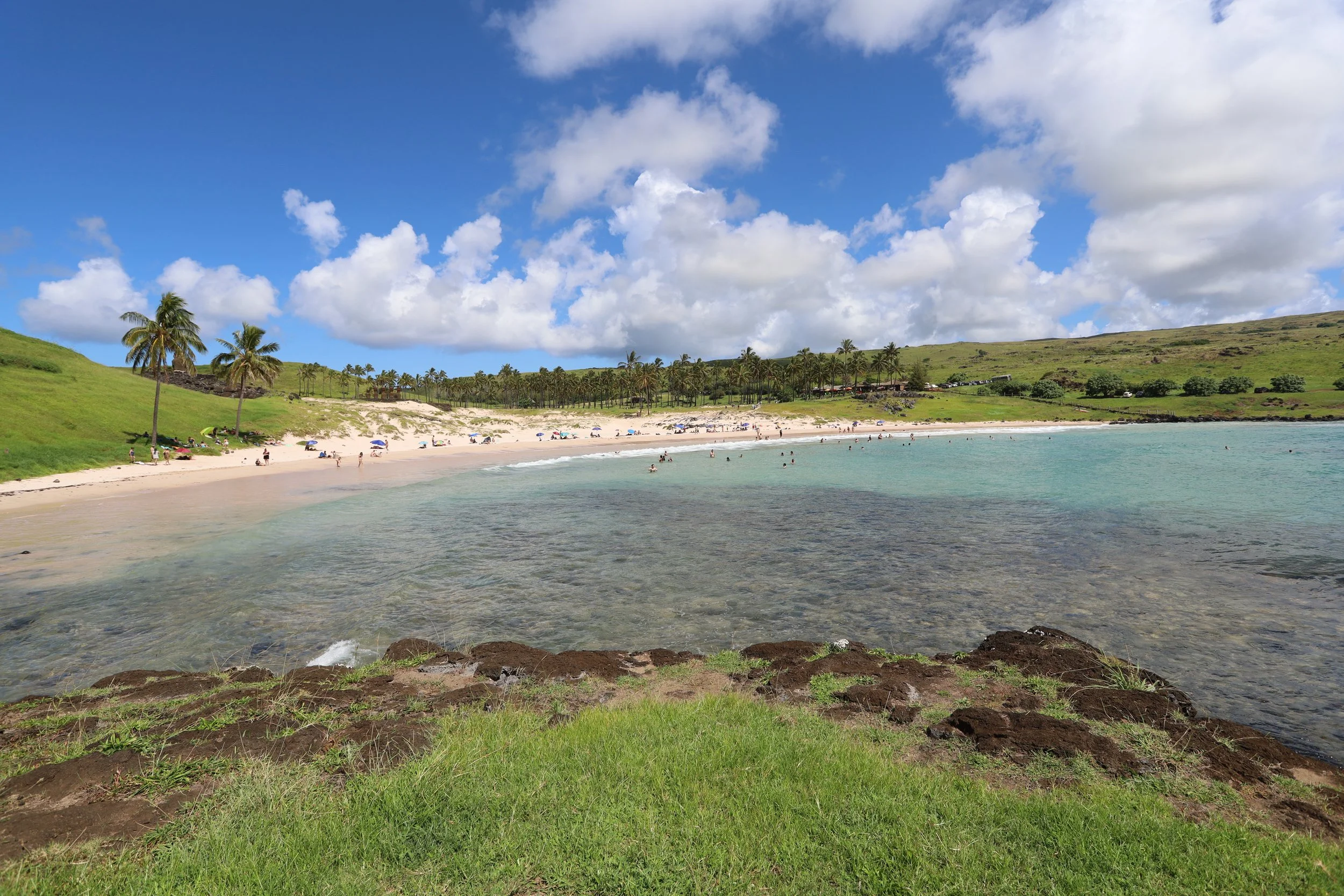
Anakena — the moais who scored on the “location, location, location” angle. Pretty little sand beach

***
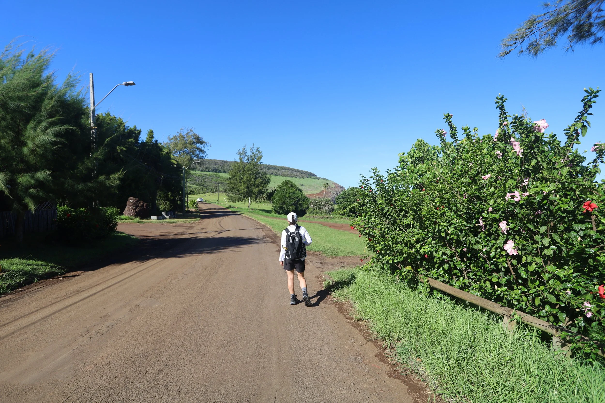
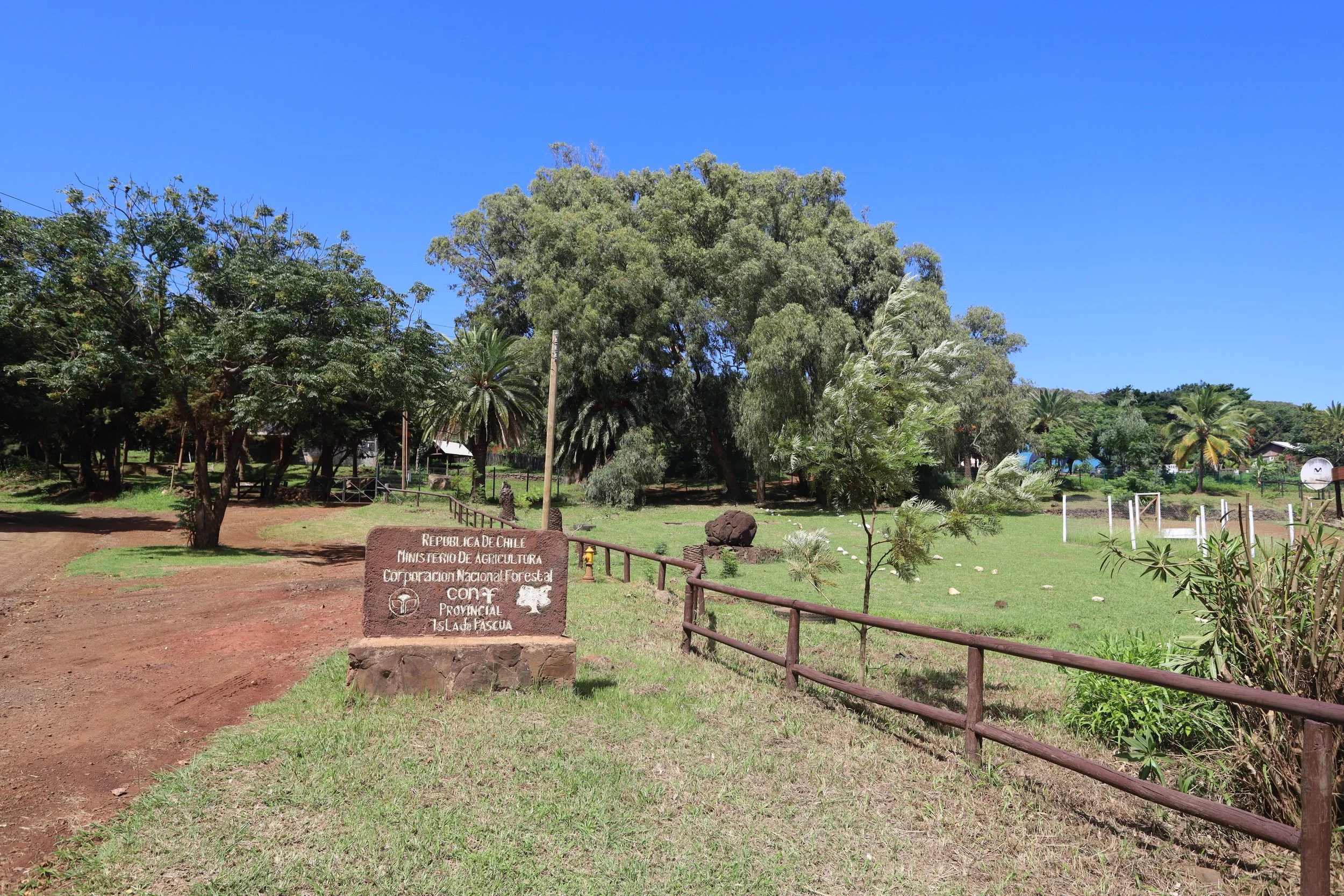
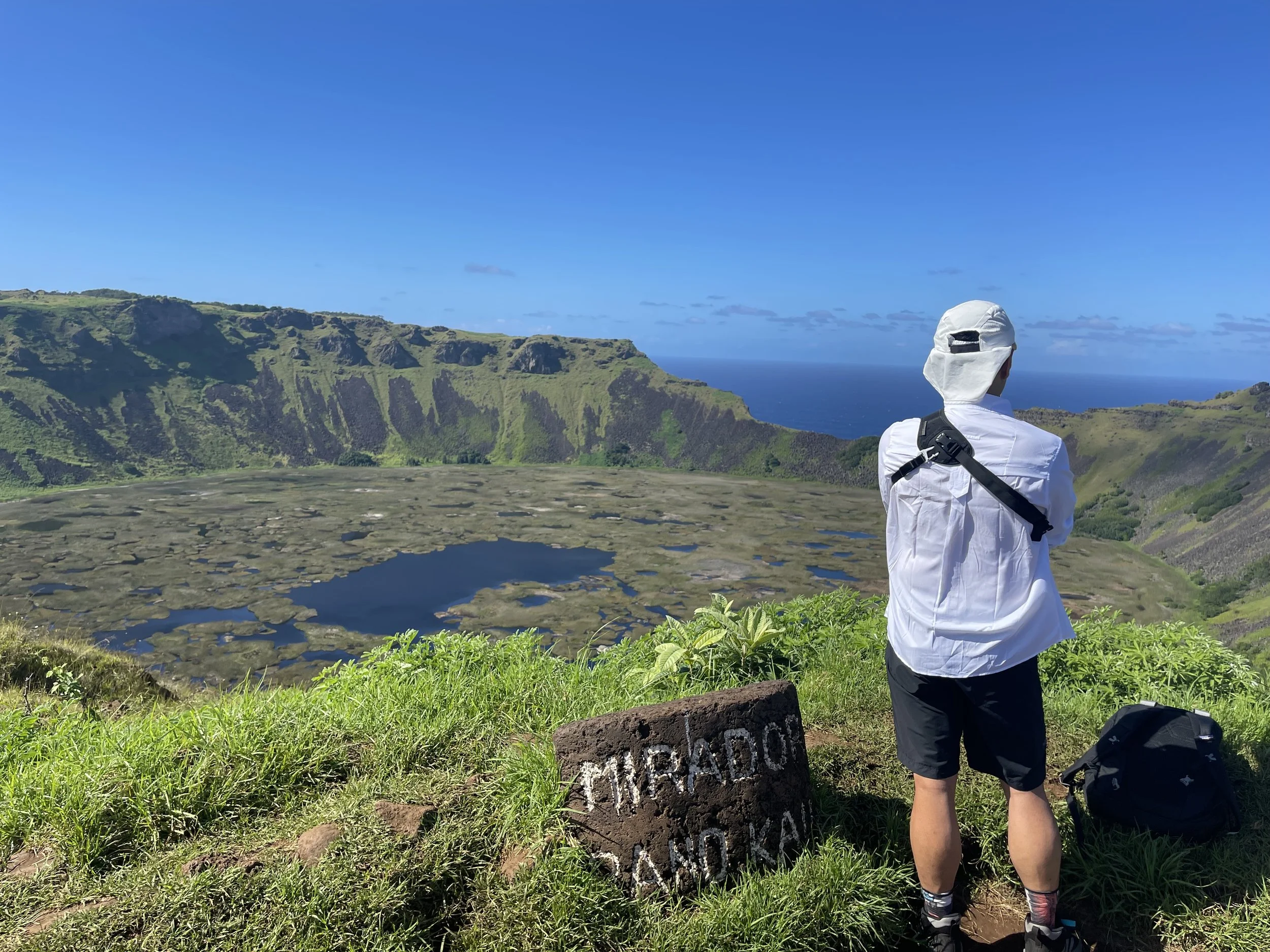
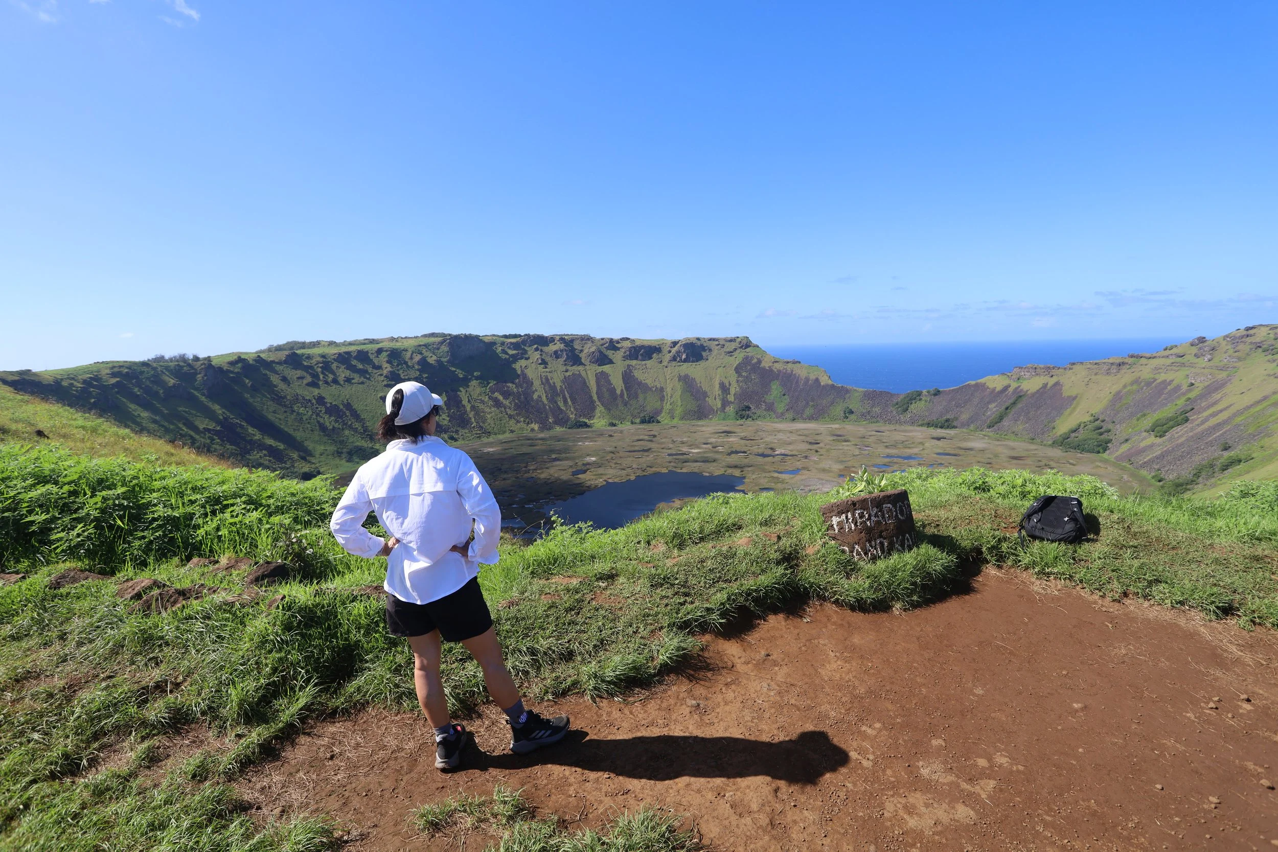
After breakfast, we packed our backpacks — water, hiking poles, battery pack — and walked a mile from our hotel to the trailhead of Rano Kao.
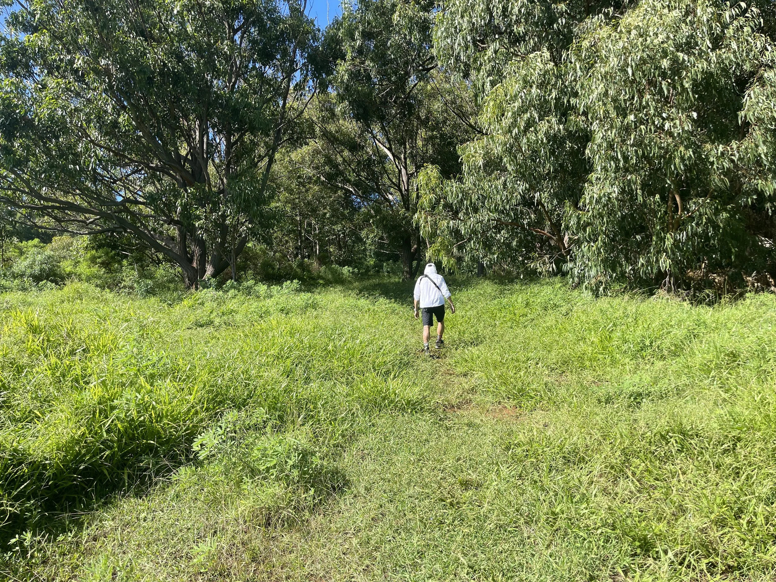
The trailhead, by the offices of the Rapa Nui National Park, was set off by white rocks, just as described by the trekking app. Beyond the first few feet, though, the grasses and plants on either side of the trail had grown so much that the thought crossed my mind that I should also have packed a machete as well. It would have been difficult to find the correct path without the GPS on the app.
We had gone on the guided tour of the moai yesterday because of weather forecast had mentioned clouds and rain for today. So it was with a bit of mercy that we trekked through the first part of the trail under some shade because the skies were instead bright blue and the air was heavy with humidity.
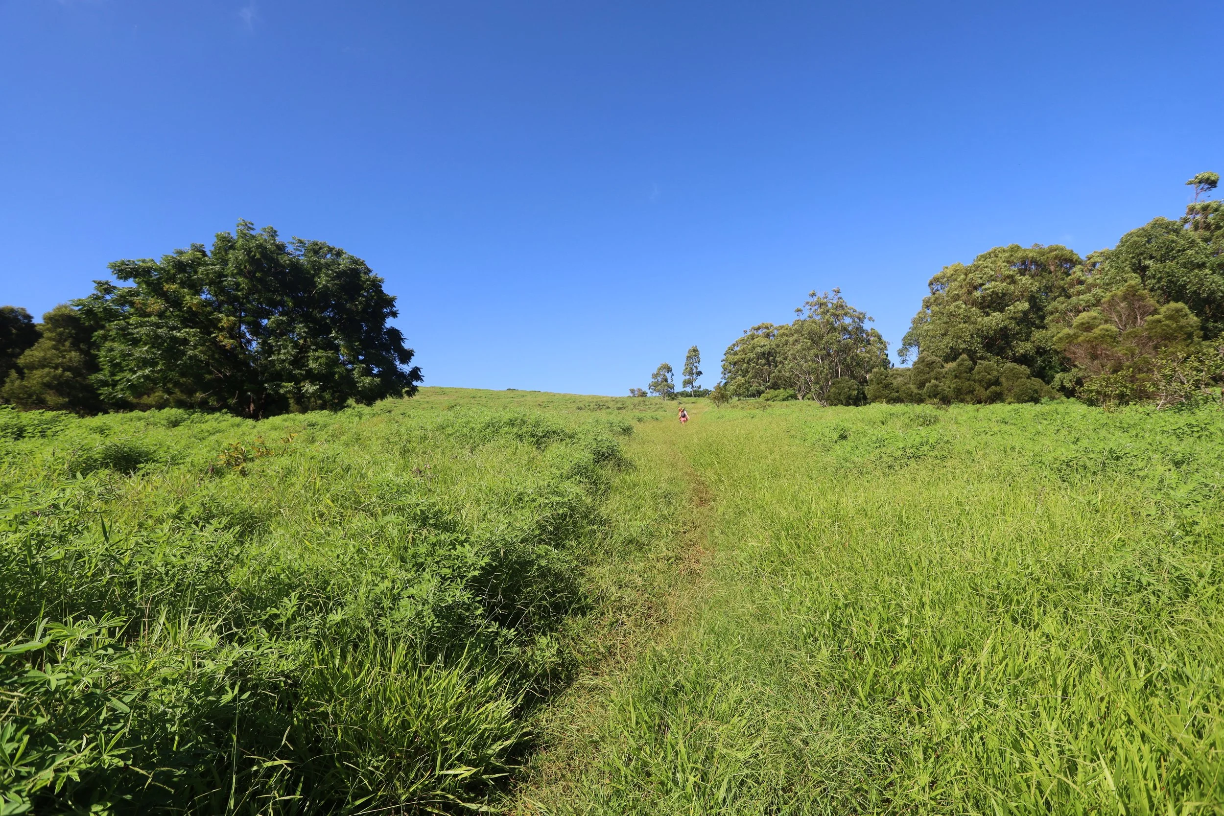
The trail gained elevation steadily. Higher up, the tree cover disappeared, and we had no option but to endure the hot sun.
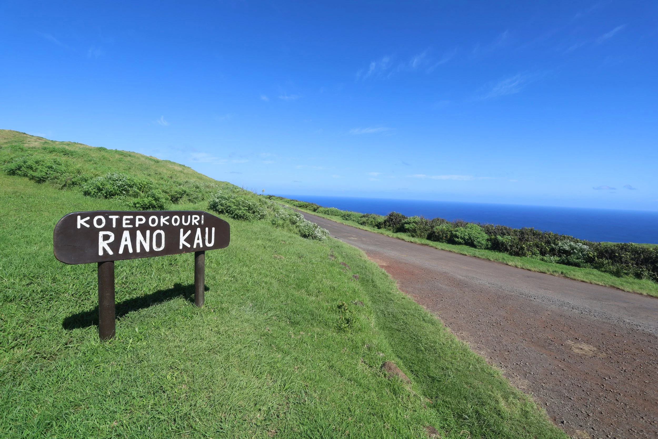
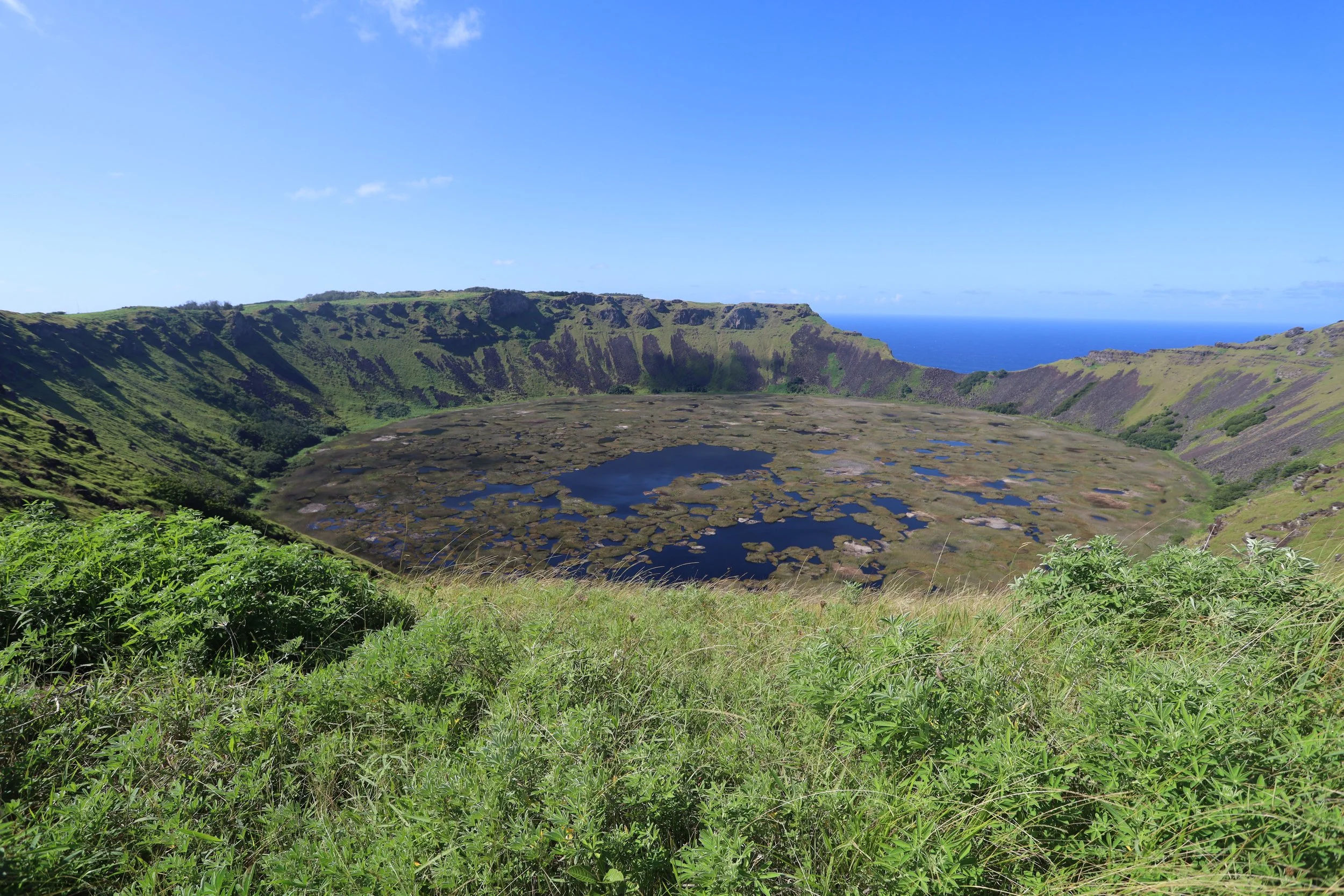
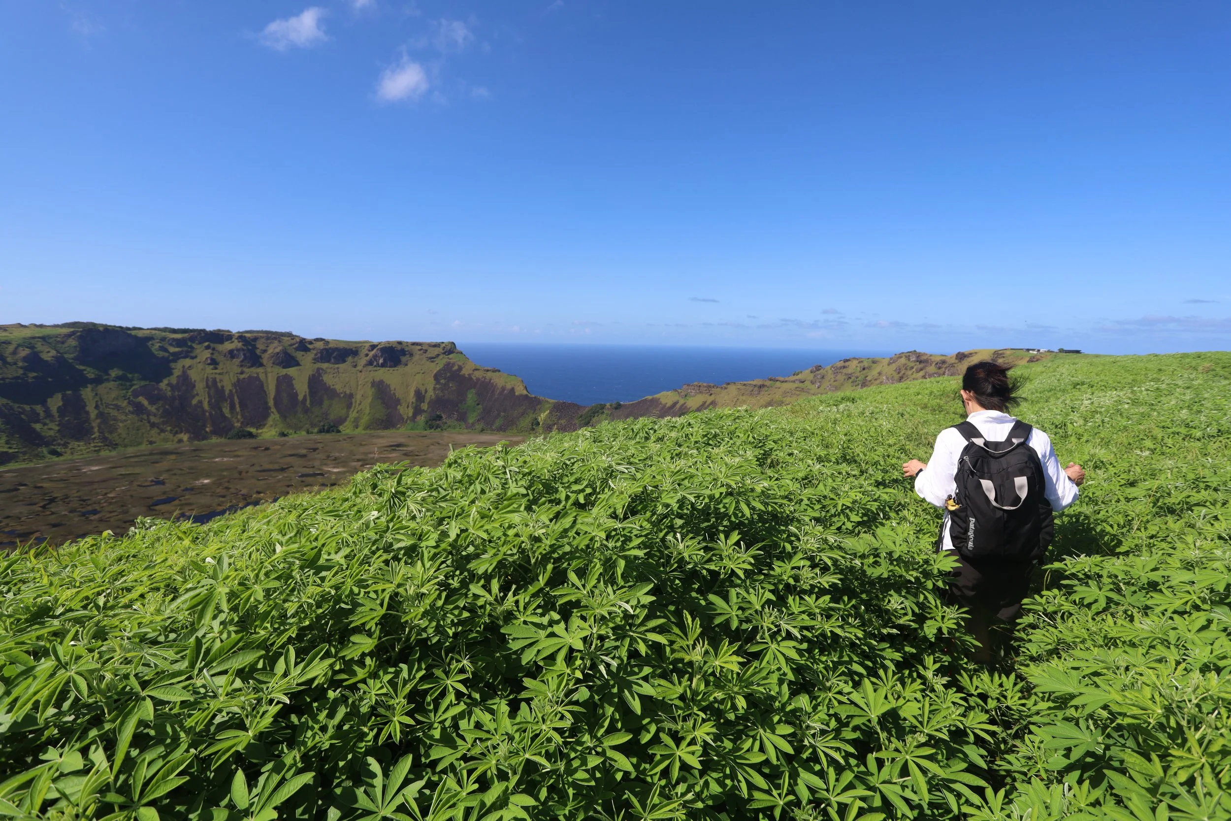
We got to Mirador Rano Kau where a refreshing breeze blew. The view of the inside of the volcano was impressive indeed: the crater was now a lake, and the surface of the lake had little “islands” — formed by twigs, or branches, or other organic debris — on which grass and other plants now grew. On the other side of the crater, we could see the ocean.
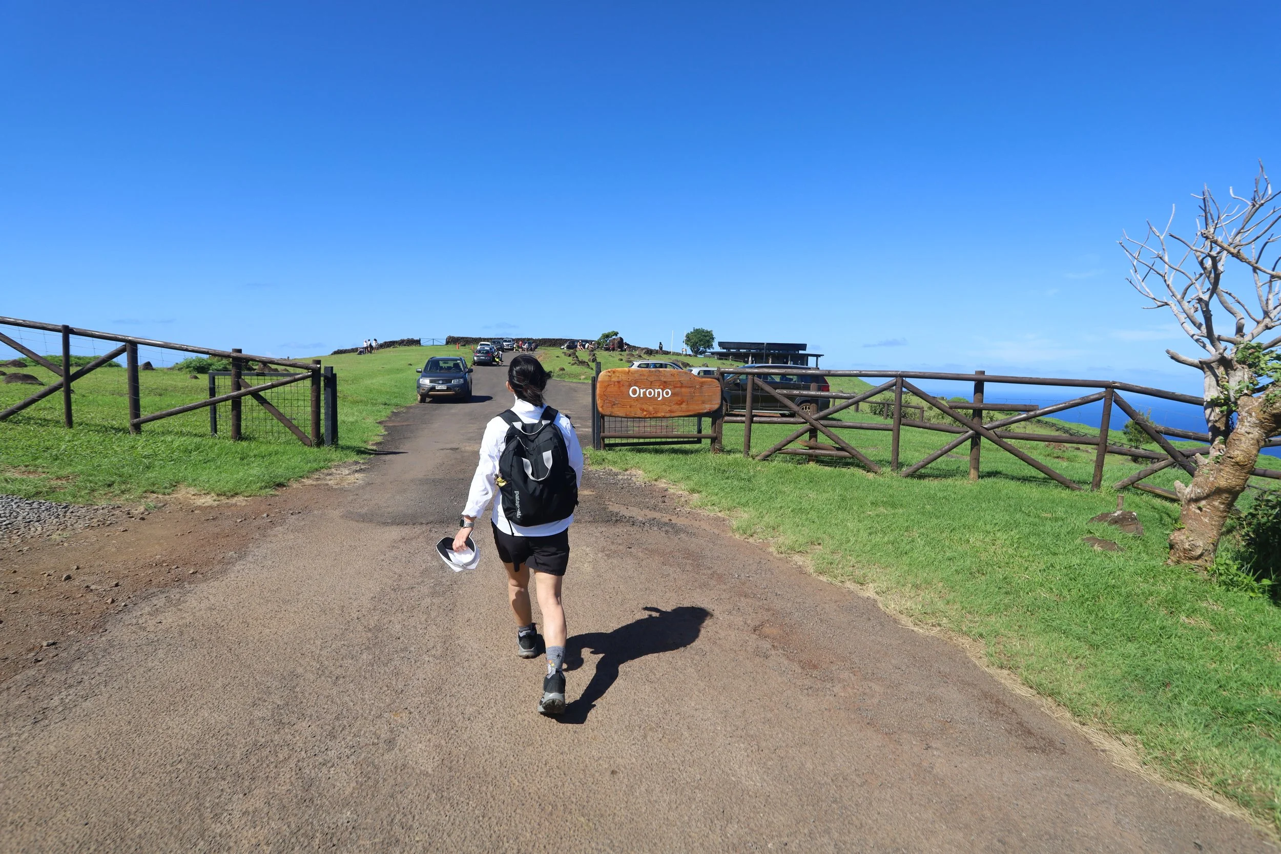
We tried to continue on the trail to the Orongo visitor’s center, but here also the wild grasses grew past our chest and, after attempting the first few feet at the edge of the crater, we were worried that we might slip and slide and join the microbiome on the crater’s bottom. We turned around and took the road to Orongo, where I pestered another park worker for a stamp. (To visit the museum on site, one had to have a guide.)
We took a short break and headed down the mountain.
***
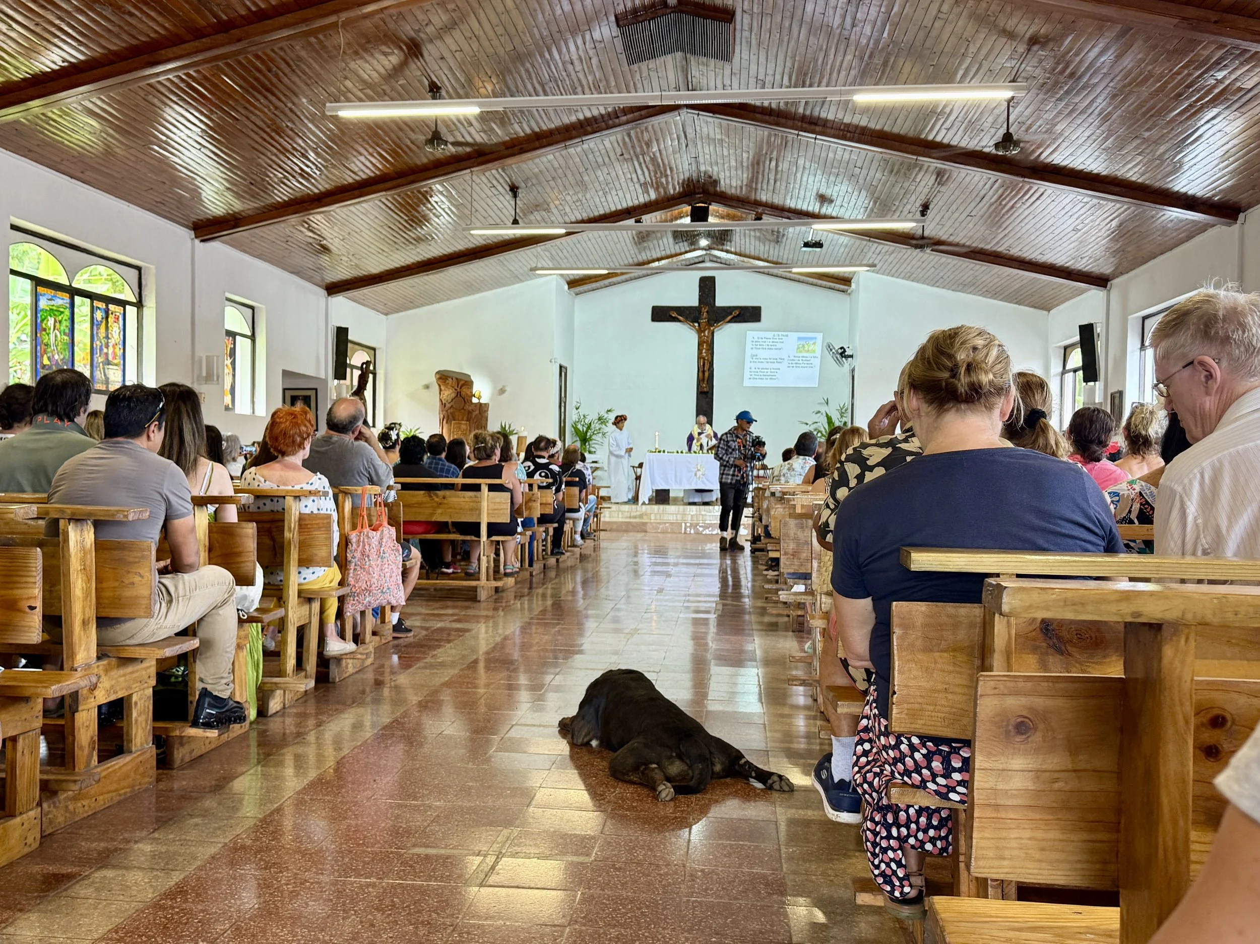
In the Parroquia de la Santa Cruz, the Catholic mass added that island flair through the hymns which were arranged for drums and ukeleles and sung in Rapa Nui. Even a dog lazily came in, halfway through the sermon, to enjoy the blessing of a cool floor.
I recognized the Spanish readings of the Hebrew Bible (Moses and the Burning Bush) and New Testament (Paul in the First Corinthians); all the congregation stood up for the Gospel reading (which I didn’t catch), but that brought vague memories of having done the same many years ago.
Afterwards, we caught a taxi for Anakena, this time not for the moais, but honestly so N. could collect something — ahem — for his collection.
We spent some time on the sand; wrote the beach name on the sand; explored the hill facing the beach; rested on the shade under the palm trees; had a drink in one of the shacks.
Soon enough, it was time to take the taxi back to town, find a restaurant and peruse the menu, pretending we could order anything other than ceviche or empanadas.
***
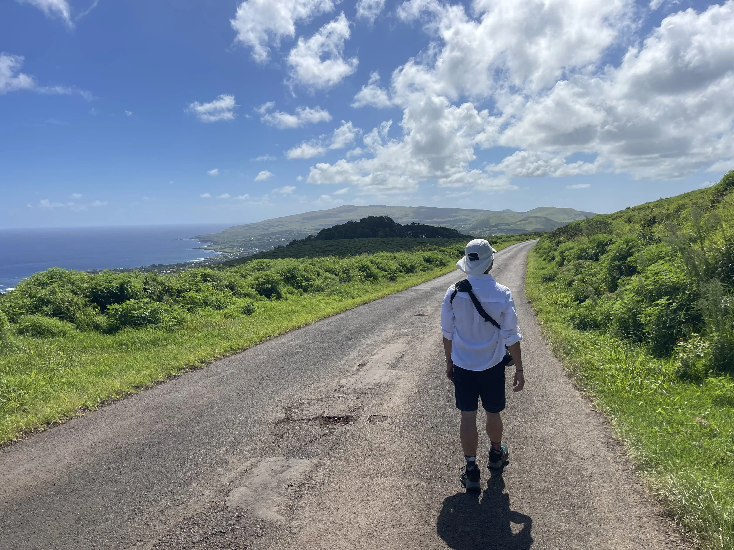
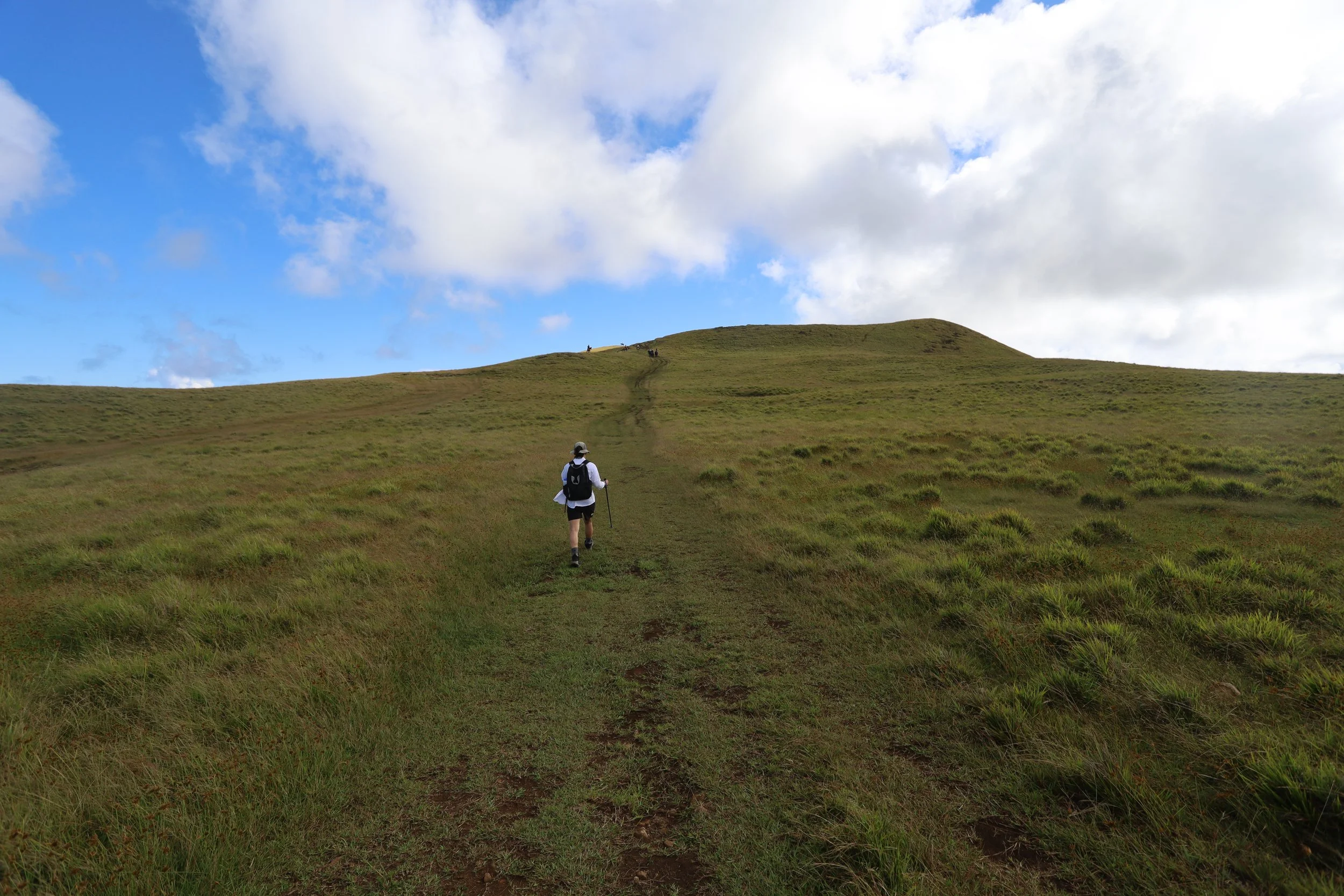
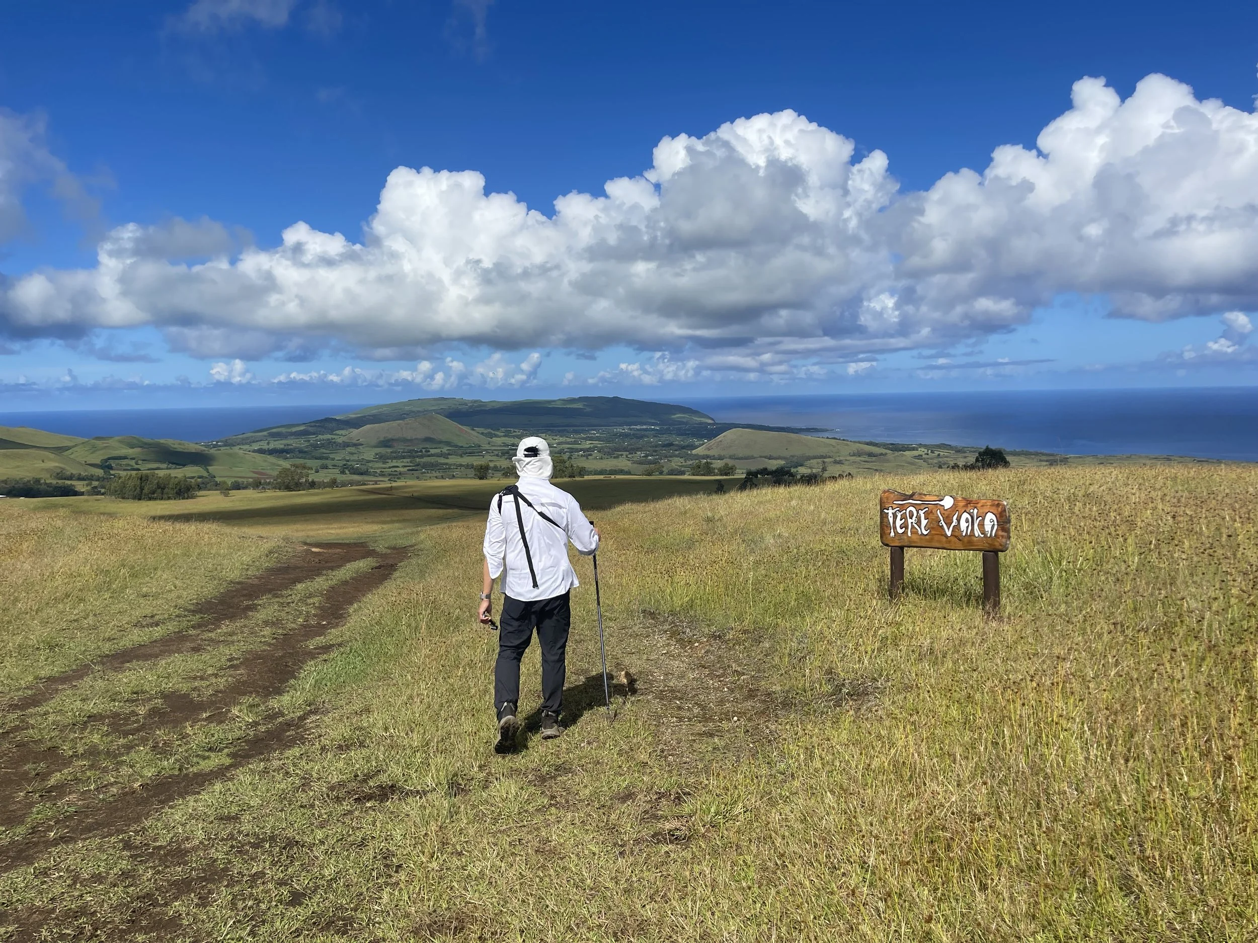
The hike to Mirador Rano Kau is one of two hikes tourists can do without a babysit… , uh, guide. The hike to the highest point on the island at Terevaka is the other.
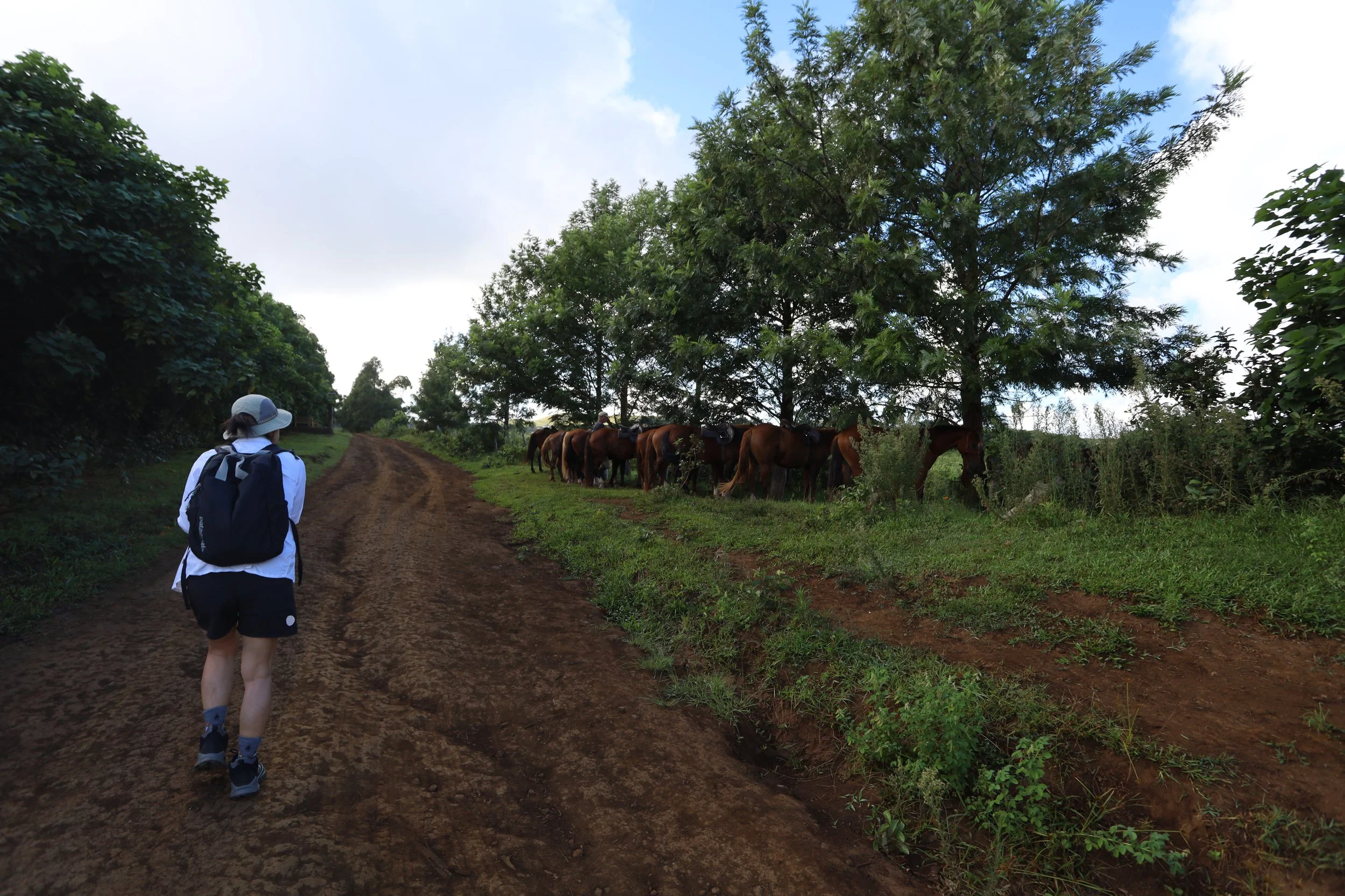
We had a taxi scheduled for 9:30 am, but we were waiting outside the hotel, while the taxi driver was waiting inside the lobby. We found each other around 9:50 am and drove 20 minutes to the entrance of Ahu Akivi, where the Terevaka trail began — or so we thought. We got out and went to the little shack where a park ranger was standing guard. Well, it turned out that Akivi was a few minutes’ walk down the road — so we trekked over there fuming at our driver.
The moais at Akivi could wait.
The trailhead was on the red dirt road used by cars and horses, although we saw neither, nor other hikers. In the beginning, there were a few trees here and there, which came in handy when suddenly the gray skies decided to start raining. I had checked the weather forecast specifically for rain and decided against bringing raincoats, which just goes to show what good forecasts are for.
N. and I crouched under a tree that provided some cover, but we had to be careful not to get snagged by the fence roped with barbed wire; I tried to take comfort in the knowledge that both of us had had a tetanus shot. After some five minutes that somehow felt like thirty, the rain pettered out and we continued on our way.
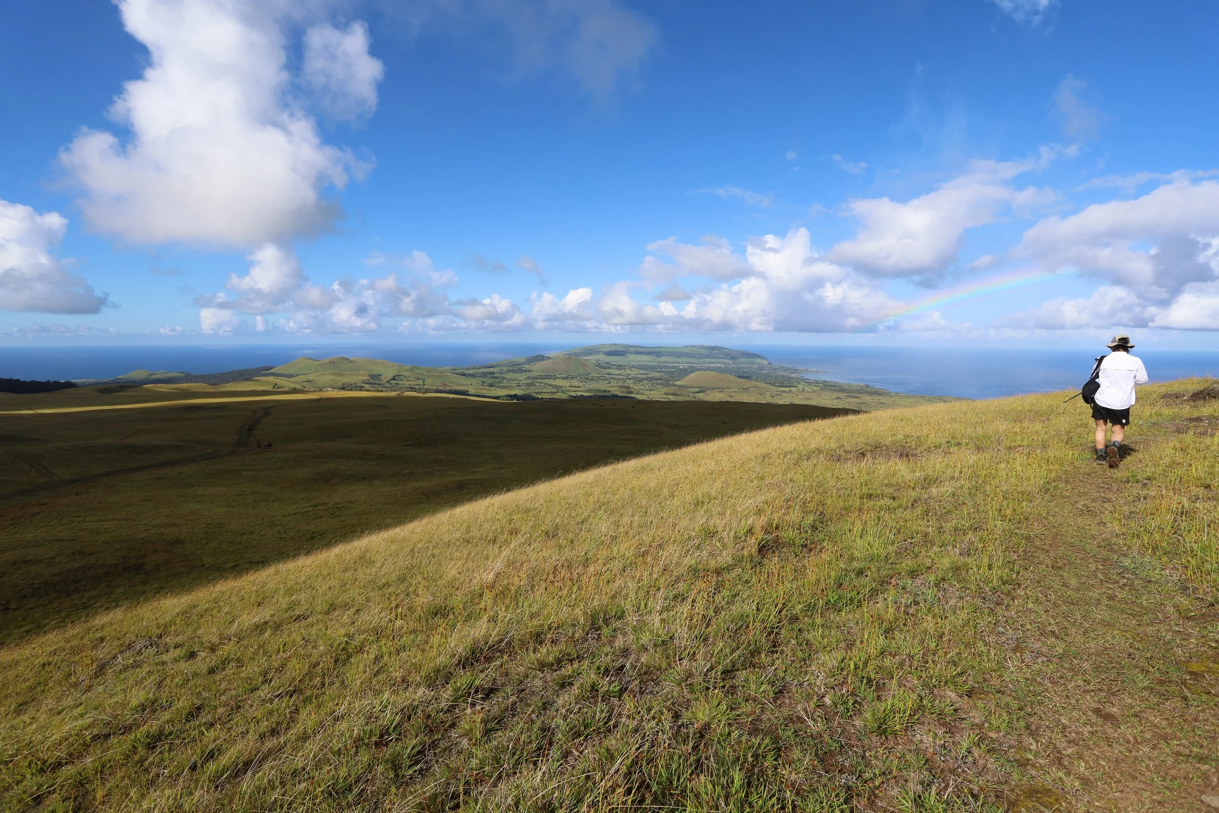
Soon enough the few trees disappeared altogether and we were left with the road and vast expanses of fenced grasses on either side of the trail. Farther out, houses dotted the fields, but we didn’t see anyone working the land.
About a mile from the summit, just as we had reached another fence, the skies opened again and there was no cover. The only mercy was the fact that the rain was coming sideways, so N. and I crouched by the fence post on the more protected side. By the time the rain stopped a few minutes later, we were soaked. Keep calm and hike on.
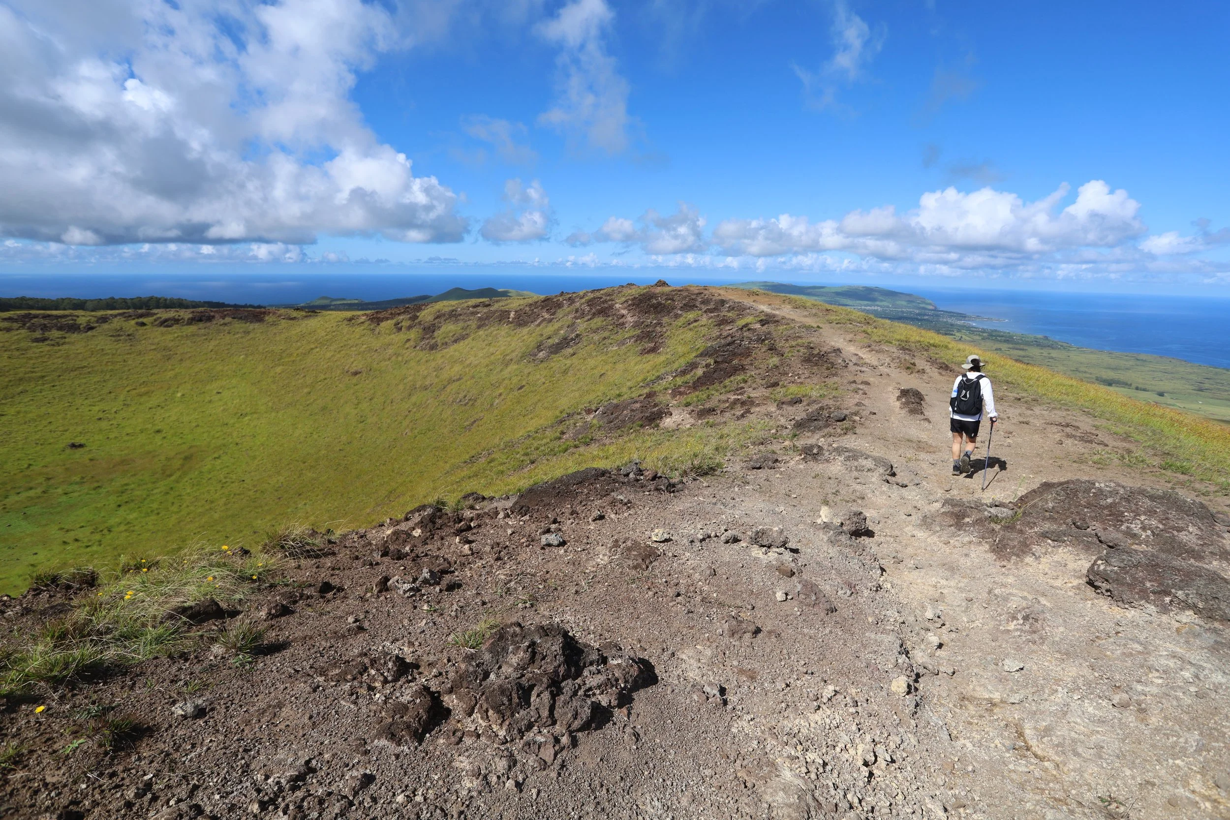
We followed our trekking app soon found ourselves going up the sides and around the rim of a crater decorated, quite nicely, by a black cow. It was from this vantage point that we saw a party of tourists coming up on horseback. They did not come up the crater rim, probably for safety reasons, so we were grateful to have the rim to ourselves — we could see the sea, Hanga Roa, and Rano Kau beyond.
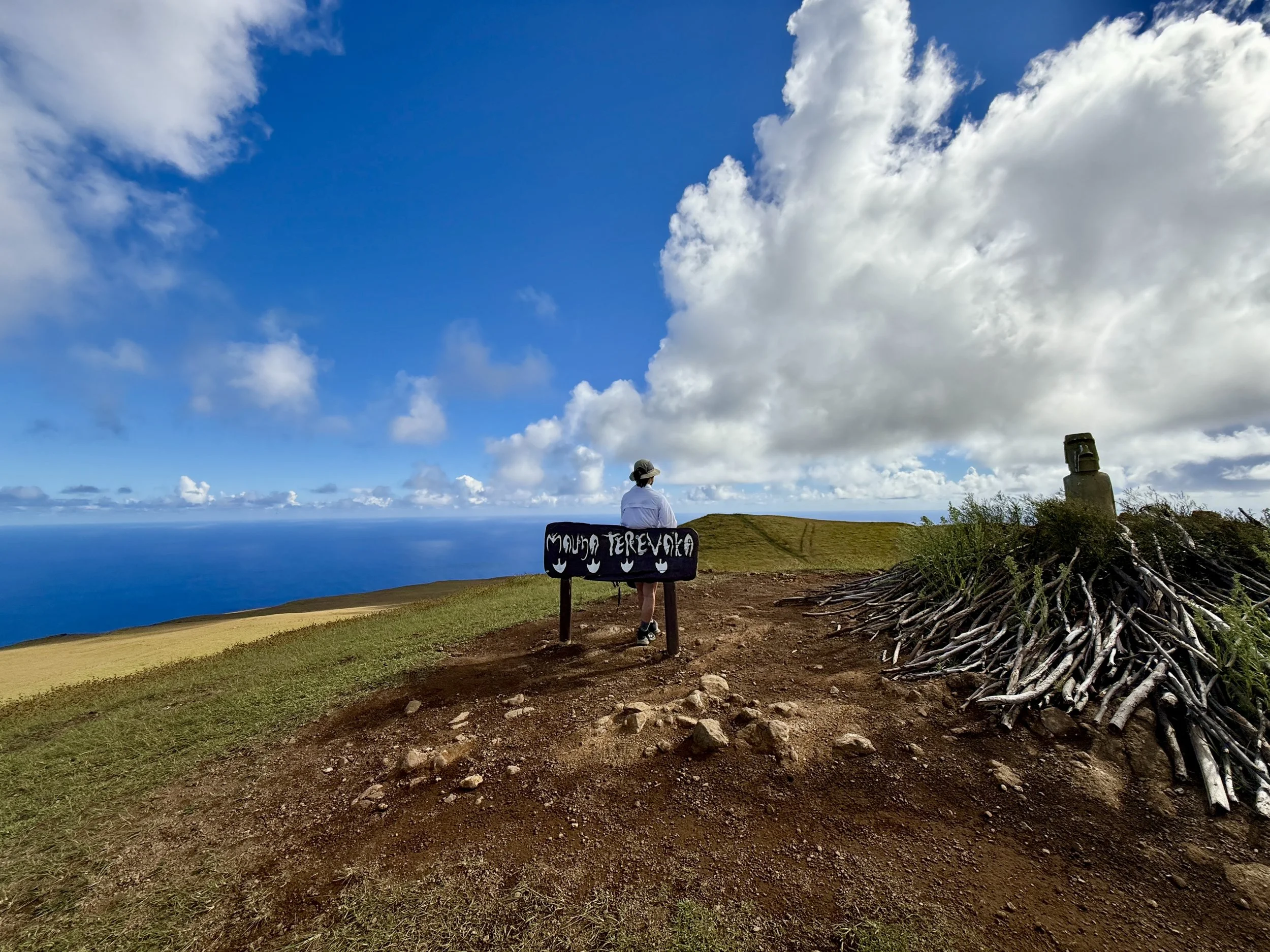
Just a couple of hills later, we reached Terevaka, with its sign, a mound of sticks, a moai replica and a horse skull. From this vantage point, one could get a 360 degree view of the horizon line on the sea.
After all our usual antics, it was time to get back.
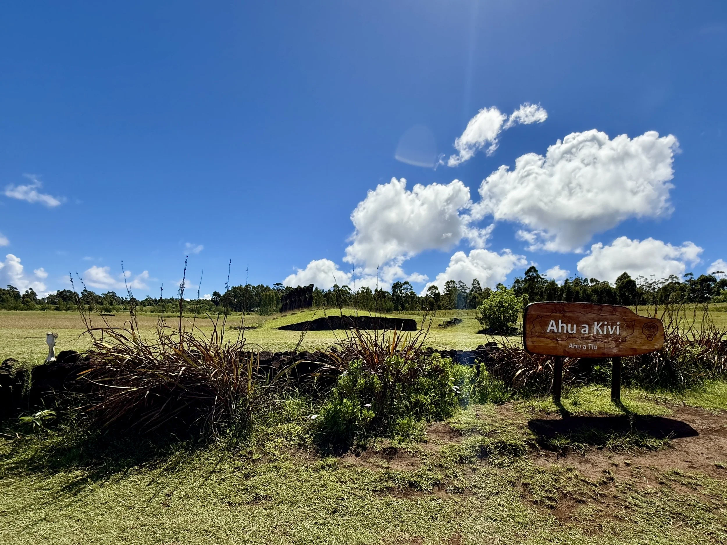
By the trailhead, we did have time to stop by Ahu Akivi and snap a few clandestine pictures — without a guide, horrors! This particular site was considered important because it’s the only set of genuine restored moais that face the sea. According to legend, they represent the seven explorers from the ancient land who first found the island. (All other moais face inland to symbolize their protectiveness of the land and people.)
We walked to the other ranger station and found our taxi driver and headed back to our hotel. (On the first day, the girl who picked us up at the airport had mentioned that everyone on the island drove slowly because there were dogs and chickens roaming around, and because everyone knew everybody — we have personal experience that this is nonsense because we have not been in a taxi where the driver did not floor it as much as he/she could.)
In the afternoon, after dinner, we stopped by the tourist office where we got recommendations for a guide for tomorrow and, most importantly, we got the official stamp for Rapa Nui.
***
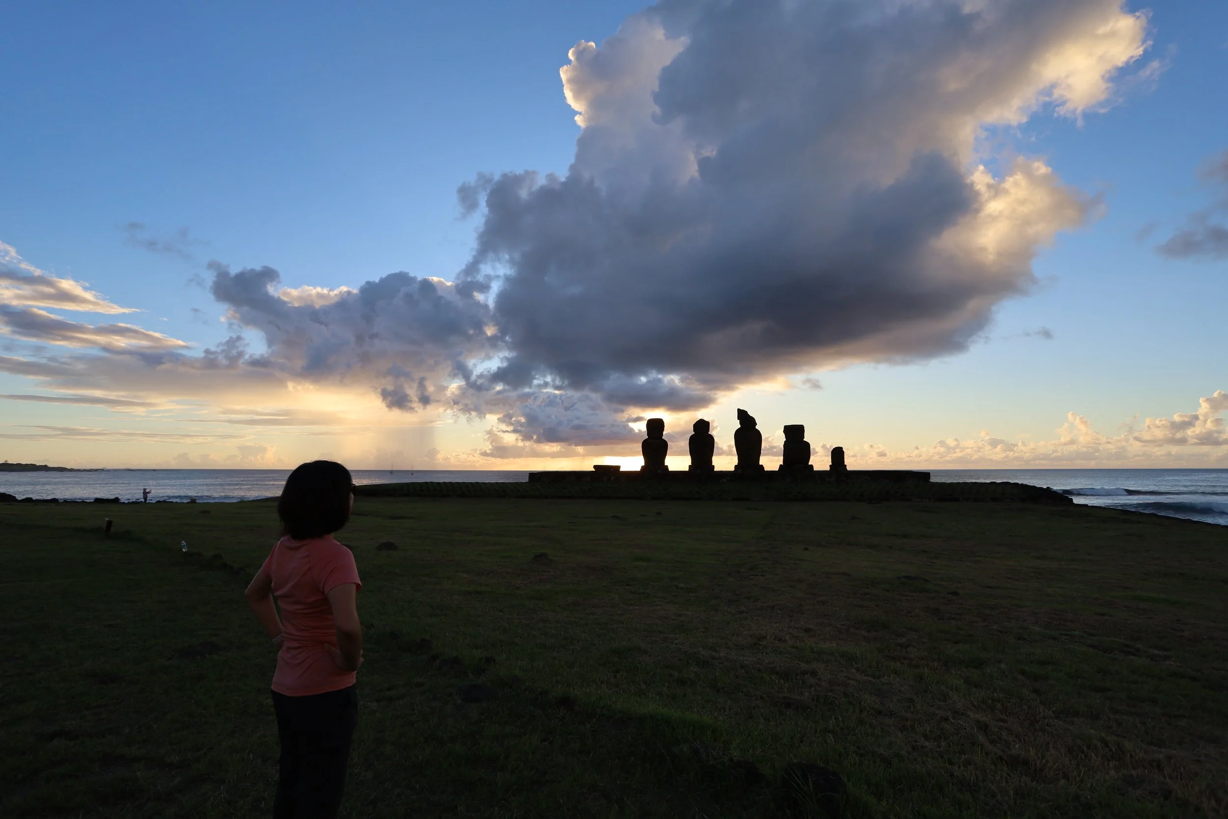
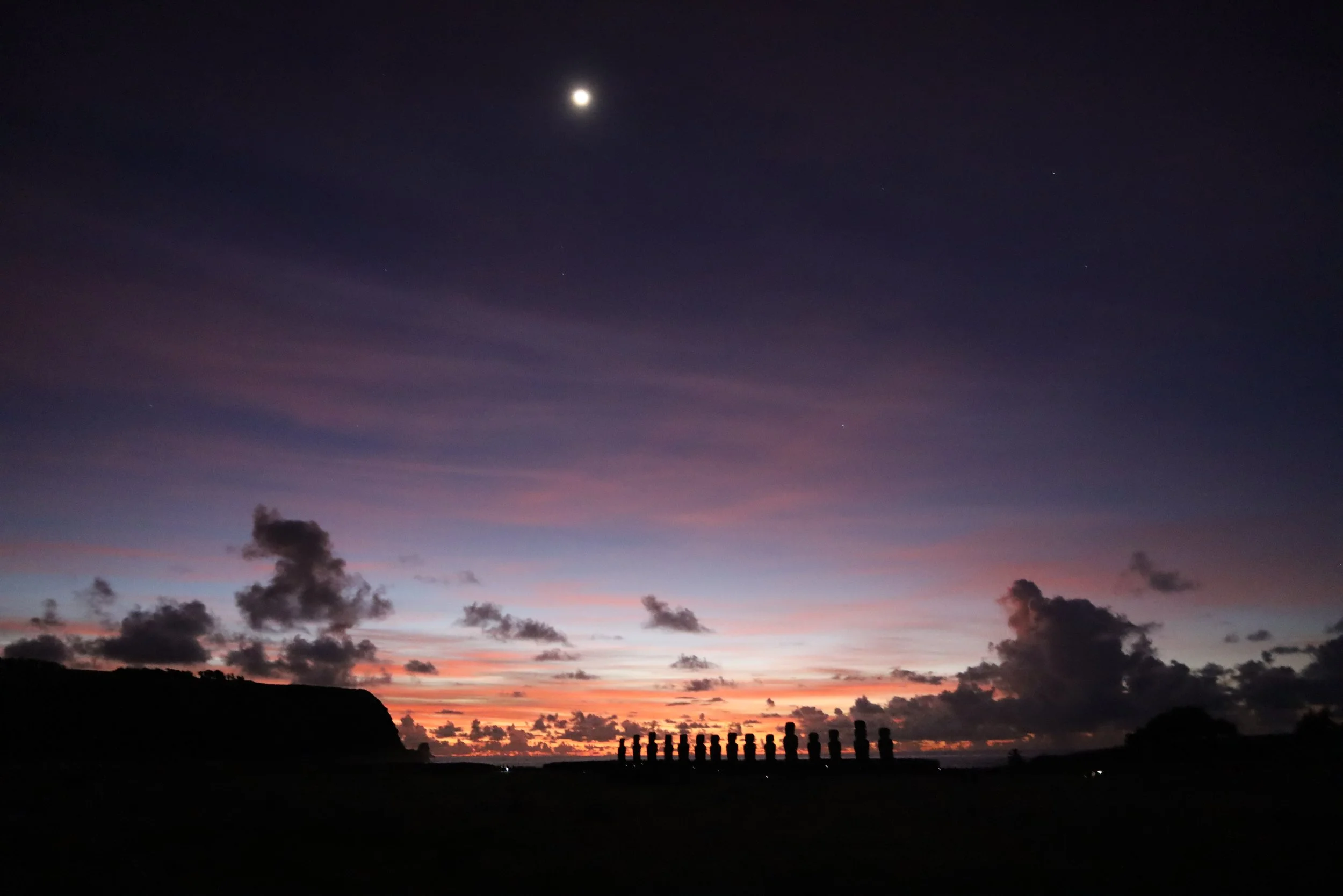
I woke up at 2 am and could not fall back asleep and comforted myself with the thought of taking a nap afterwards. Both N. and I woke up bleary eyed at 5:30, picked up our breakfast which the hotel staff had kindly packed for us, and got in the guide’s car.
We drove in the dark, enjoying the quiet; I happened to look up and see stars, more than we are able to see in light-polluted cities.
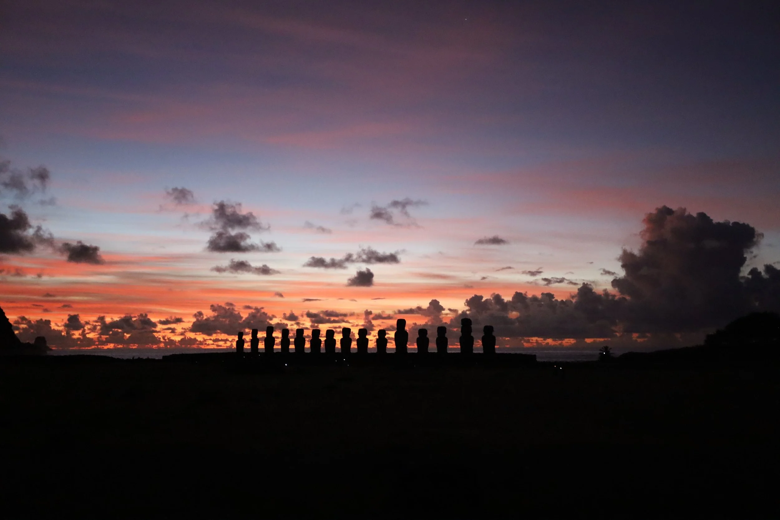
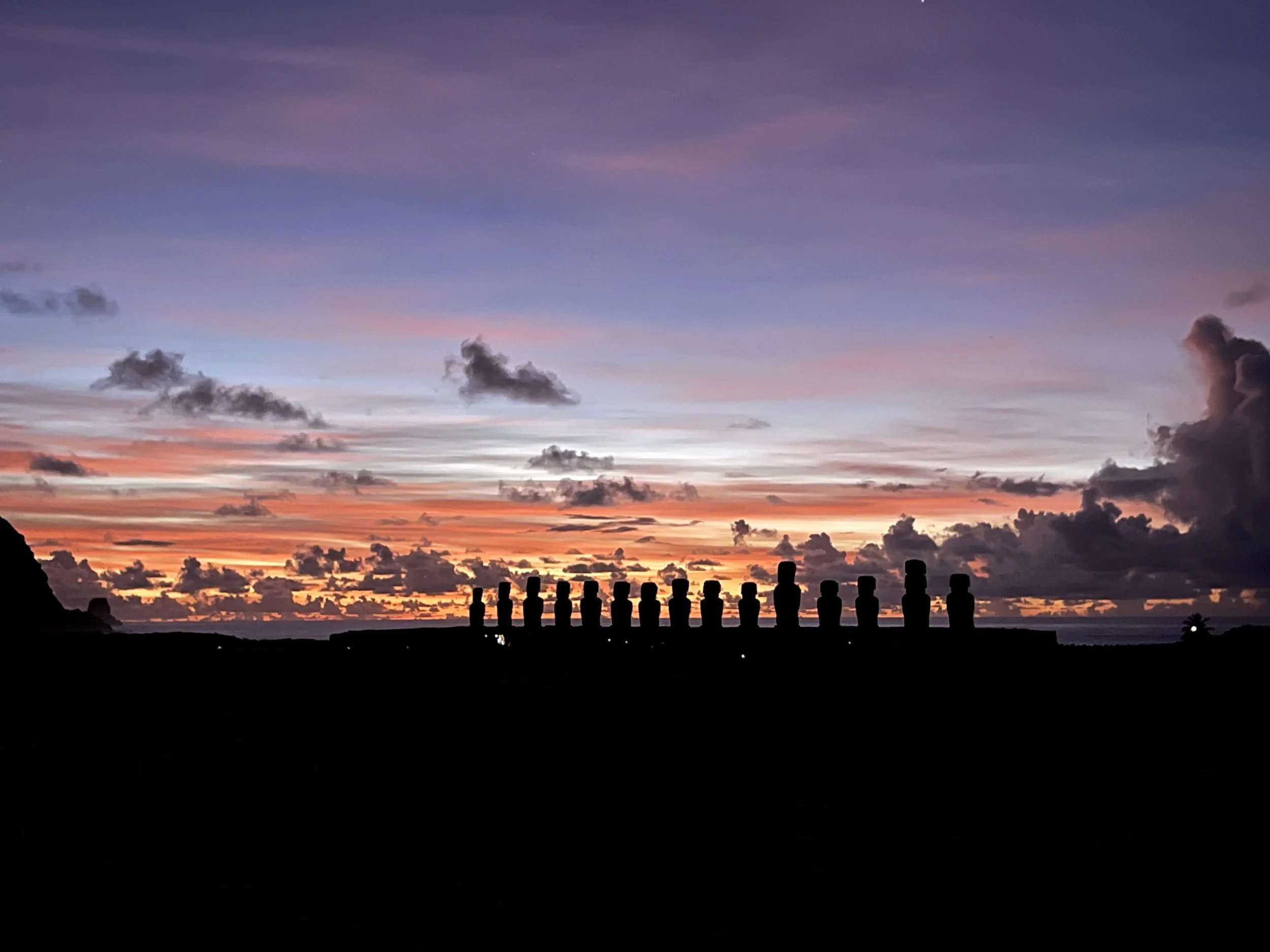
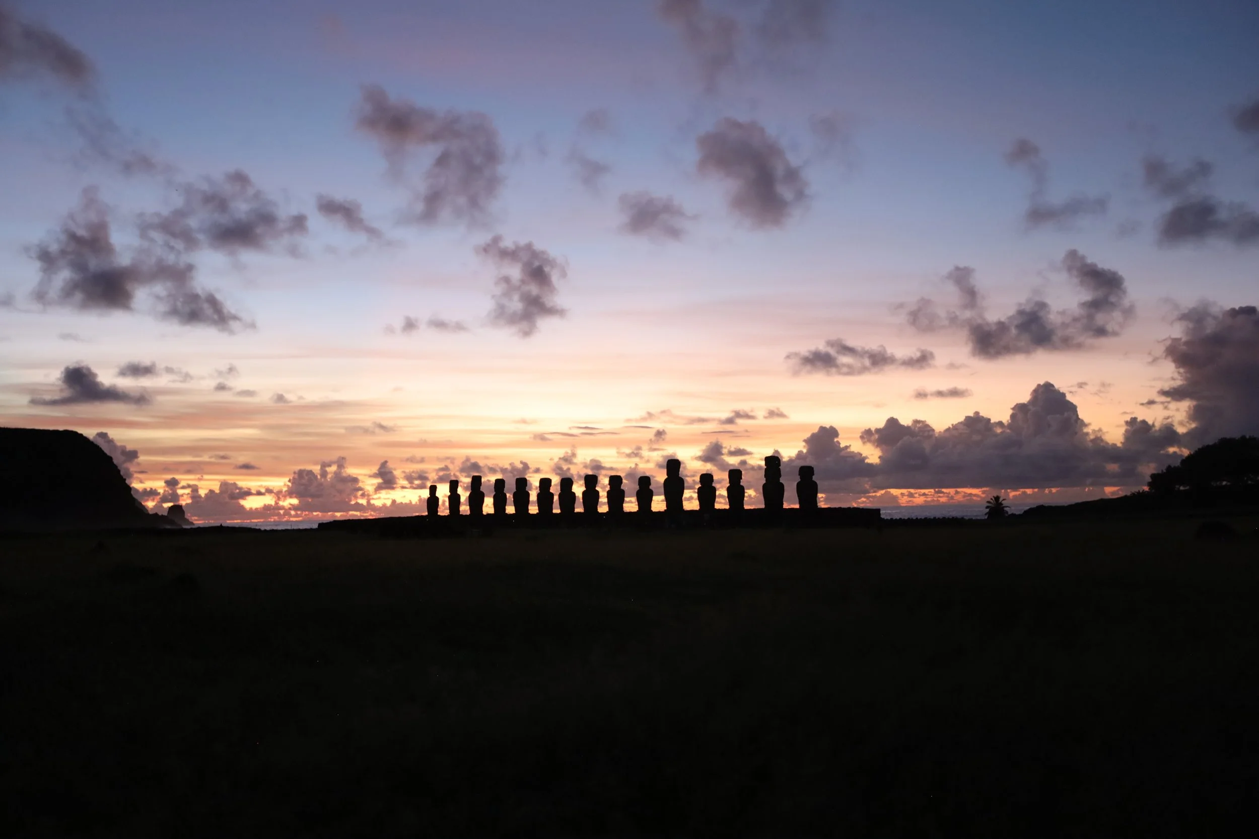
It was still dark when we arrived at Tongariki; groups were already waiting by the gates. We presented our tickets, waded through dew-wet high grass, and made a beeline for the wooden platform farther away from the moais, which our previous guide had mentioned as a good spot to see the sunrise.
Suddenly, out of the blue — out of the dark? — a galloping horse swerved around us and continued at top speed; we sensed its heavy breathing and fast power. Anyone in its way would have been trampled to death; our guide, who probably had a better sense of the danger, seemed more scared than we.
The magic happened slowly and quickly, or maybe it’s just our sense of these things: we kept our eyes on the moais, and the colors behind them kept shifting from black to lavenders to pinks to oranges and yellows. The presence of clouds obscured our view of the sun rays, but they were welcome canvasses for a whimsical sun which kept painting the sky in different shades.

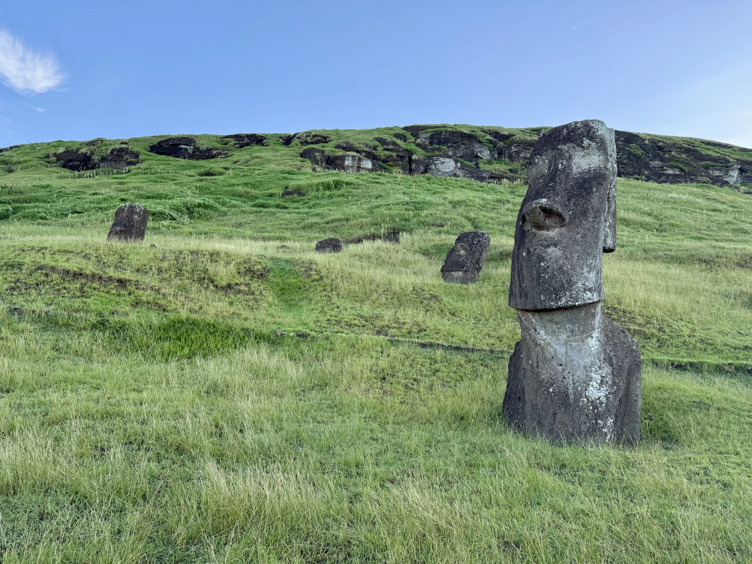
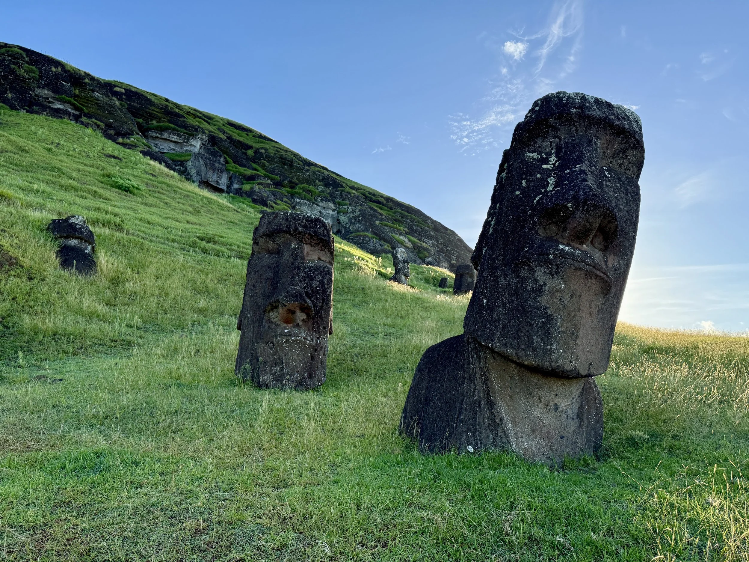
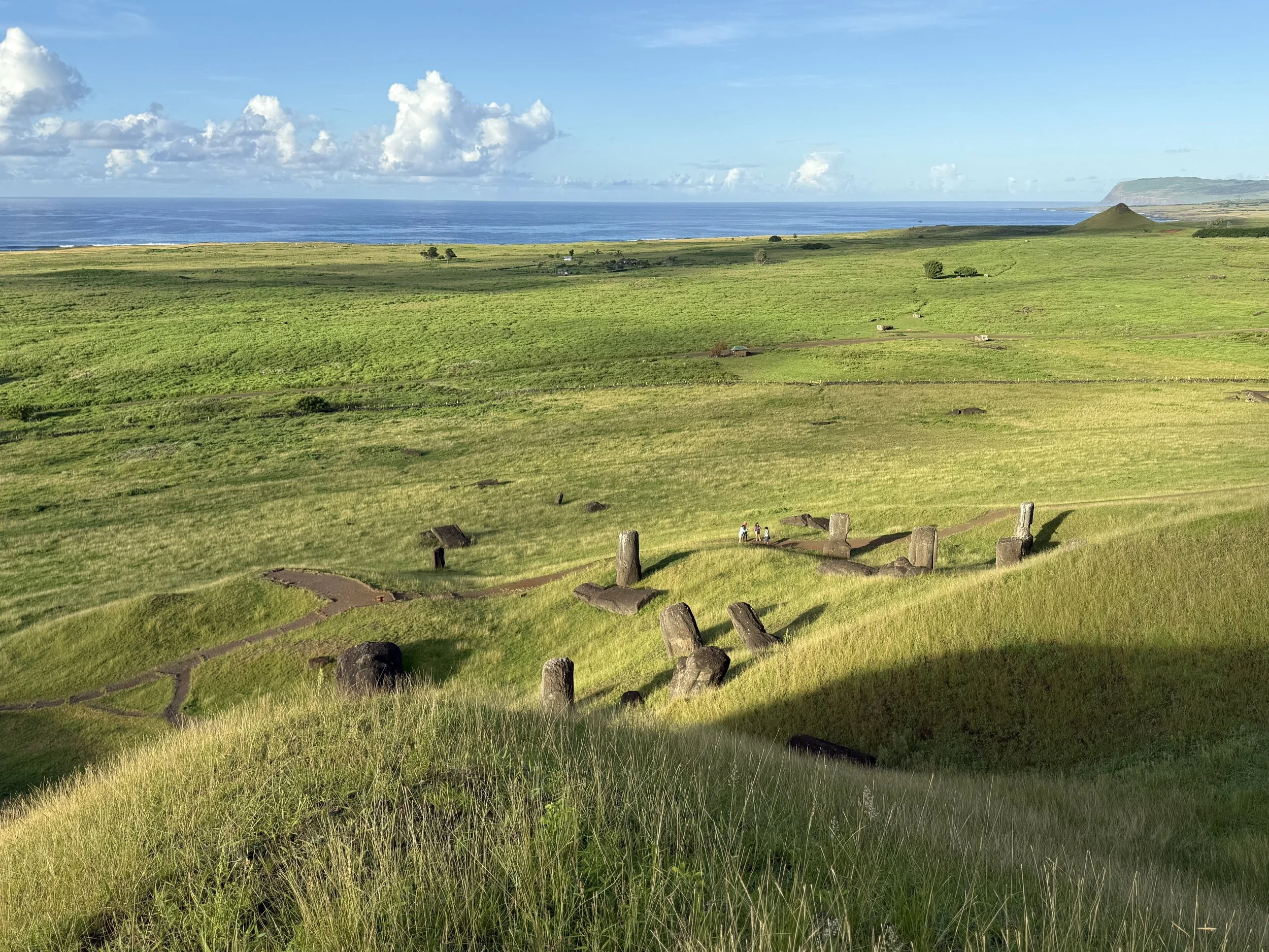
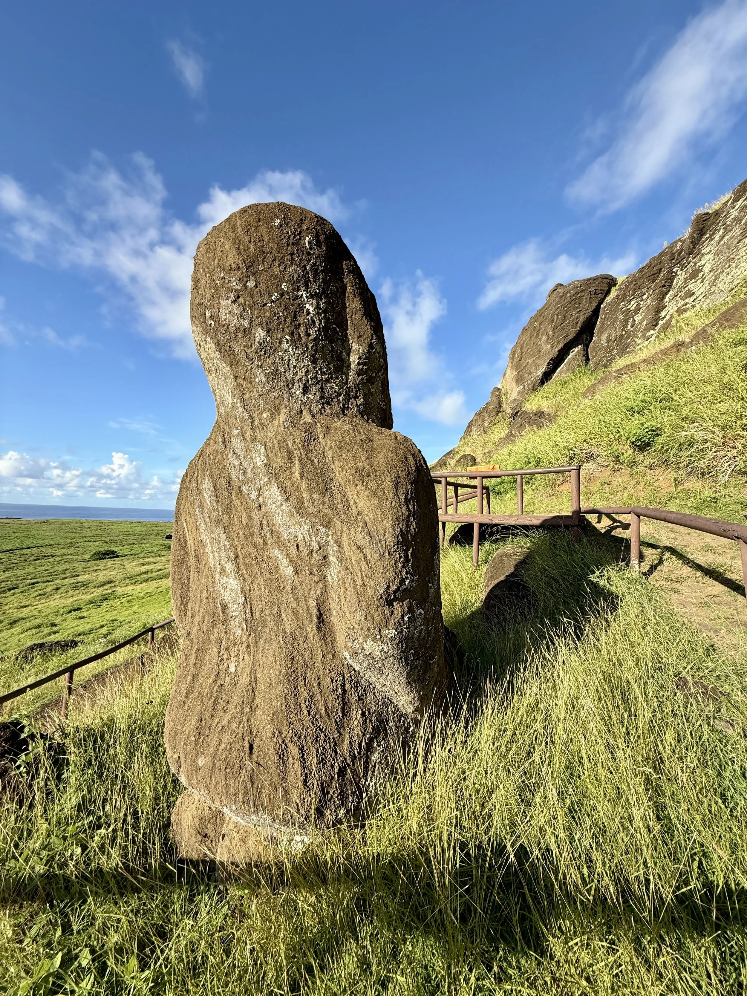
It was just a skip and a hop to Rano Rarako, the mountain factory of moais, which had been closed for a movie shoot during our previous stop. This was N.’s and my favorite site on the island.
One can see the ancient assembly line — literally moais still attached to the mountain, moais standing up (throughout the years, as they’ve stood there, rain and the elements had eroded the mountain, which as dirt and soil and rock accumulated, buried the statues), moais in line in a deep channel headed to ahus around the island, moais broken and left where they fell, one special moai with legs and kneeling in prayer — in short, moais up to here!
Iorana, Rapa Nui!